
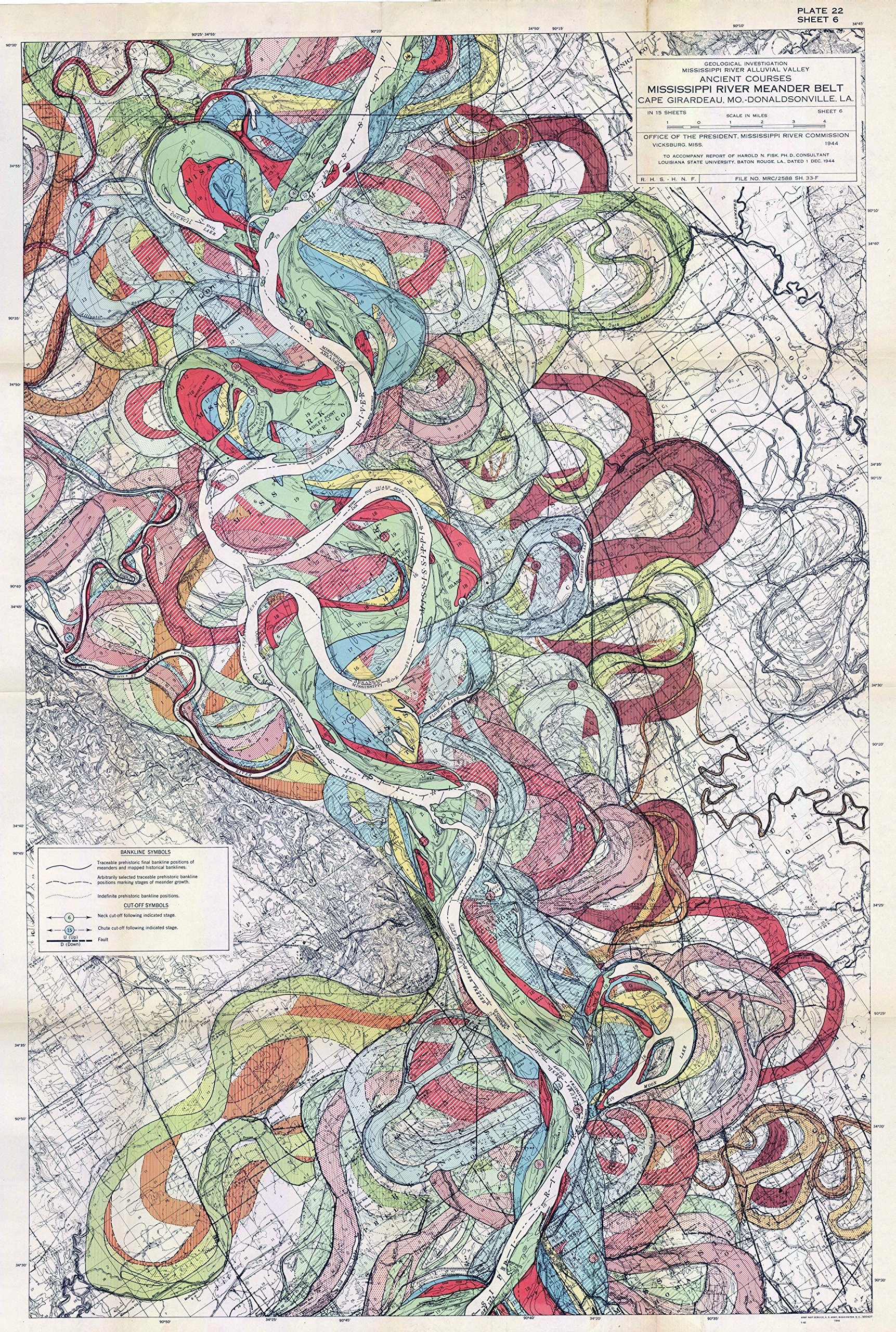
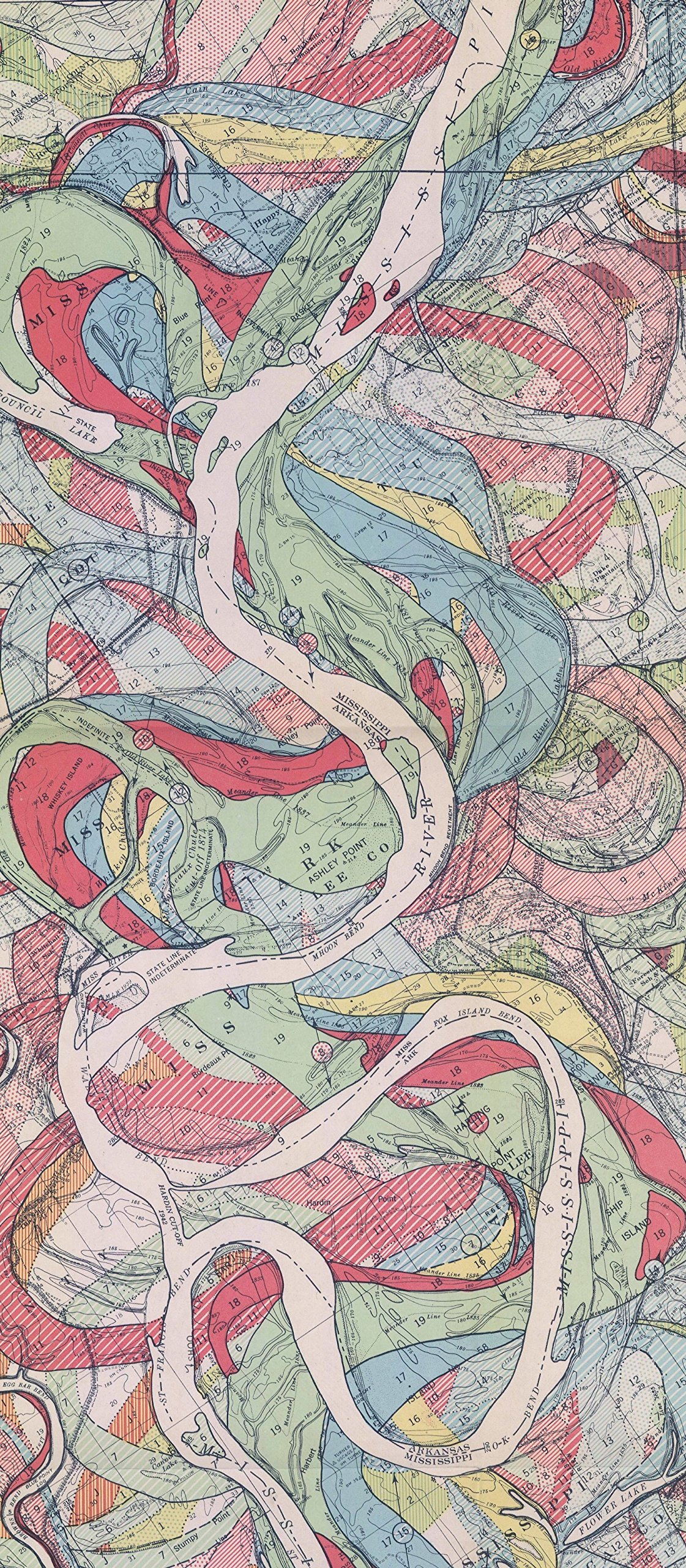
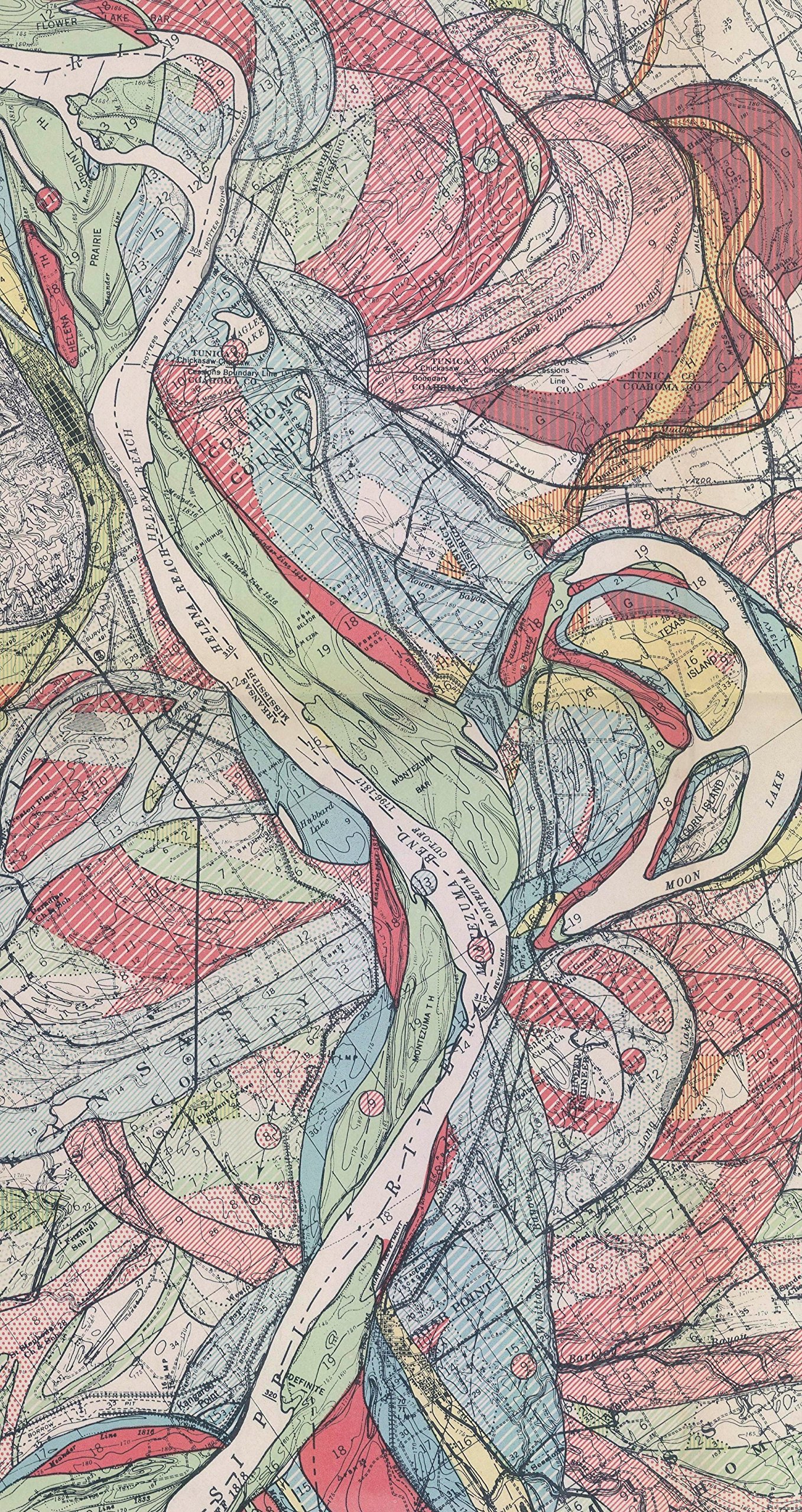
This is a modern reprint.Geological Investigation of the Alluvial Valley of the Lower Mississippi River In a report for the US Army Corps of Engineers, in 1944 Fisk had completed a mammoth effort entitled, “Geological Investigation of the Alluvial Valley of the Lower Mississippi River” The report and maps cover over 2,000 miles of river and its previous paths. This is one of 15 maps of the “Ancient Meanderings of the Mississippi” from “Geological Investigation of the Alluvial Valley of the Lower Mississippi River,” This map shows the ancient meanderings of the Mississippi. A river doesn’t stay still. As it flows it carves out new paths in a route towards its ultimate destination. Over time, the bends and curves of what seems like river snakes coiling around one another. By looking at the geologic evidence, you can see the paths a river once took like looking at the past lives of the waters, the river’s ghosts. The maps, scanned at high resolution and full scale, are some of the most beautiful I’ve seen. They are “nature’s art” and make excellent display maps. Printed on 32 pound HP coated paper with archival inks. Great for research or display.
1944 Fisk Mississippi Meander Map Ancient River Bed Sheet 6 – Map Reproduction 16 X 24 inches
$13.50
This geological map supports the study of geography and earth science by visually demonstrating river formation and erosion over time.
![Wall Art Impact 30"x24" Poster Thematic Map - The Pilgrim Progress [Laminated]~](https://m.media-amazon.com/images/I/71B3ErUr4TL.jpg)


Reviews
There are no reviews yet.