
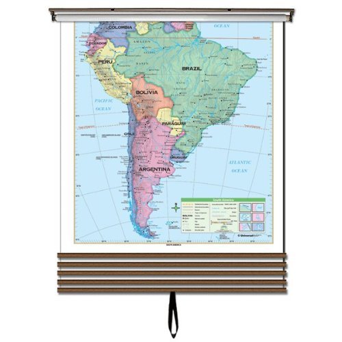
The 7-Map Continent Wall Map Set includes individual continent wall maps of North America, South America, Africa, Asia, Europe, Australia, and Antarctica. Continent edition wall maps clearly identify political county borders, with shaded relief highlighting the physical features of the land. Capitals, major cities, Waterways, and latitude and longitude lines are also included. A World inset map shows the location of each continent. Meets U.S. History curriculum requirements. This product is ideal for public, private, parochial, and home schools. All maps in this series are markable with a dry erase or water-soluble marker. Durably laminated maps measure, in inches, 54 x 43 or 54 x 69, and are mounted on roller with backboard.
Features
- These sets are perfect for space saving while getting the most out of your lessons
- Mounted on a roller with a backboard so it can be easily rolled up when not in use
- Features a coating that allows for markups with a dry erase marker
- Meets national and state curriculum standards
- Perfect addition to a classrooms, offices and home


Reviews
There are no reviews yet.