
Each map has two sides. Side 1 includes: A colorful map of Florida that includes all the major cities A map legend that includes where all the major industries are located throughout the state Origin of Florida’s name History of Florida’s flag and image of the flag Florida’s statehood date Florida state seal Side 2 includes: A black & white image of all of the counties in Florida Each map is 8.5” X 11” and printed glossy paper.
Features
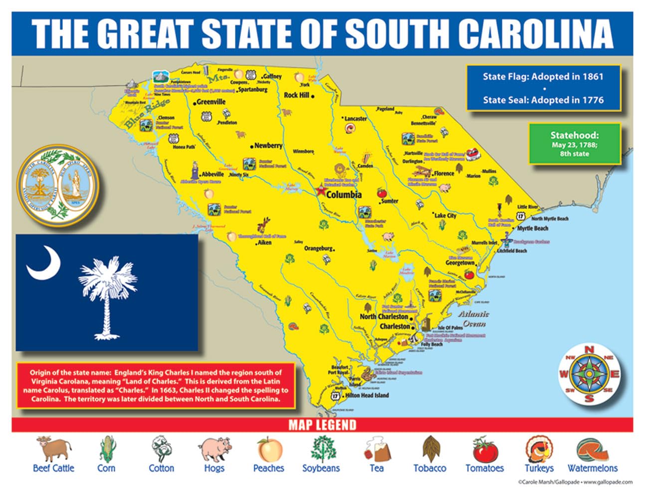
- A map legend that includes where all the major industries are located throughout the state (beef/cattle corn cotton hogs peaches soybeans tobacco tomatoes turkeys watermelons)
- Origin of South Carolina’s name History of South Carolina’s flag and image of the flag South Carolina’s statehood date South Carolina state seal
- Side 2 includes: A black & white image of all of the counties in South Carolina
- Each map is 8.5”X 11”and printed glossy paper.

![Wall Art Impact 34"x24" Poster Large scale detailed political map of Oceania with major cities and capitals - 1982 Oceania [Laminated]](https://m.media-amazon.com/images/I/61Py1032UML.jpg)
![Wall Art Impact 30"x24" Poster Thematic Map - The Pilgrim Progress [Laminated]~](https://m.media-amazon.com/images/I/71B3ErUr4TL.jpg)
Reviews
There are no reviews yet.