
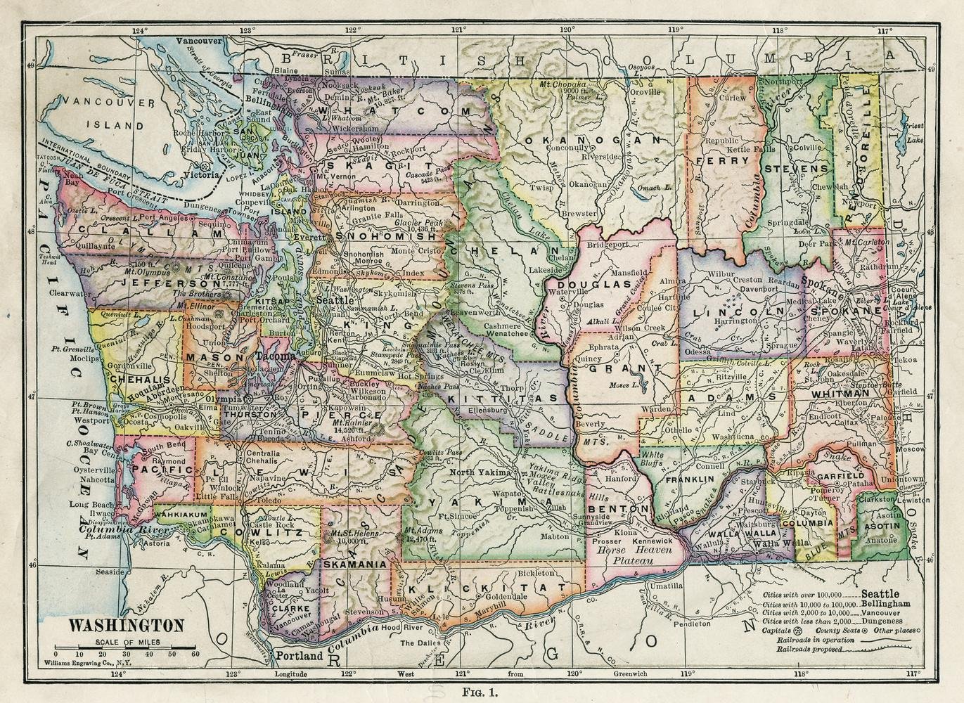
33×24 inches Laminted high quality poster. Decorate your home or office with high quality posters. Printed on the high quality thick poster paper, it will please your eyes for years to come. This is a political map of the State of Washington from 1913-14. It shows major cities, railroads and counties. This particular version of this map is taken from the textbook. Categories and tags: Maps of counties of Washington state, Old maps of Washington state, 1914 maps
Gifts Delight Laminated 33×24 Poster: Washington State Map –
$15.00
This laminated map of Washington state serves as a visual aid for geography lessons, helping students learn about the state’s political divisions, cities, and railroads.
Additional information
| Weight | 0.136 lbs |
|---|---|
| Dimensions | 83.8 × 61 in |


Reviews
There are no reviews yet.