
An annually updated political map of the USA. Beautifully colored. Rolled and tubed, with statistical information including population, surface area, state capital, (40 x 50). Highlights the flags of each state. Scale: 1/3,850,000 – 1cm = 38.5km – 1in = 55 miles. Legend/Key in three languages (English, French, Spanish)
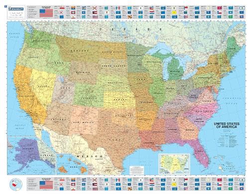
Michelin USA Political Map
$10.95
This political map of the USA supports learning about national geography, state capitals, and civics.
Additional information
| Weight | 0.118 lbs |
|---|---|
| Dimensions | 11.3 × 0.5 × 25 in |


Reviews
There are no reviews yet.