
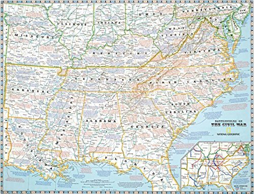
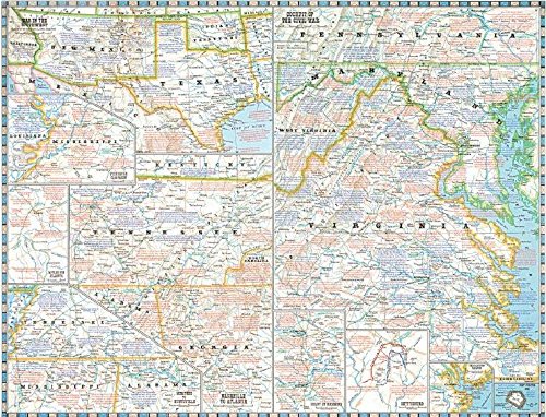
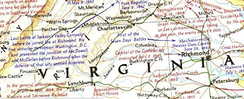
National Geographic Battlefields of the Civil War Map On the 100th anniversary of the shots fired at Fort Sumter, the April 1961 issue of National Geographic Magazine featured in-depth articles on the U.S. Civil War. The issue included a supplement map that located and described every battle, campaign and major event of the war. This historic map is available once again in a new printing, in cooperation with National Geographic Maps. All key battles and events are described with National Geographic’s renowned map notes. Each battle is located with a crossed-swords symbol. Side One of the map covers the main region of the War, from New Jersey to Louisiana. Portraying the country as charted in 1863, it is based on a map on which General Grant marked his proposed lines of operation. Both armies’ major offensives are charted on an inset. Side Two features more detailed maps, including: “Cockpit of the Civil War” (southern Pennsylvania to southern Virginia), “Nashville to Atlanta” and “Memphis to Huntsville.” There are insets of Gettysburg; “Grant at Richmond”; the “War in the Southwest” (Texas to California), the Vicksburg Campaign and the battles for Atlanta. Size 28″ x 21-3/4″ folded to 4″ x 9″

National Geographic 1961 Battlefields of The Civil War Map
$9.95
This map provides a visual aid for a student to learn about the geography and key events of the U.S. Civil War.


Reviews
There are no reviews yet.