
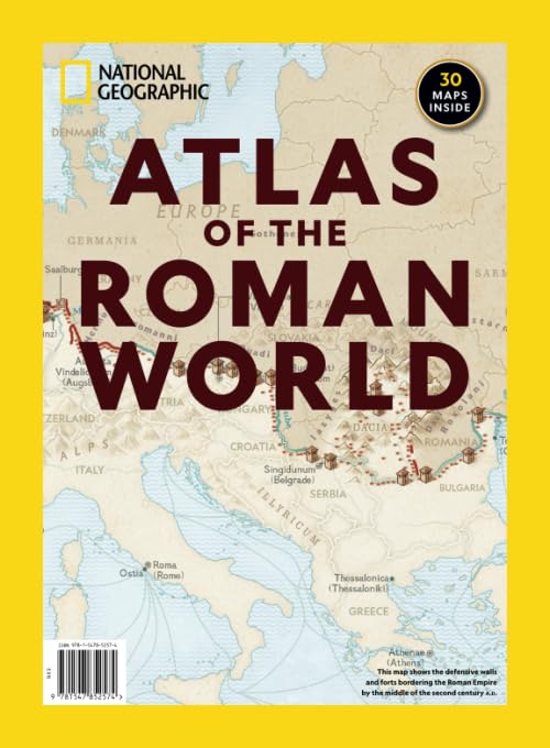
At its height, the Roman Empire stretched from Constantinople in the east to London in the west. The comprehensive Atlas of the Roman World lets readers travel its highways and byways with maps of major cities, trade routes, and the conquests of the feared Roman legion. Some highlights include: Geographic factors that maintained the balance of power and allowed Rome to dominate the Mediterranean and beyond, Hannibal’s March, the rise of Caesar, and other key events in the rise and fall of the Roman empire, Maps of Pompeii and Herculaneum, the forgotten towns buried in the volcanic ash of Mt. Vesuvius that preserved their treasures for modern archeologists. Please note that this is an authorized edition published by the Meredith Corporation and sold by Amazon. This edition is printed using a high quality matte interior paper and printed on demand for immediate fulfillment.
National Geographic Atlas of the Roman World
$14.99
This atlas offers a detailed exploration of the Roman world through maps of its cities, trade routes, and military conquests.


Reviews
There are no reviews yet.