
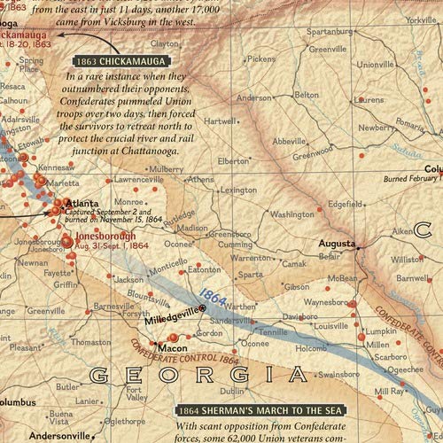
This comprehensive map shows major land campaigns, Union and Confederate troop movements, major Union naval campaigns, roads, railroads, battle outcomes and their impacts on the war, dates of capture by Union forces and more. Two inset maps – Battle for the Capitals and Turning Points of the War – as well as a timeline of battles with map location, casualties and impacts of battles are included. Created with the assistance of the National Park Service, Civil War Preservation Trust, American Battlefield Protection Program, Naval Historical Center, Virginia War Museum, National Museum of Civil War Medicine, and the U.S. Naval Academy. The map is packaged in a two inch diameter tube with a label showing a thumbnail of the map with dimensions and other pertinent information. Map Scale = 1:2,550,000 Sheet Size = 35.75″ x 23.25″

National Geographic Battles of the Civil War Wall Map (35.75 x 23.25 in) (National Geographic Reference Map)
$19.00
This wall map serves as a visual aid for students to learn about the geography, key battles, and troop movements of the U.S. Civil War.
Additional information
| Weight | 0.413 lbs |
|---|---|
| Dimensions | 8 × 8 × 96.2 in |


Reviews
There are no reviews yet.