
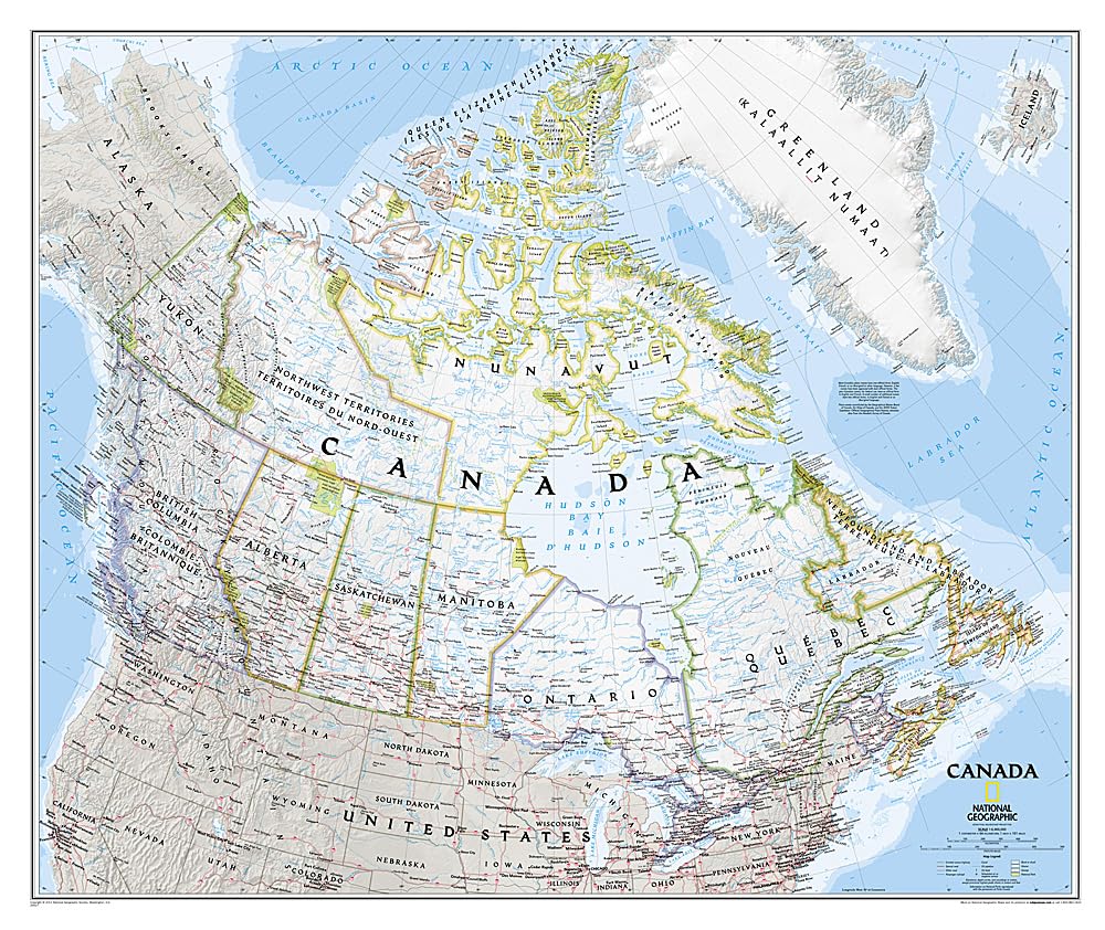
National Geographic’s map of Canada is one of the most authoritative maps of “The Great White North.” This Classic style wall map features a bright color palette with blue oceans and the country’s terrain detailed in stunning shaded relief that has been a hallmark of National Geographic maps for over 75 years. Thousands of place names, accurate political boundaries, national parks, and major infrastructure networks such as roads, canals, ferry routes, and railroads are detailed. Coastal bathymetry is shown with depth curves and soundings, and the boundaries of the winter extent of sea ice are marked as well. Coverage also includes Iceland, Greenland, and portions of the United States. The map is encapsulated in heavy-duty 1.6 mil laminate which makes the paper much more durable and resistant to the swelling and shrinking caused by changes in humidity. Laminated maps can be framed without the need for glass, so the frames can be much lighter and less expensive. Map Scale = 1:6,509,000 Sheet Size = 38″ x 32″
National Geographic Canada Wall Map – Classic – Laminated (38 x 32 in) (National Geographic Reference Map)
$29.95
This wall map of Canada serves as an authoritative visual aid for social studies and geography lessons.
Additional information
| Weight | 0.567 lbs |
|---|---|
| Dimensions | 7.6 × 101.6 × 101.6 in |


Reviews
There are no reviews yet.