
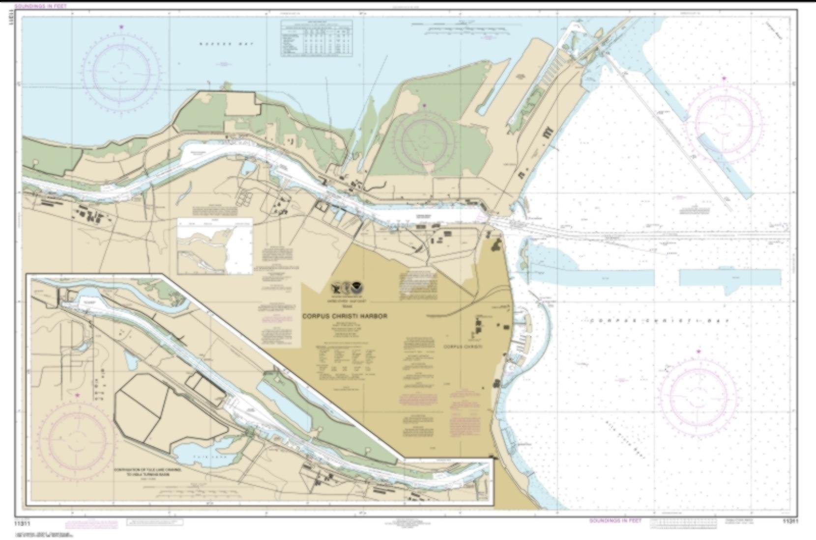
Features
- Printed on PaperTyger, a lightweight, tear-resistant, water-resistant paper with a smooth matte paper feel.
- Printed on demand using the most up to date NOAA data and latest Notice to Mariners (NTMs) applied at time of print.
- Meets United States Coast Guard carriage requirements.
- Pre-production finishing for superior quality.
- Printed by East View Geospatial. Map scale: 1:10,000. Map size (inches): 92 x 138.


Reviews
There are no reviews yet.