
East View Geospatial (EVG) is a certified NOAA and NGA print on demand printer. Our nautical charts are printed using high resolution images. All NOAA nautical charts are printed by East View Geospatial. NOAA-OCS cancelled this Raster and PDF chart. The product will NOT meet U.S. and international carriage requirements for commercial vessels defined in SOLAS Chapter V Regulation 19.2.1.
Features
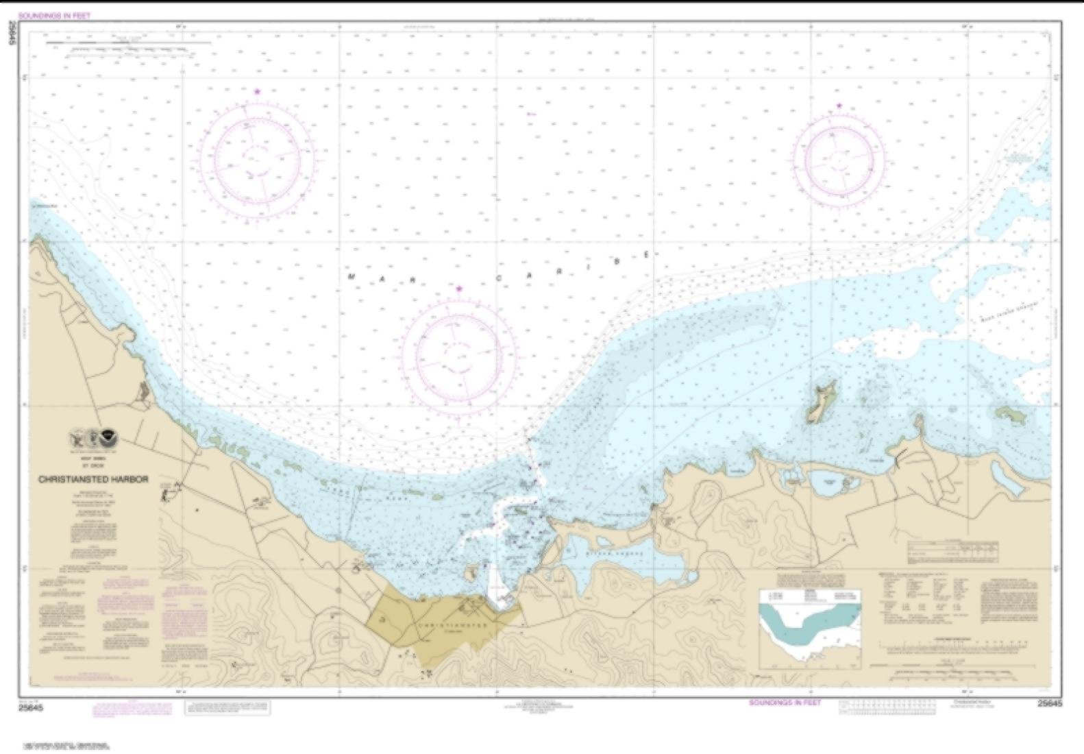
- Notice: NOAA-OCS cancelled Raster and PDF chart 25645- Christiansted Harbor, Edition #20 on June 15, 2022. The product will NOT meet U. S. and international carriage requirements for commercial vessels defined in SOLAS Chapter V Regulation 19.2.1.
- Printed on PaperTyger, a lightweight, tear-resistant, water-resistant paper with a smooth matte paper feel.
- Pre-production finishing for superior quality.
- Printed by East View Geospatial. Map scale: 1:10,000. Map size (inches): 85 x 122.


Reviews
There are no reviews yet.