
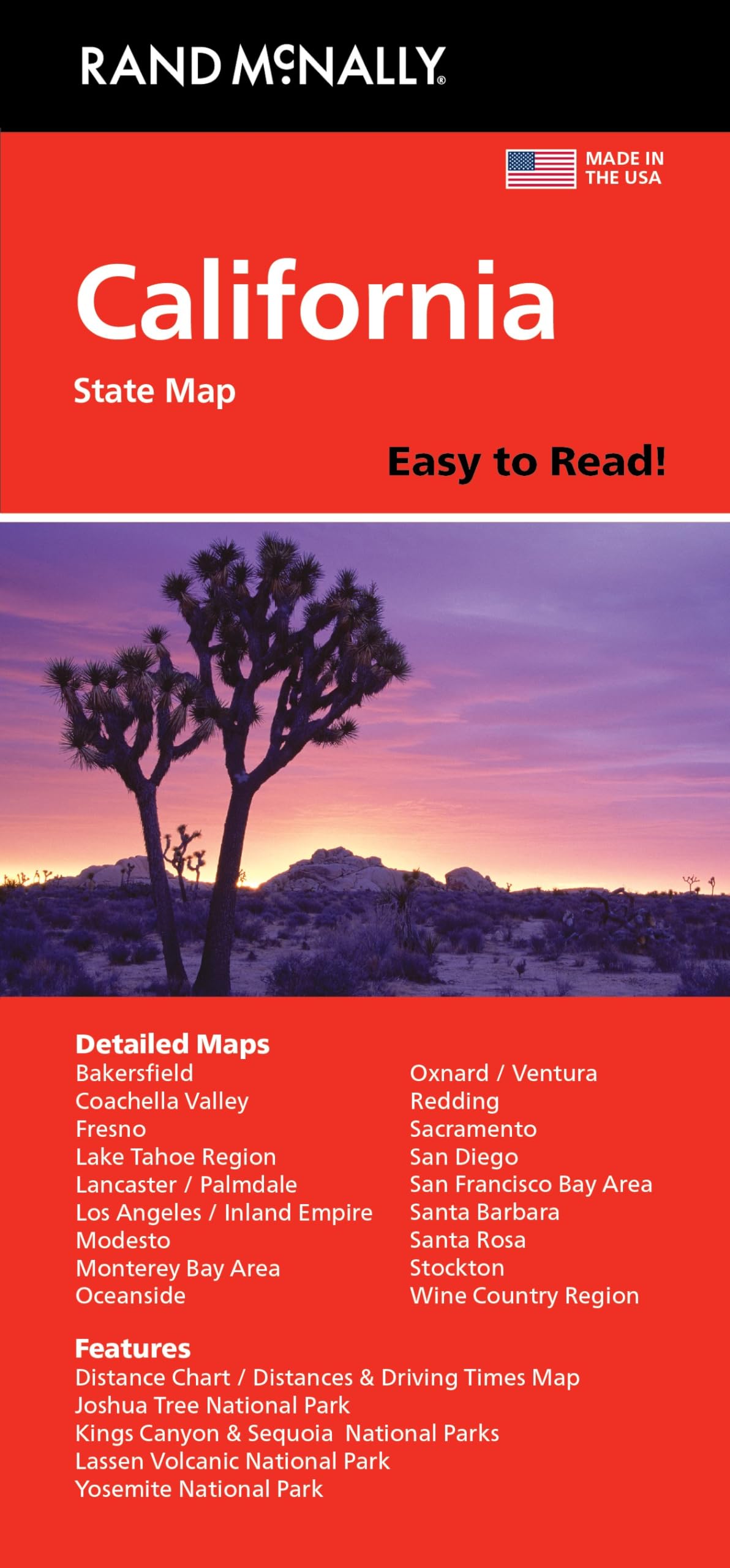
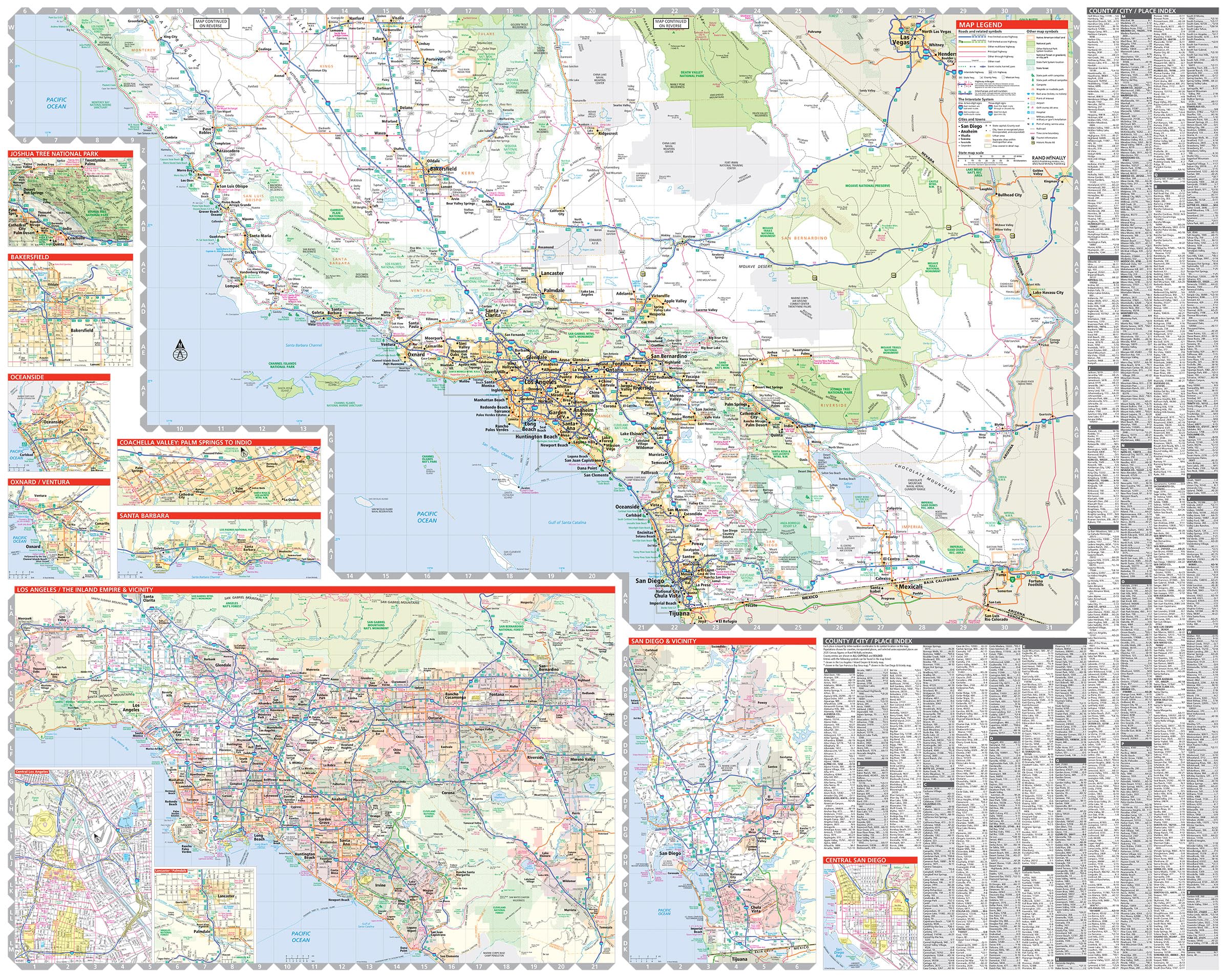
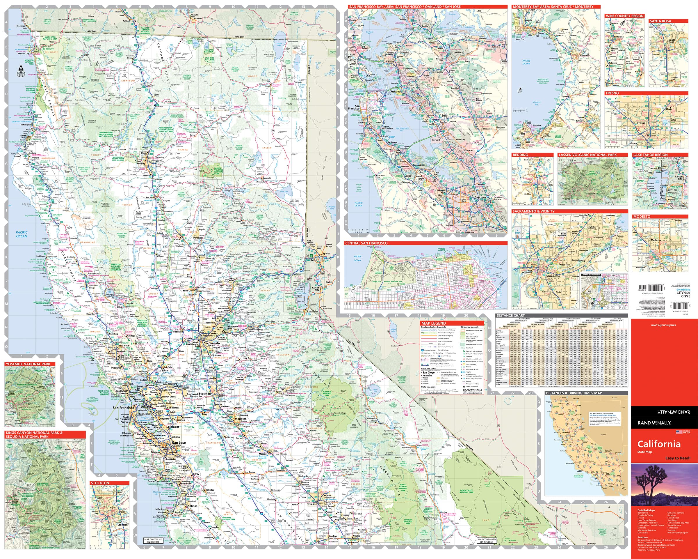
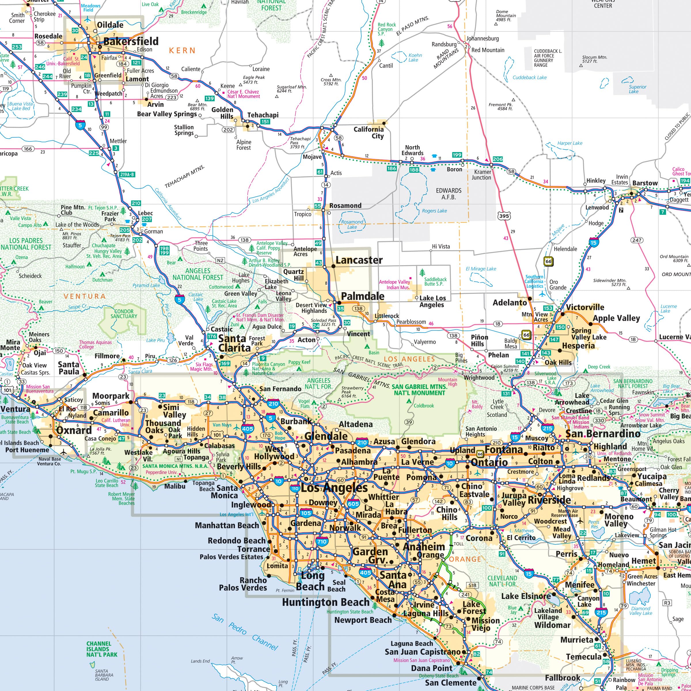
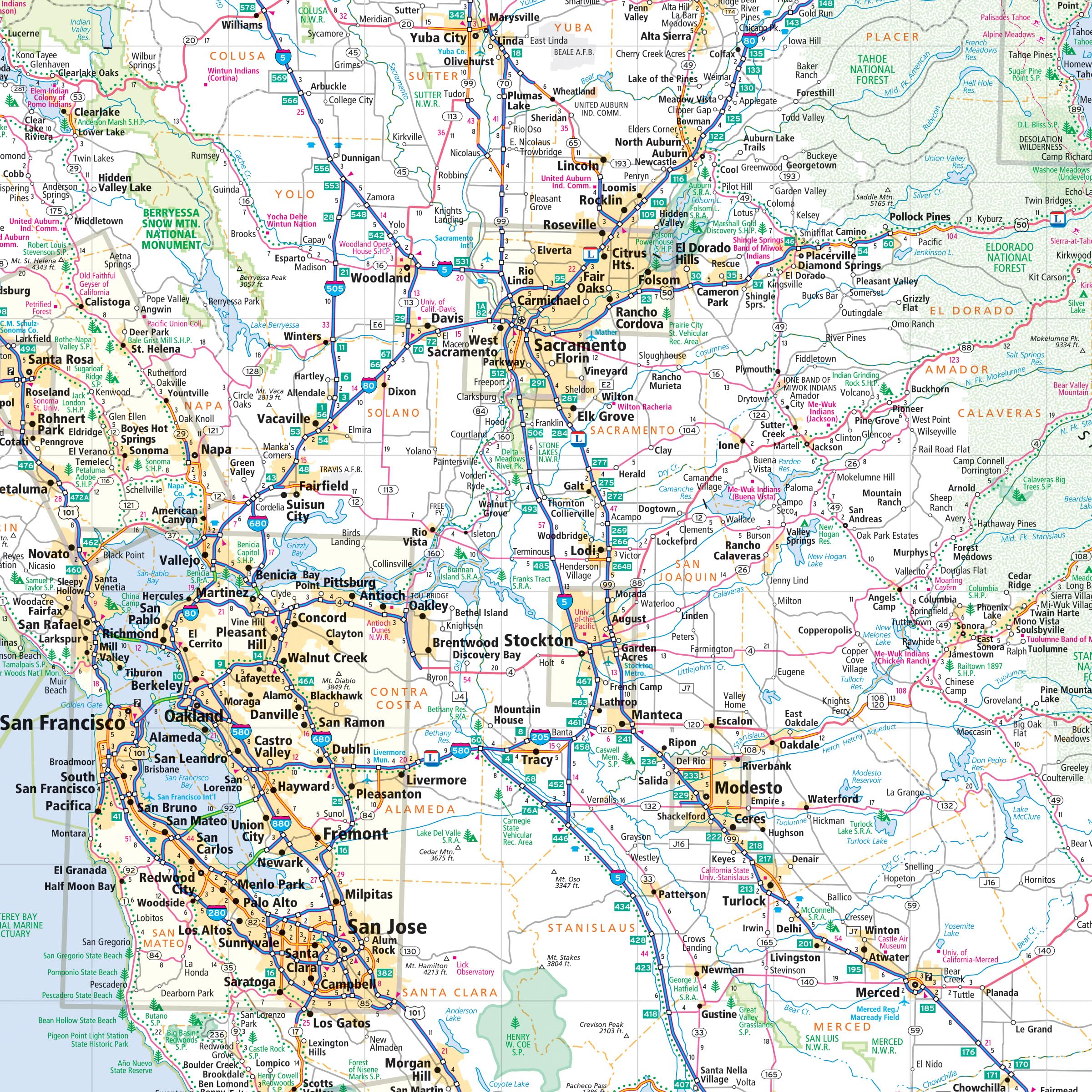
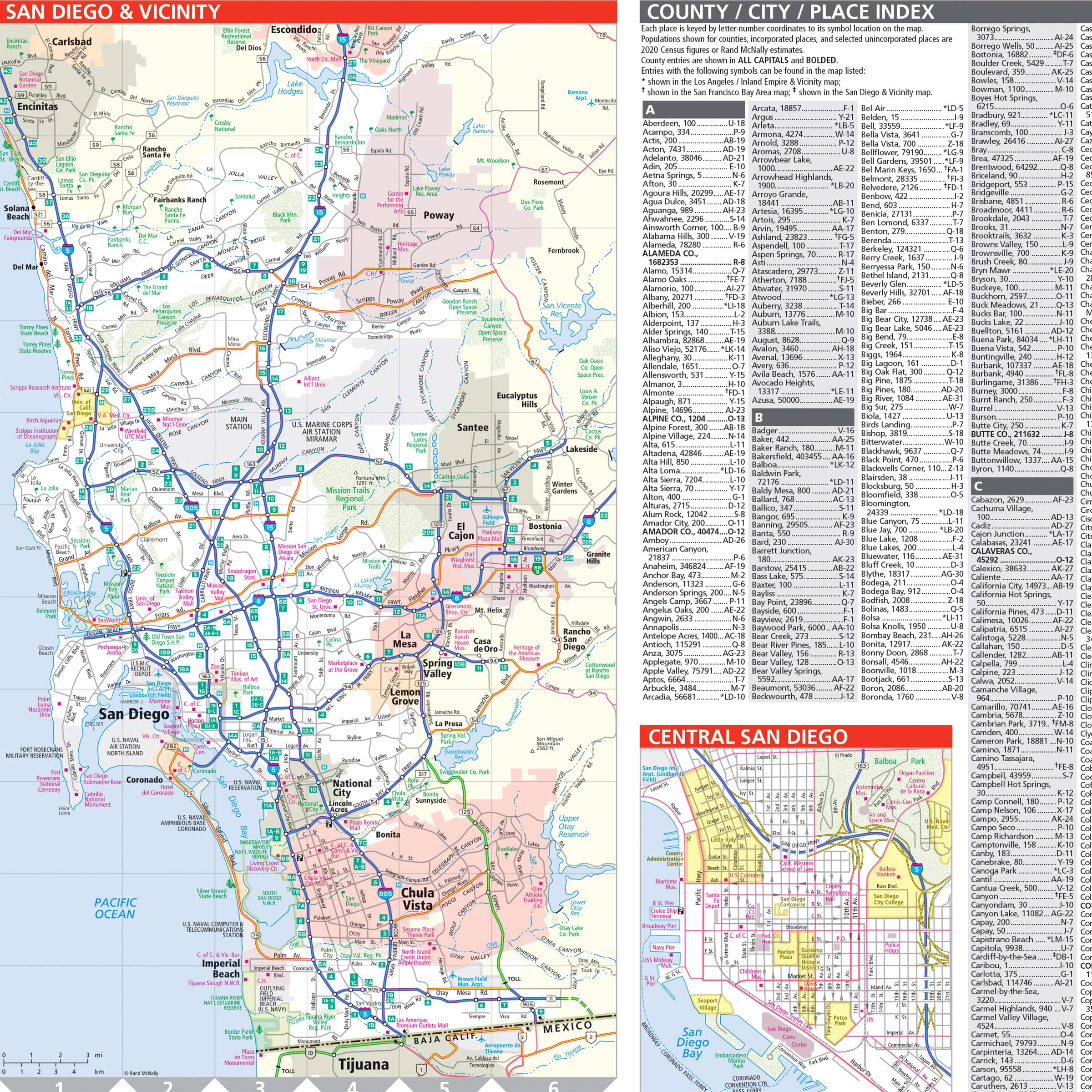
Rand McNally’s Easy To Read State Folded Map is a must-have for anyone traveling in and around California, offering unbeatable accuracy and reliability at a great price. Our trusted cartography shows all Interstate, U.S., state, and county highways, along with clearly indicated parks, points of interest, airports, county boundaries, and streets. The easy-to-use legend and detailed index make for quick and easy location of destinations. You’ll see why Rand McNally folded maps have been the trusted standard for years. – Regularly updated, full-color maps. – 40% larger map with a bigger type size than the Rand McNally Folded Map. – Clearly labeled Interstate, U.S., state, and county highways. – Indications of parks, points of interest, airports, county boundaries, and more. – Mileage and driving times map. – Detailed index. – Convenient folded size. Coverage Area Detailed maps of: Bakersfield, Fresno, Joshua Tree National Park, Kings Canyon Natl Park & Sequoia Natl Park, Lake Tahoe Region, Lancaster/Palmdale, Los Angeles, Modesto, Monterey/Salinas, Oceanside, Oxnard/Ventura, Palm Springs, Sacramento, San Diego. Product Details Dimensions: (Unfolded): 36″ x 45″. (Folded): 4.125″ x 9″.
Features
- Regularly updated, full-color maps
- Clearly labeled Interstate, U.S., state, and county highways
- 40% larger map with a bigger type size than the Rand McNally Folded Map
- Indications of county boundaries, schools, shopping malls, parks, golf courses, hospitals, airports, and points of interest
- Mileage and driving times map
- Detailed index
- Copyright 2023
- Coverage Area Detailed maps of: Bakersfield, Fresno, Joshua Tree National Park, Kings Canyon Natl Park & Sequoia Natl Park, Lake Tahoe Region, Lancaster/Palmdale, Los Angeles, Modesto, Monterey/Salinas, Oceanside, Oxnard/Ventura, Palm Springs, Sacramento, San Diego


![Wall Art Impact 38"x24" Poster Topographic Map - MyTopo Custom Topo Maps, Aerial Photos, Online Maps, and Map Software [Laminated]](https://m.media-amazon.com/images/I/51BS36akJaL.jpg)

Reviews
There are no reviews yet.