

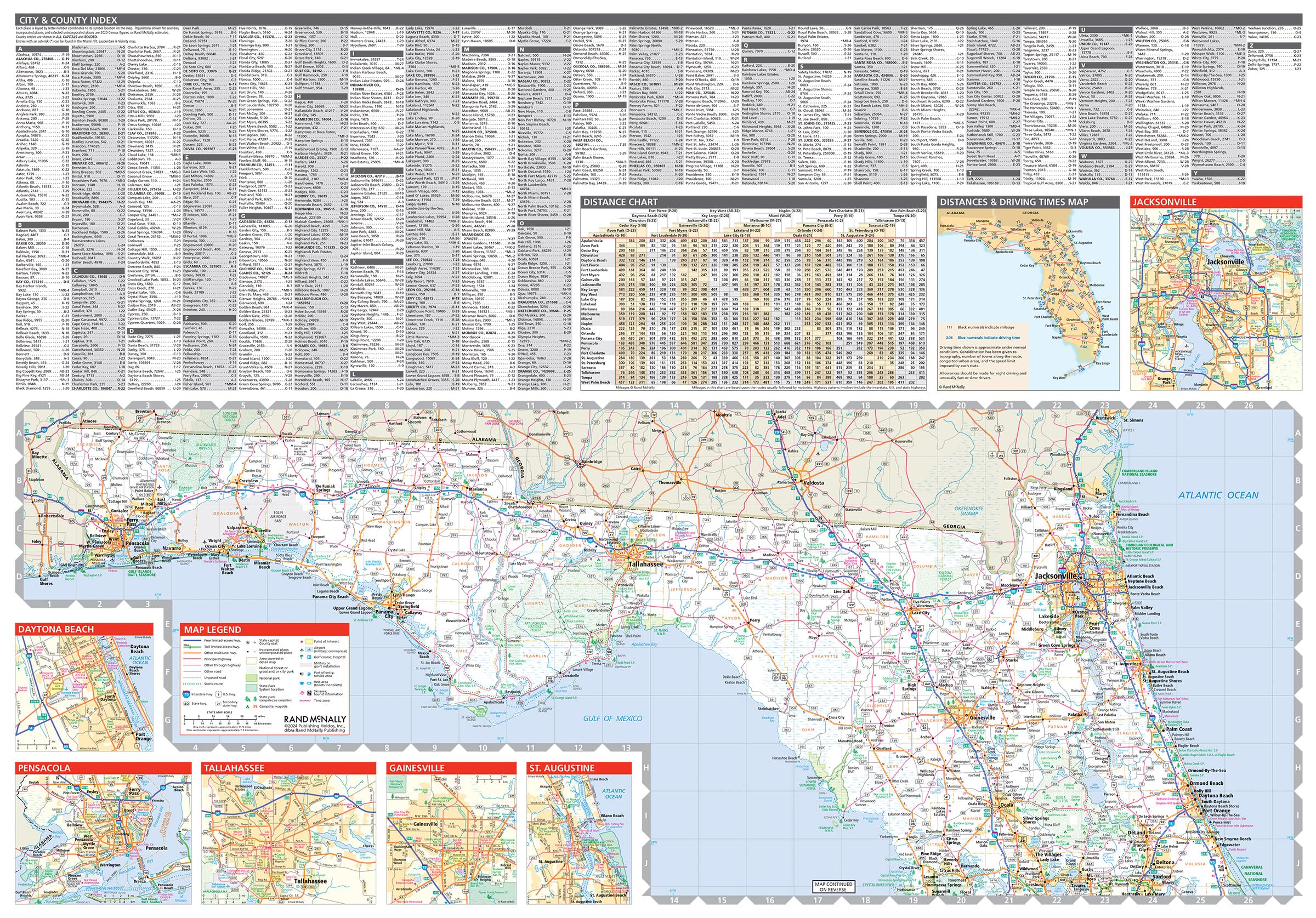
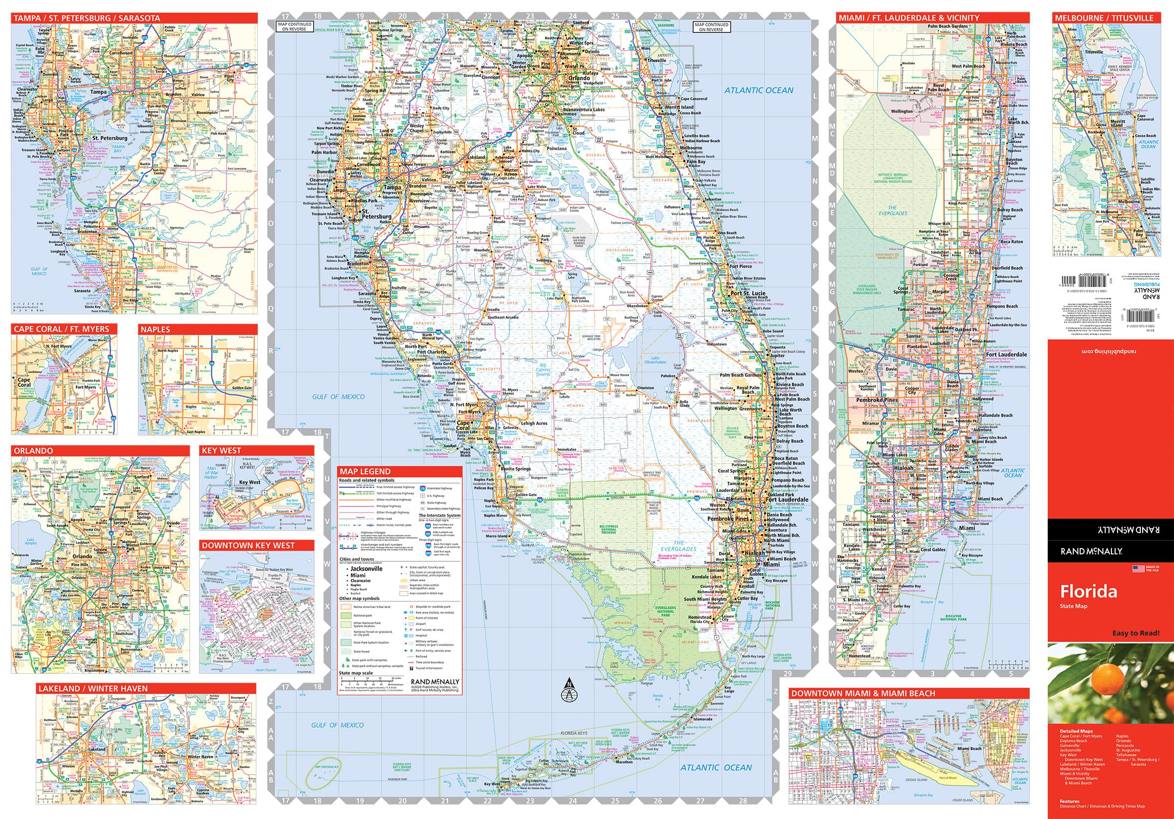
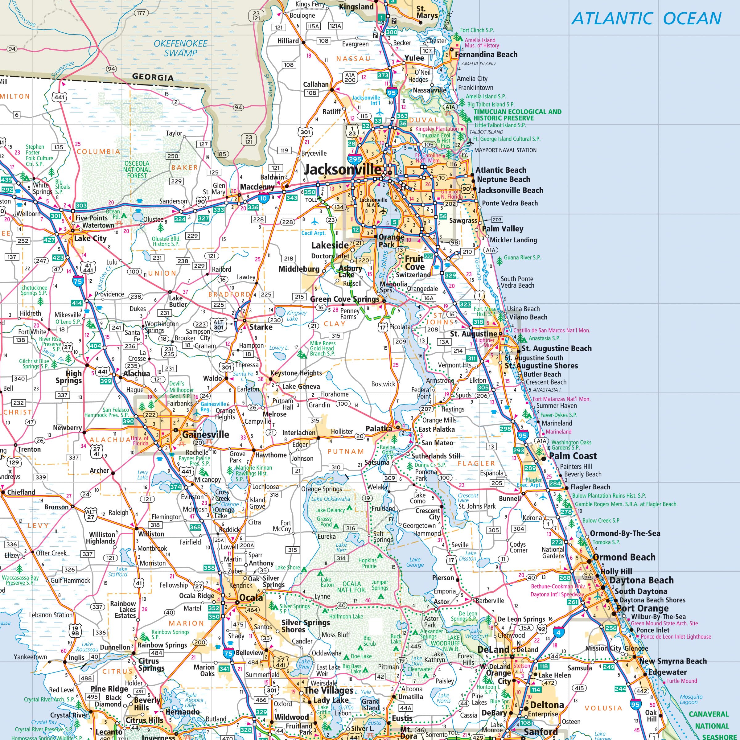
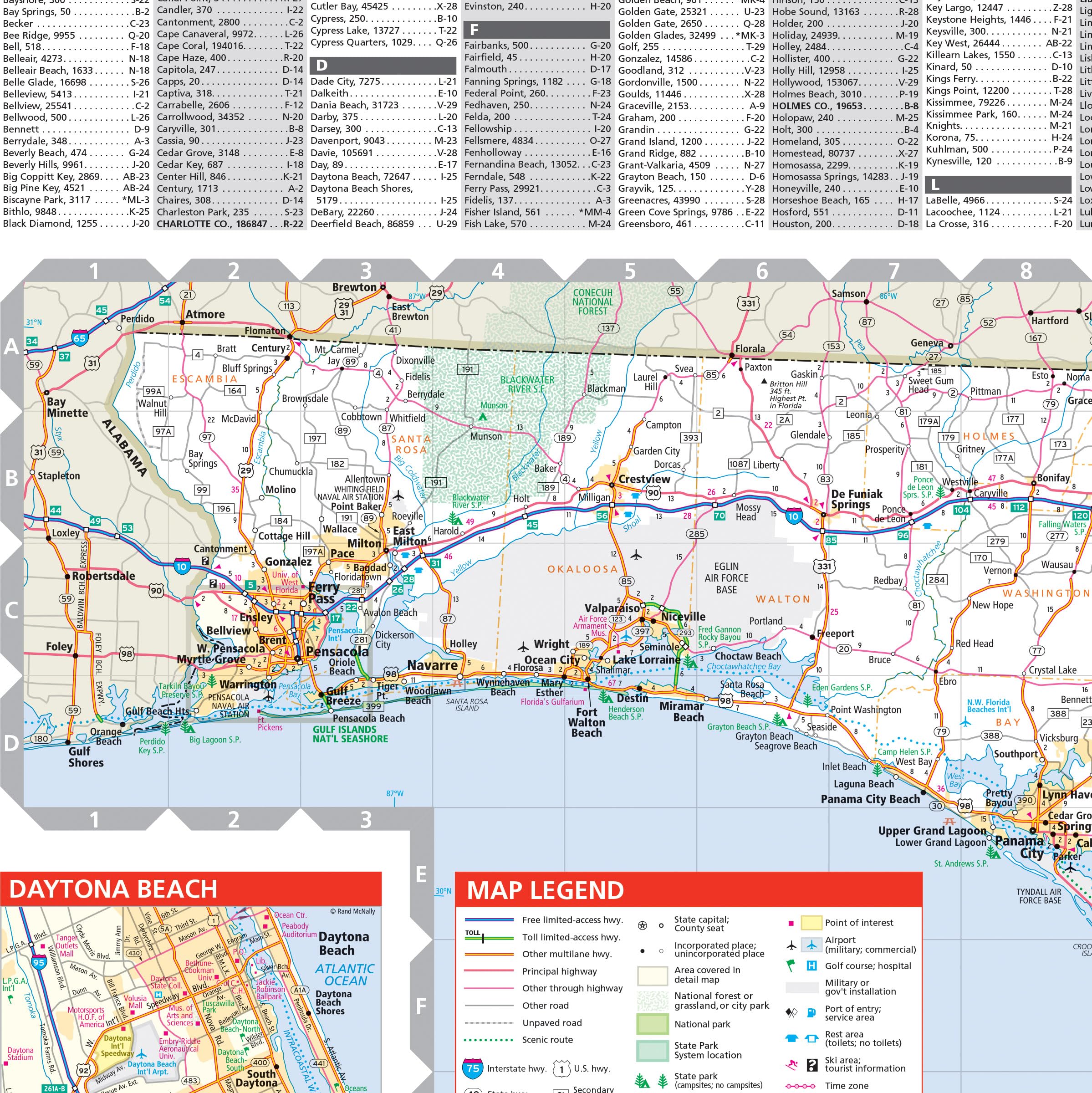
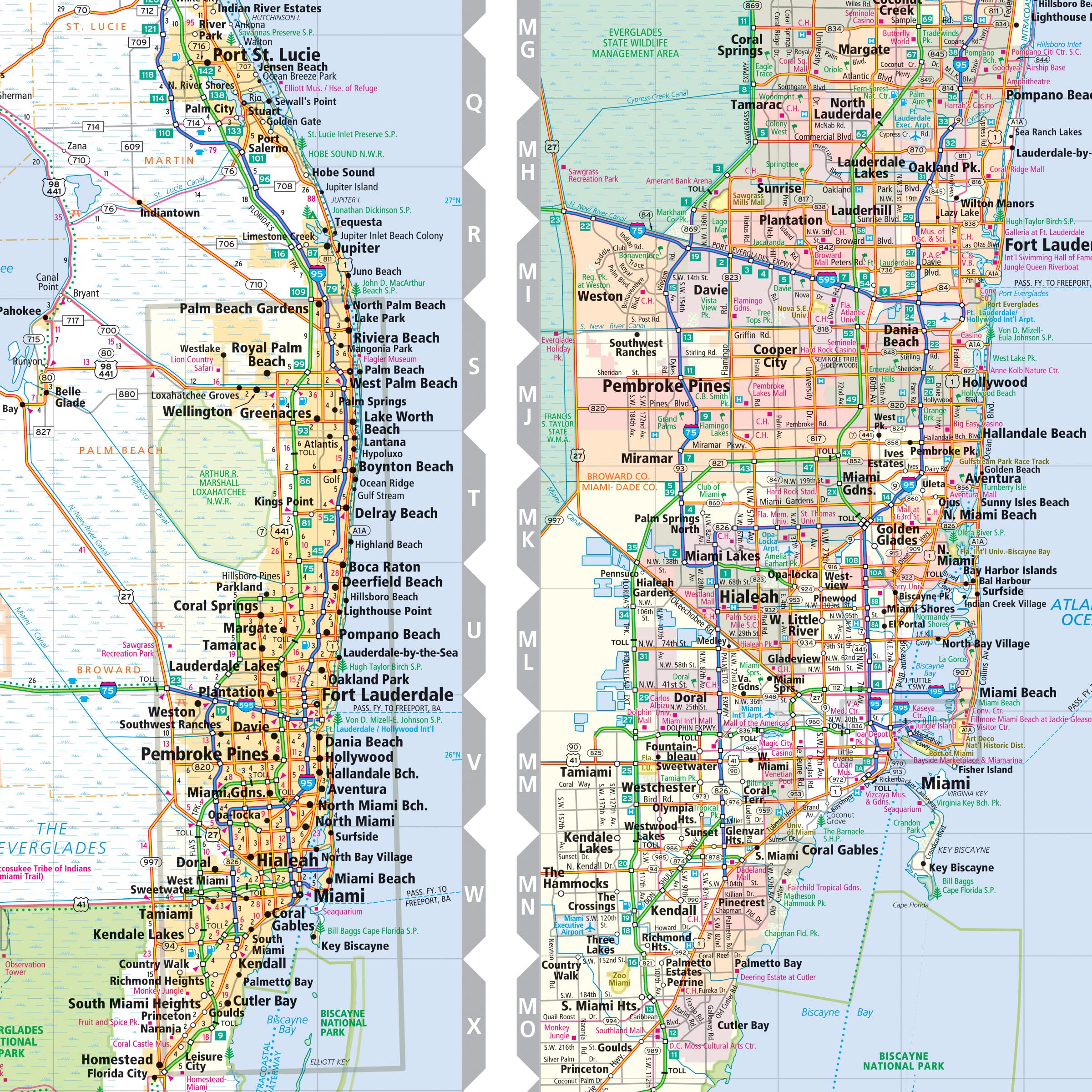
Rand McNally’s Easy To Read State Folded Map is a must-have for anyone traveling in and around Florida, offering unbeatable accuracy and reliability at a great price. Our trusted cartography shows all Interstate, U.S., state, and county highways, along with clearly indicated parks, points of interest, airports, county boundaries, and streets. The easy-to-use legend and detailed index make for quick and easy location of destinations. You’ll see why Rand McNally folded maps have been the trusted standard for years. – Regularly updated, full-color maps. – Larger map with a bigger type size than the Rand McNally Folded Map. – Clearly labeled Interstate, U.S., state, and county highways. – Indications of parks, points of interest, airports, county boundaries, and more. – Mileage and driving times map. – Detailed index. – Convenient folded size. Coverage Area: Detailed maps of Daytona Beach, Fort Myers/Cape Coral, Gainesville, Jacksonville, Key West, Downtown Key West, Lakeland/Winter Haven, Melbourne/Titusville, Miami & Vicinity, Downtown Miami & Miami Beach, Naples, Orlando, Pensacola, St. Augustine, Tallahassee. Product Details: Dimensions (unfolded): 28 x 40.
Features
- Regularly updated, full-color maps
- Clearly labeled Interstate, U.S., state, and county highways
- Indications of parks, points of interest, airports, county boundaries, schools, shopping malls, downtown & vicinity maps
- Major attractions and Golf Courses
- Detailed index & full street index
- Copyright 2024
- The map includes detailed maps of Cape Coral/Fort Myers, Daytona Beach, Gainsville, Jacksonville, Key West/downtown, Lakeland/Winter Haven, Melbourne/Titusville, Miami & vicinity, downtown Miami & Miami beach, Naples, Orlando, Pensacola, St. Augustine, Tallahassee, Tampa/ St. Petersburg/ Srasota.


![Wall Art Impact 38"x24" Poster Topographic Map - MyTopo Custom Topo Maps, Aerial Photos, Online Maps, and Map Software [Laminated]](https://m.media-amazon.com/images/I/51BS36akJaL.jpg)
Reviews
There are no reviews yet.