
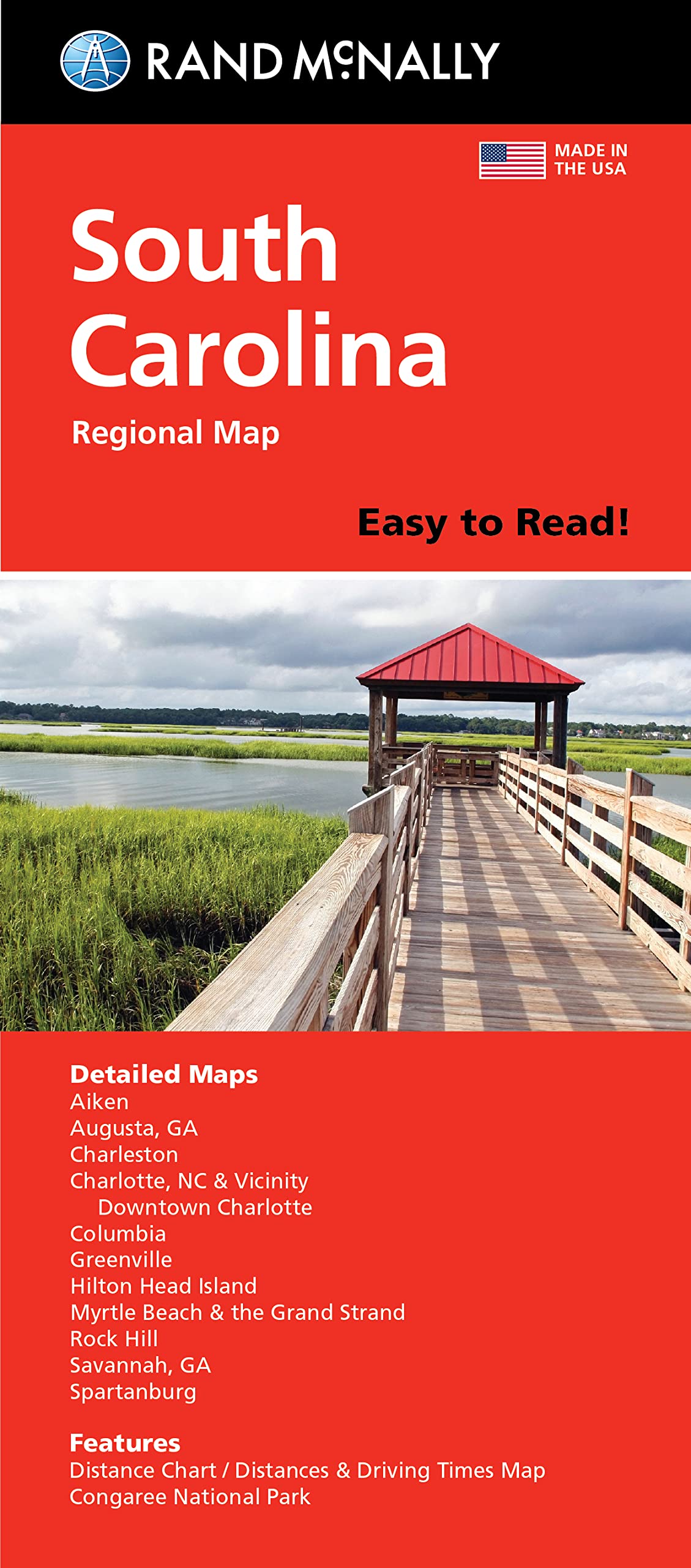
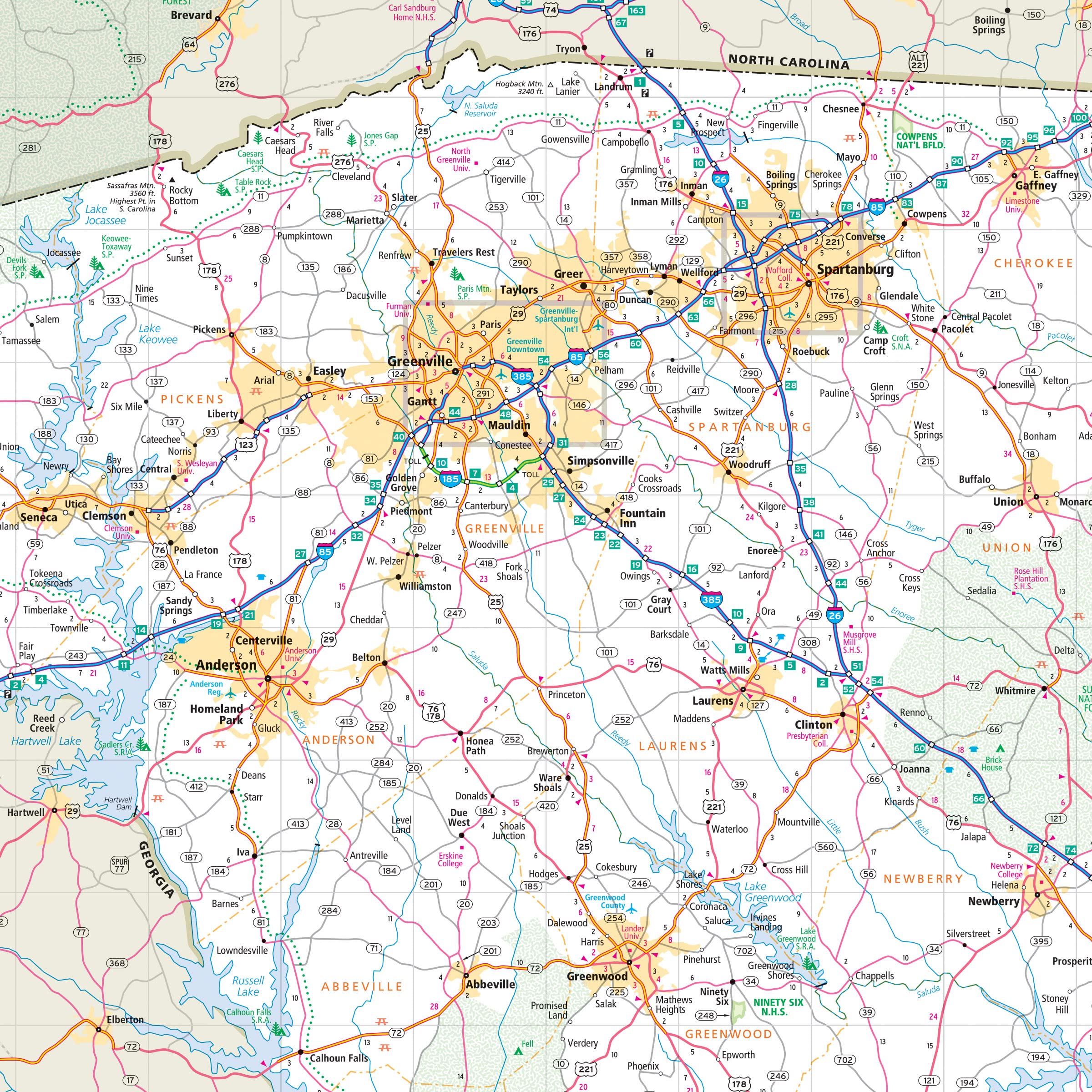
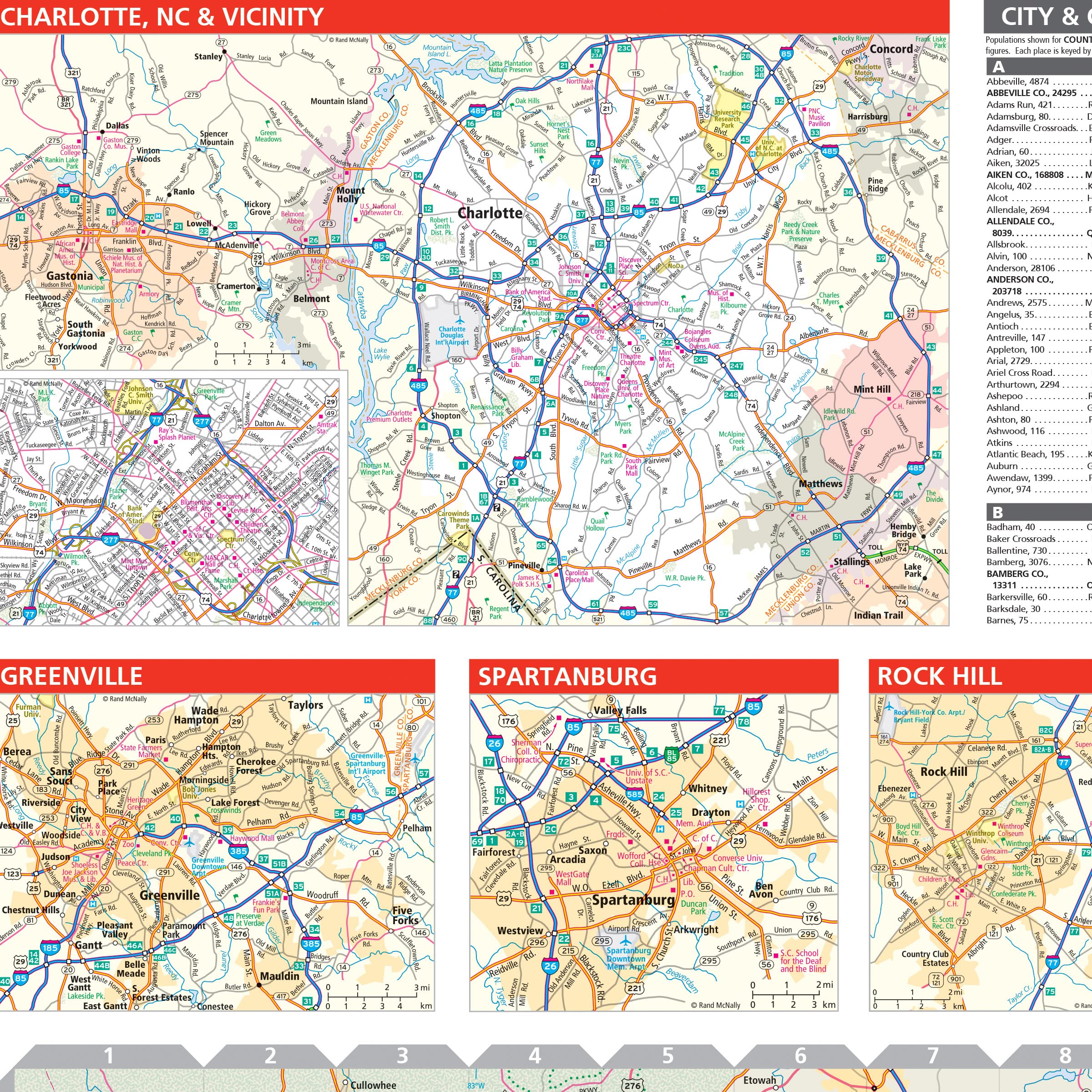
Rand McNally’s Easy To Read State Folded Map is a must-have for anyone traveling, offering unbeatable accuracy and reliability at a great price. Our trusted cartography shows all Interstate, U.S., state, and county highways, along with clearly indicated parks, points of interest, airports, county boundaries, and streets. The easy-to-use legend and detailed index make for quick and easy location of destinations. You’ll see why Rand McNally folded maps have been the trusted standard for years. * Regularly updated, full-color maps.
Features
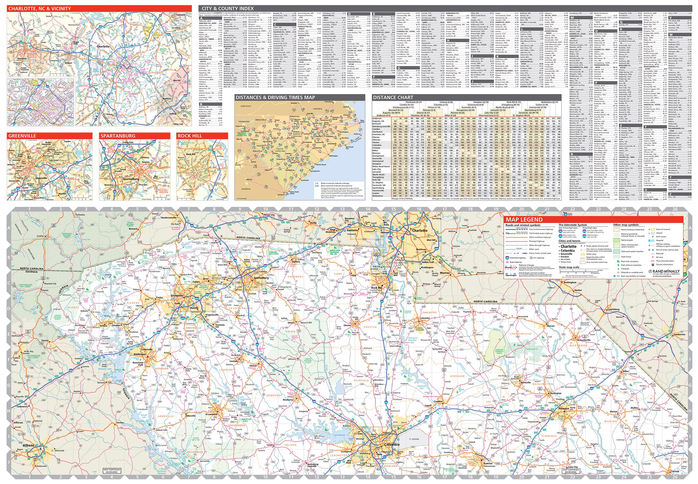
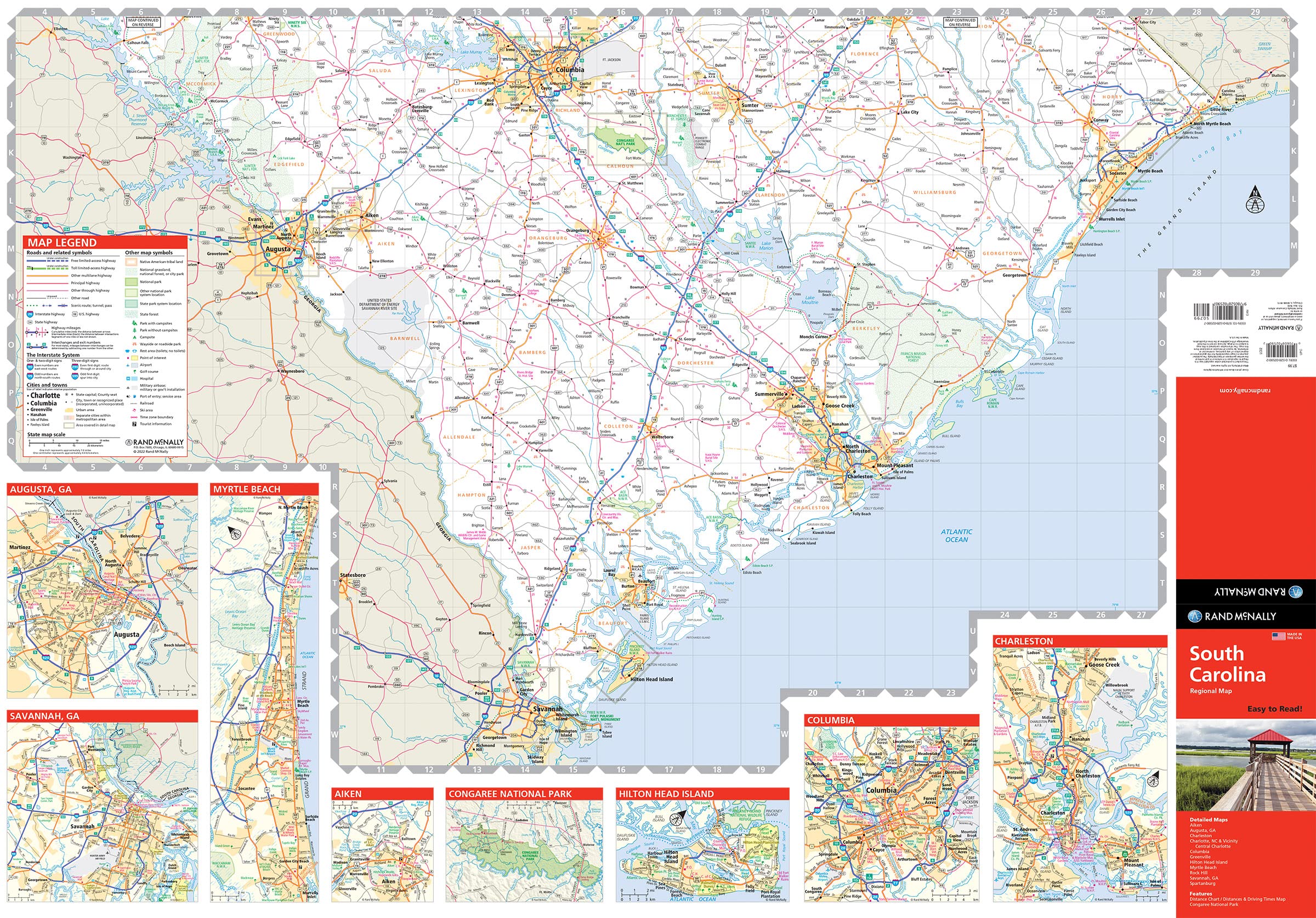
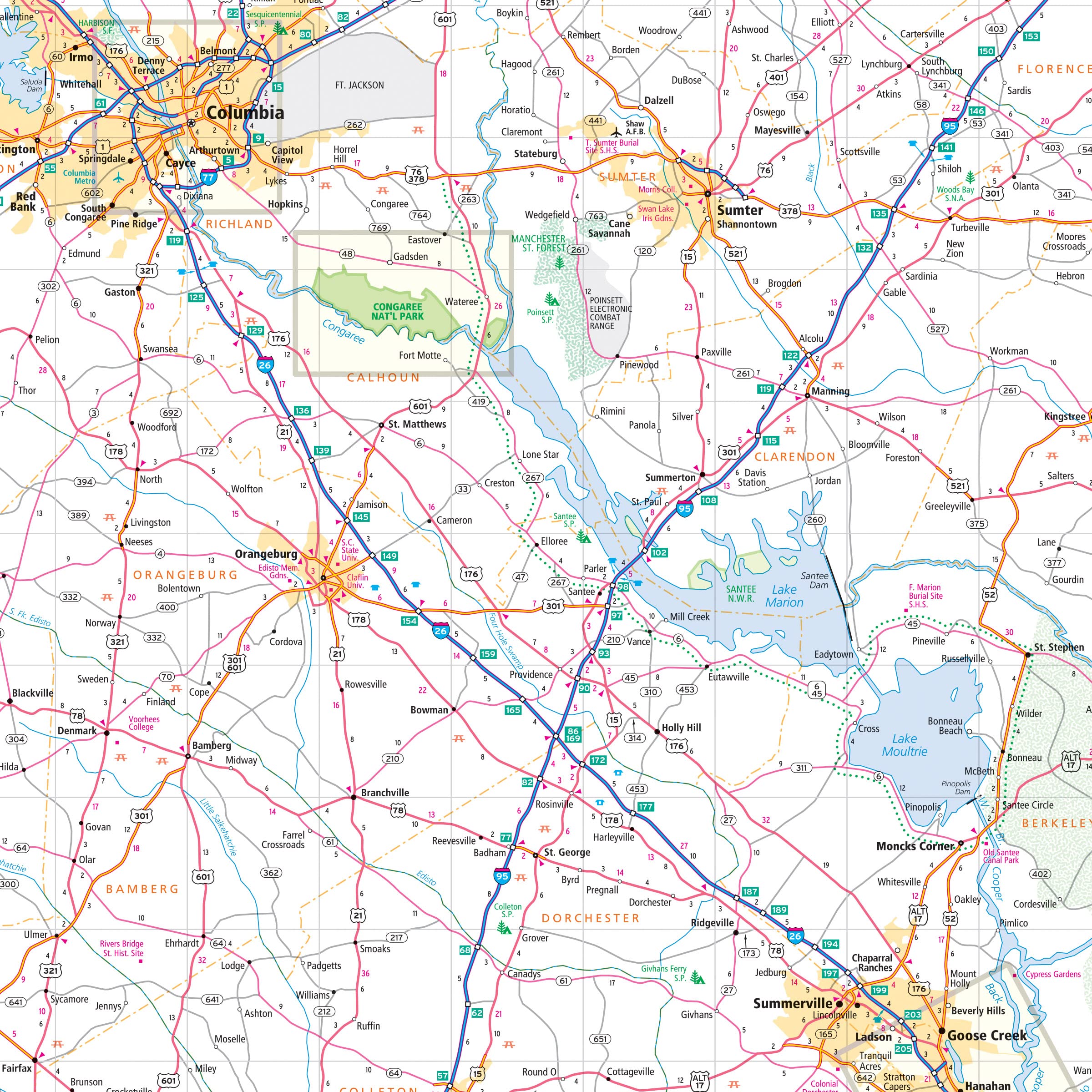
- Points of interest
- State park chart
- State mileage chart
- Driving times map
- On-the-road toolbox
- Visitor center information
- Climate data
- State facts & symbols
- Easy-to-use legend
- Detailed indexed
- Copyright 2022


Reviews
There are no reviews yet.