
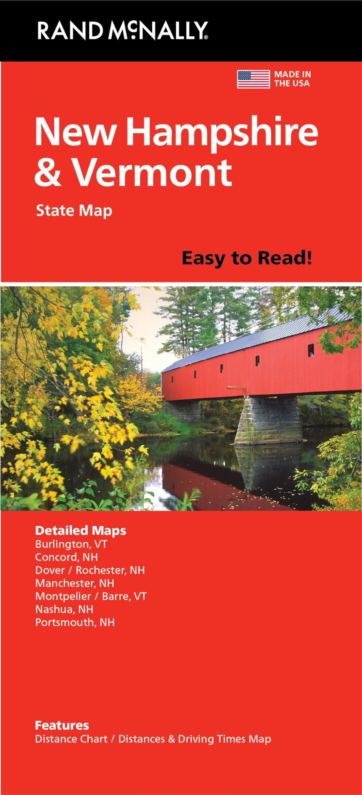
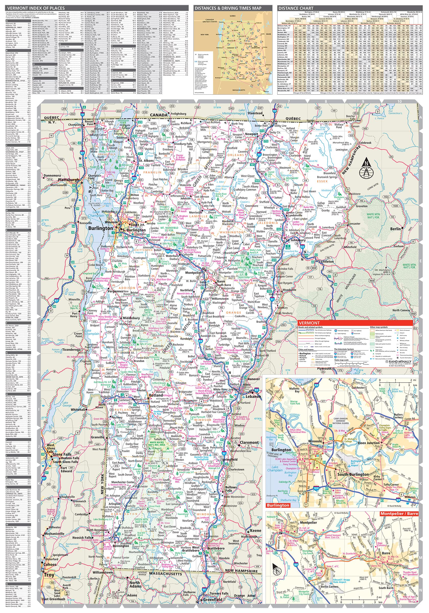
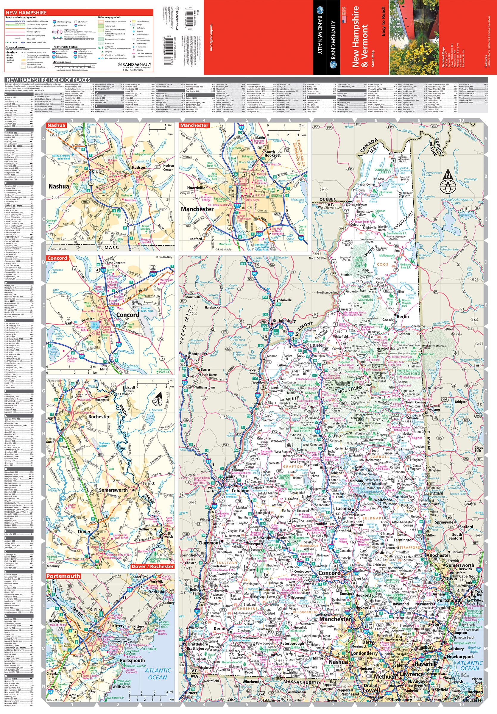
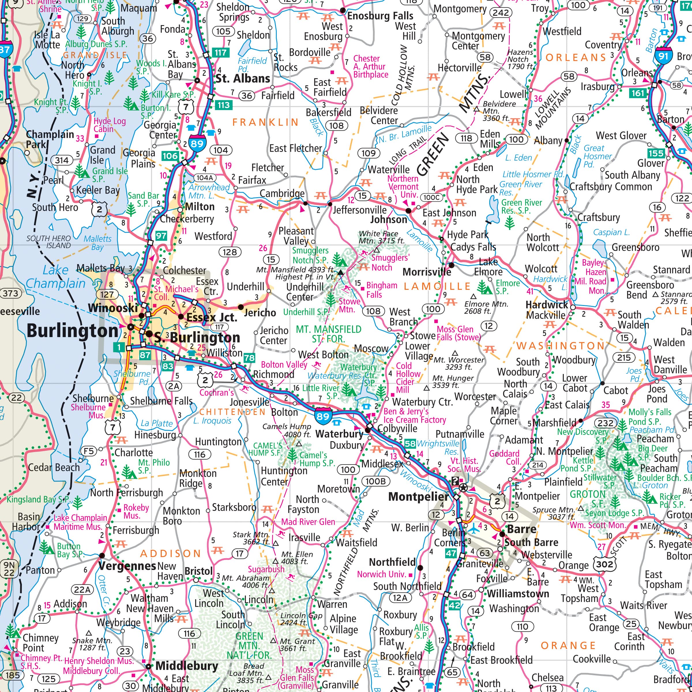
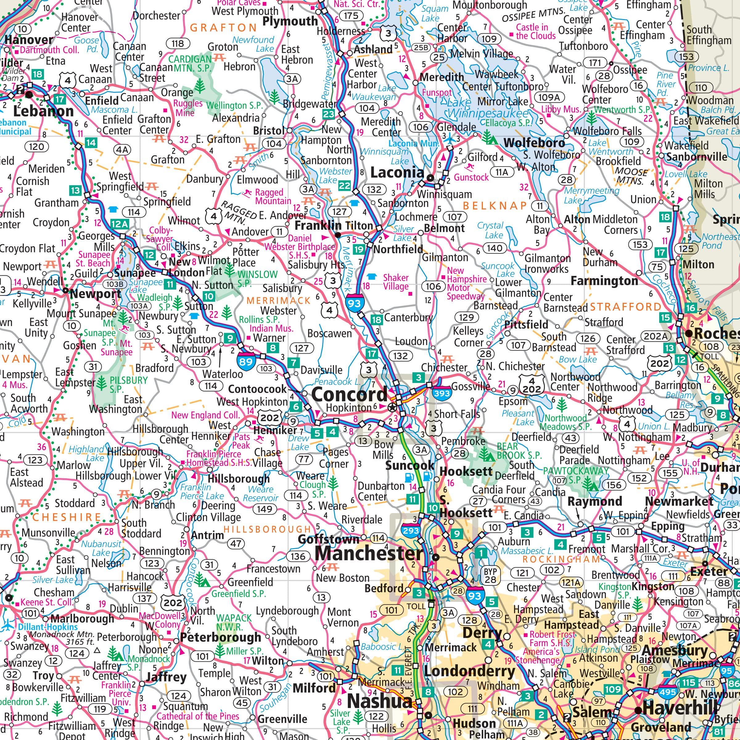
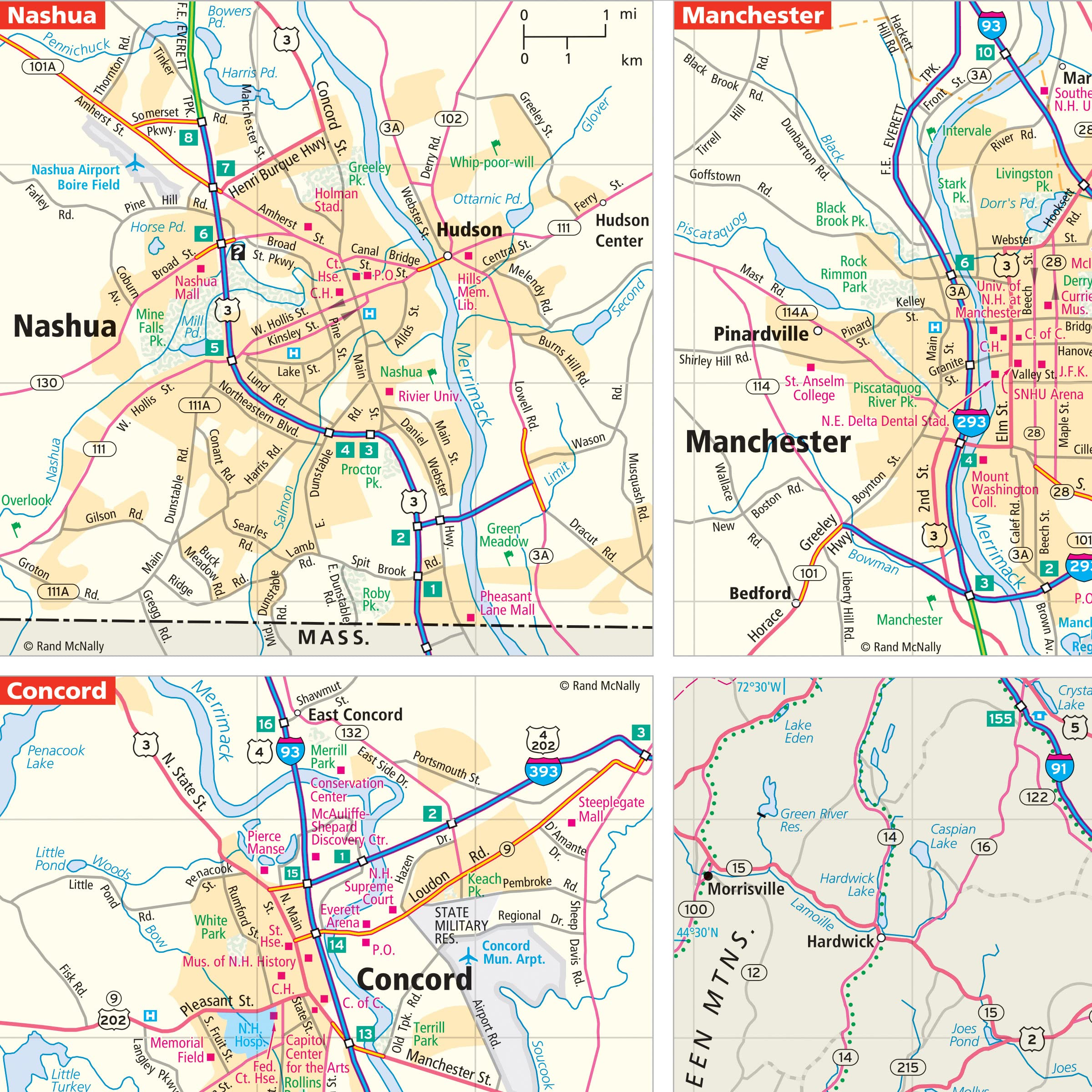
Rand McNally’s Easy To Read State Folded Map is a must-have for anyone traveling in and around New Hampshire and Vermont, offering unbeatable accuracy and reliability at a great price. Our trusted cartography shows all Interstate, U.S., state, and county highways, along with clearly indicated parks, points of interest, airports, county boundaries, and streets. The easy-to-use legend and detailed index make for quick and easy location of destinations. You’ll see why Rand McNally folded maps have been the trusted standard for years. – Regularly updated, full-color maps. – 53% larger map with a bigger type size than the Rand McNally Folded Map. – Clearly labeled Interstate, U.S., state, and county highways. – Indications of parks, points of interest, airports, county boundaries, and more. – Mileage and driving times map. – Convenient folded size. Coverage Area Detailed maps of: Burlington, VT; Concord, NH; Manchester, NH; Montpelier/Barre, VT; Nashua, NH; Portsmouth, NH; Rochester, NH. Product Details: Dimensions (unfolded): 28″ x 40″.
Features
- Regularly updated, full-color maps
- 53% larger map with a bigger type size than the Rand McNally Folded Map
- Clearly labeled Interstate, U.S., state, and county highways
- Indications of county boundaries, schools, shopping malls, parks, golf courses, hospitals, airports, and points of interest
- Mileage and driving times map
- Detailed index
- Copyright 2021
- Coverage Area Detailed maps of: Burlington, VT; Concord, NH; Manchester, NH; Montpelier/Barre, VT; Nashua, NH; Portsmouth, NH; Rochester, NH

![2 Pack - Giant World Map & US Map Poster Set - Extra Large Mega Chart of the World & United States - Laminated - 46" x 60" [Blue]](https://m.media-amazon.com/images/I/91LEEQUE1bL.jpg)
![Wall Art Impact 26"x24" Poster Resource Map - Australia Mineral Resources Map My [Laminated]](https://m.media-amazon.com/images/I/81kDfsItG3L.jpg)

Reviews
There are no reviews yet.