
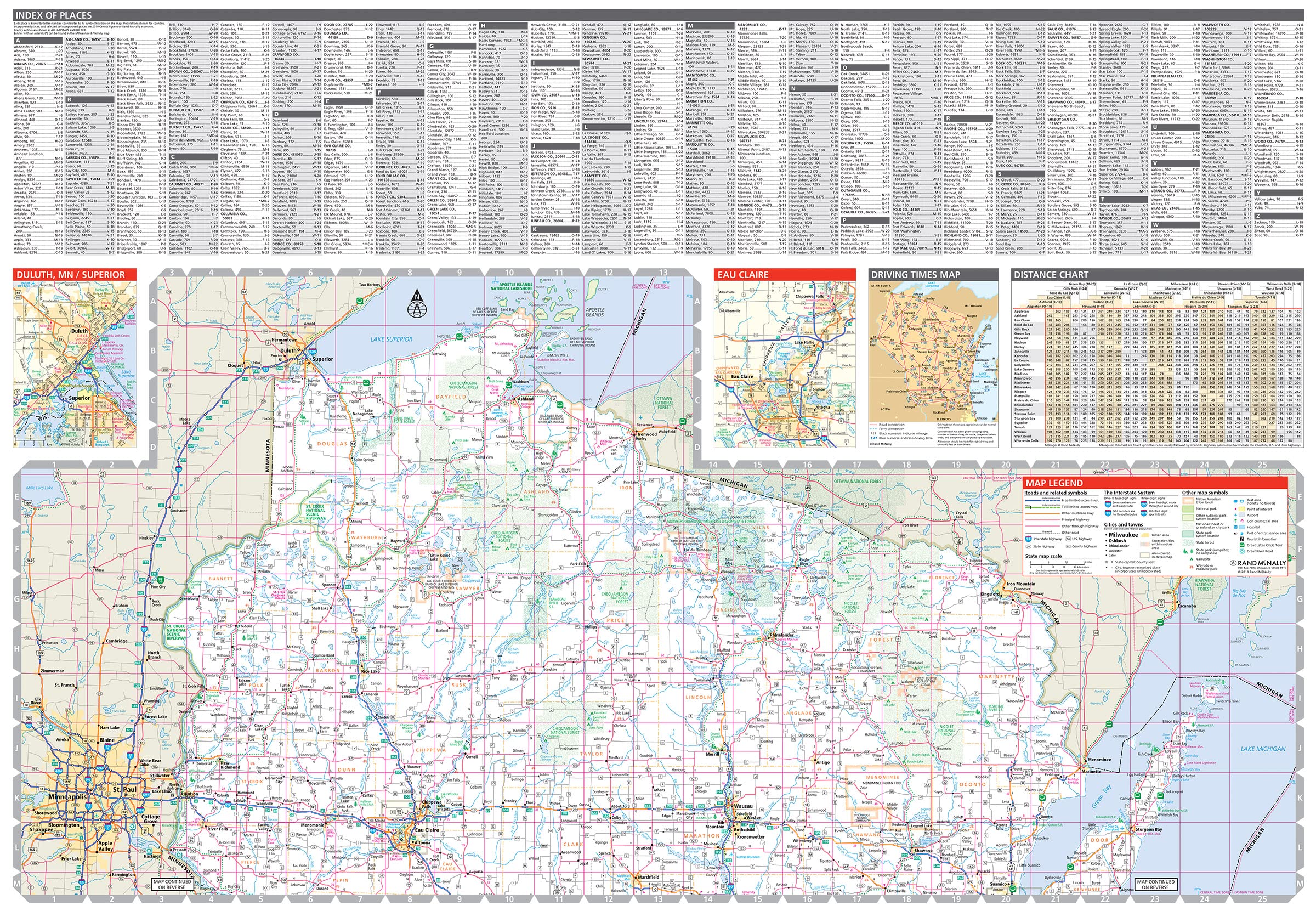
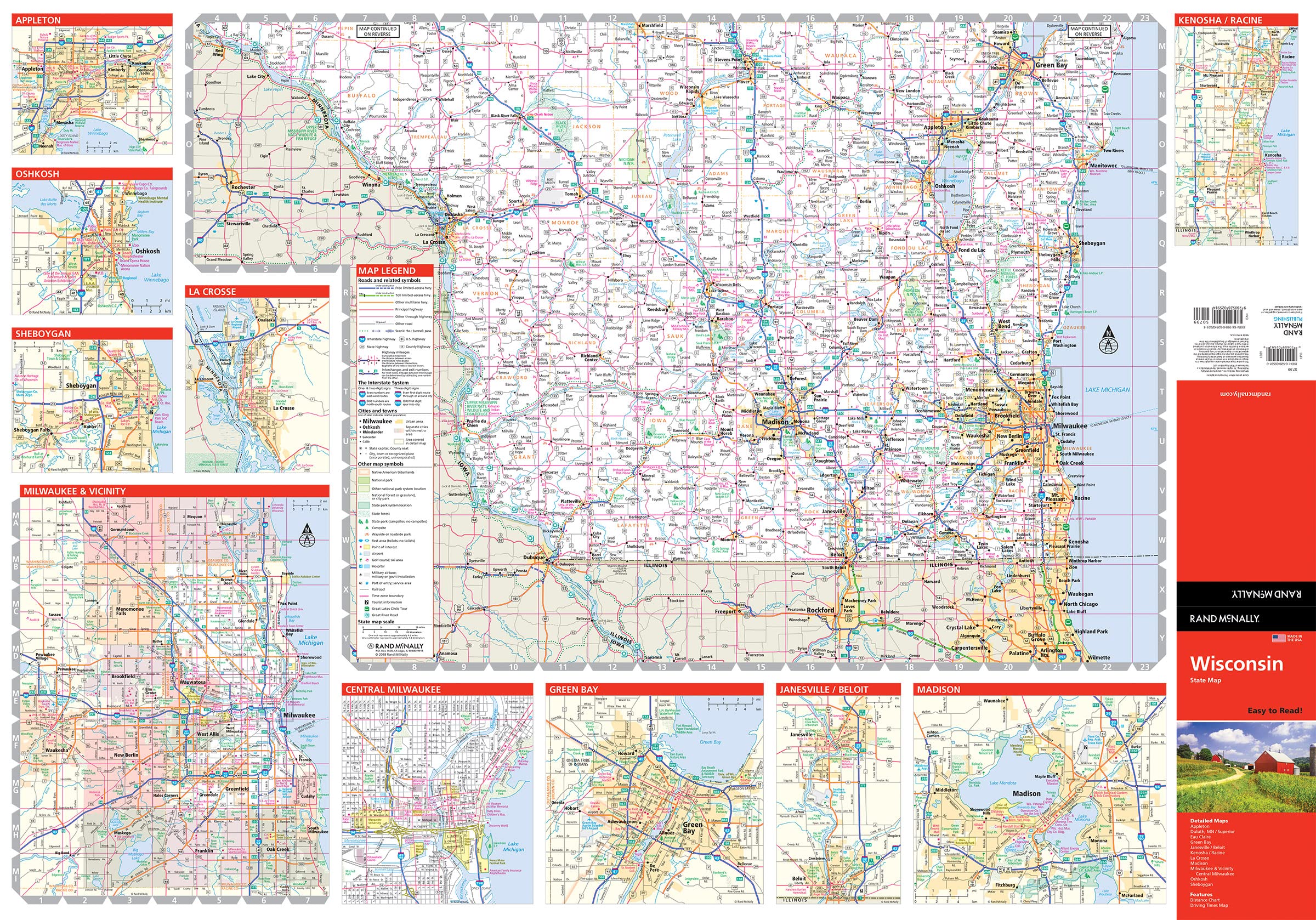
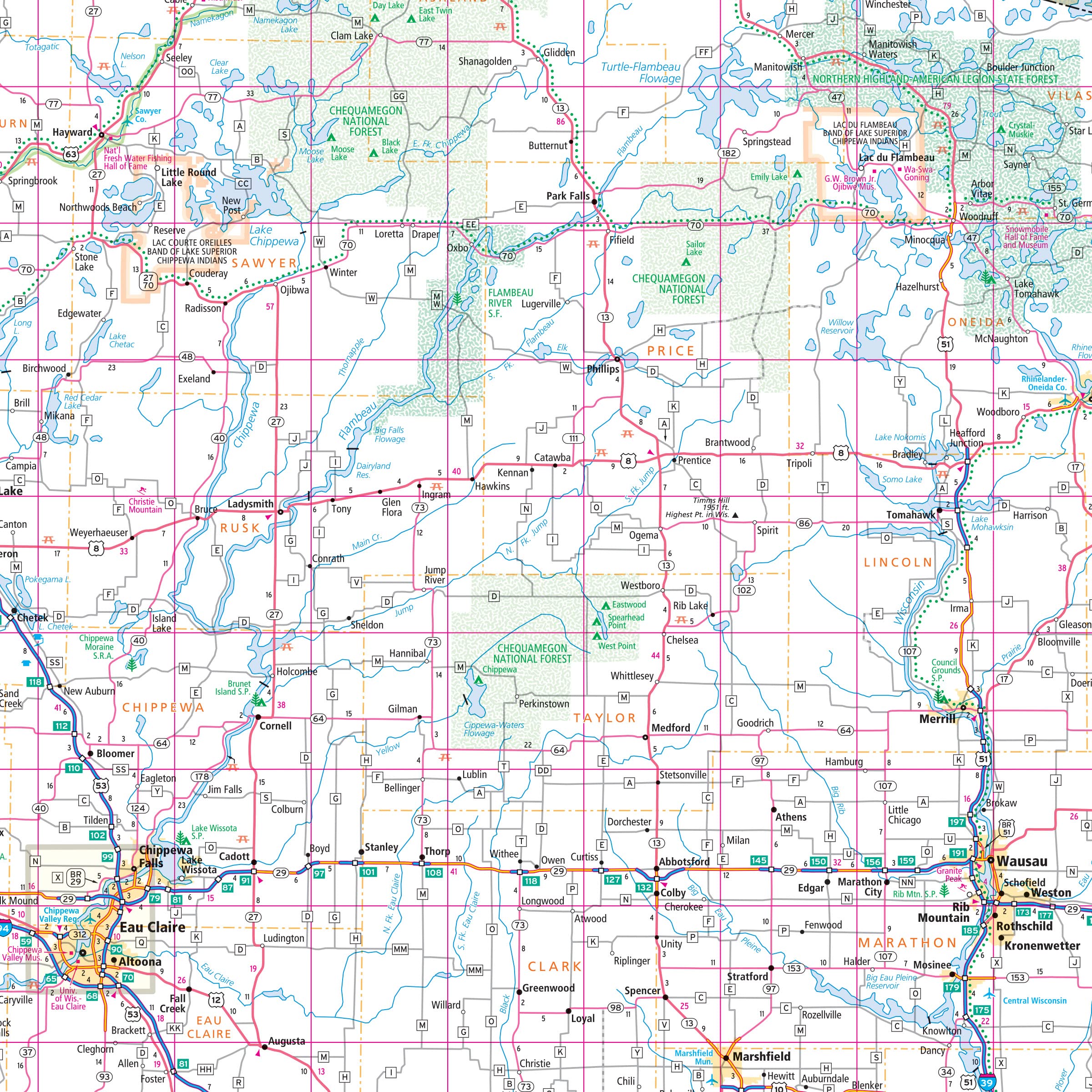
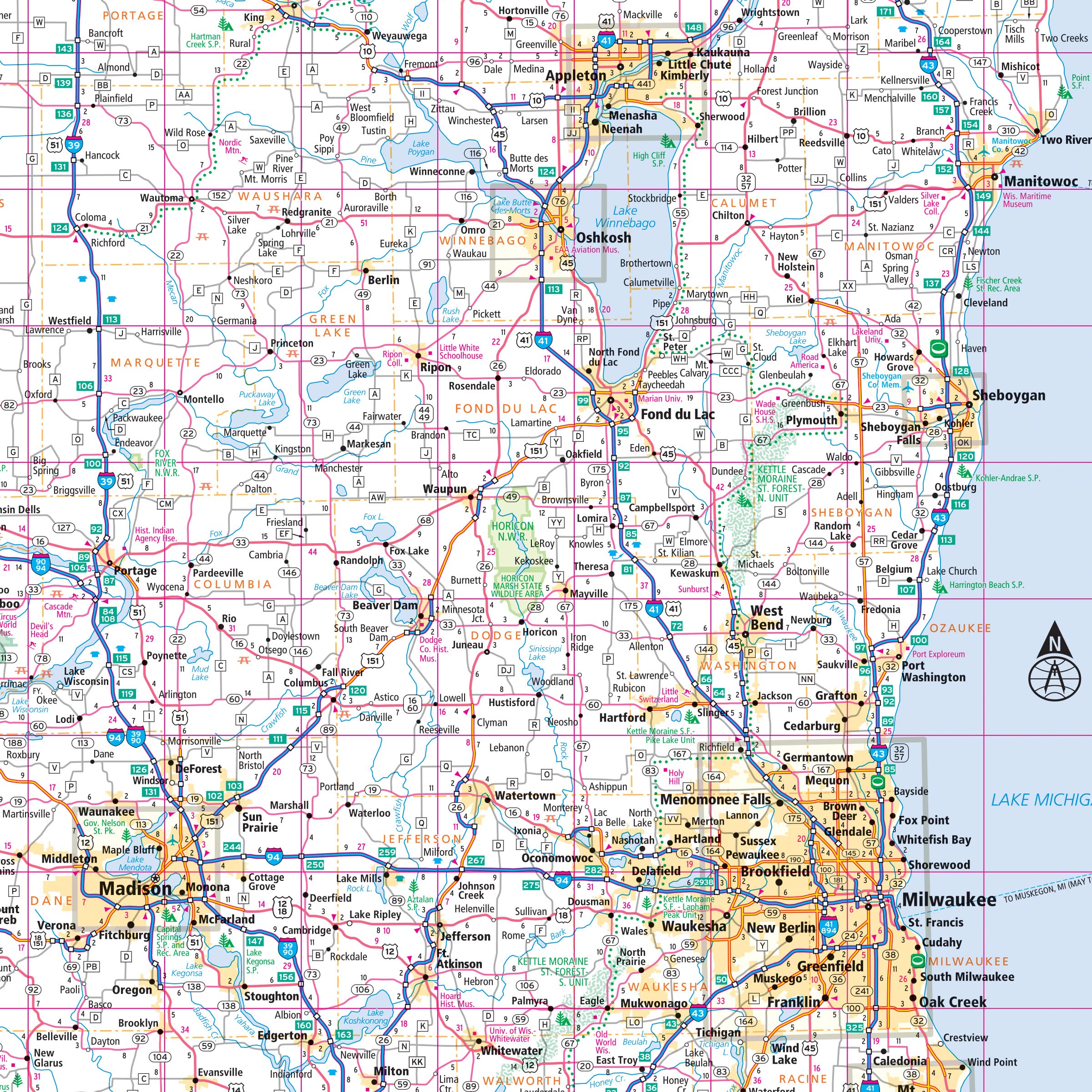
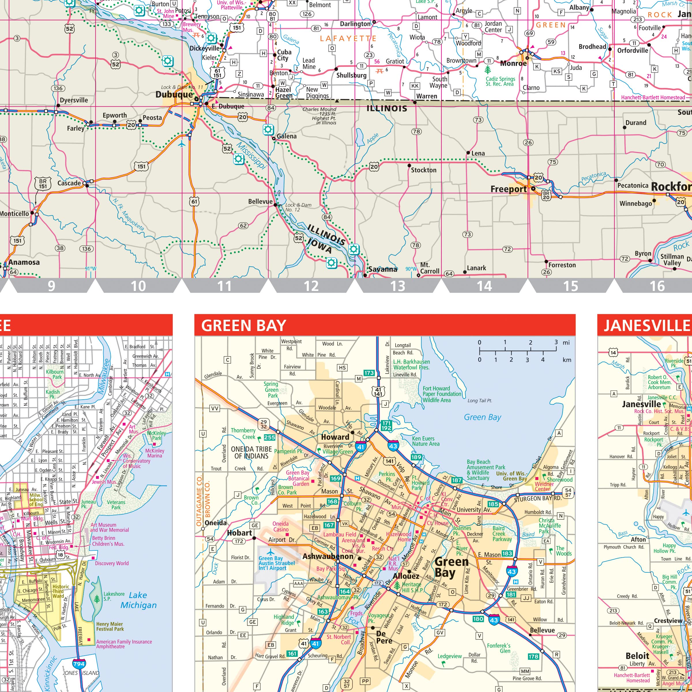
Rand McNally’s Easy To Read State Folded Map is a must-have for anyone traveling in and around Wisconsin, offering unbeatable accuracy and reliability at a great price. Our trusted cartography shows all Interstate, U.S., state, and county highways, along with clearly indicated parks, points of interest, airports, county boundaries, and streets. The easy-to-use legend and detailed index make for quick and easy location of destinations. You’ll see why Rand McNally folded maps have been the trusted standard for years. – Regularly updated, full-color maps. – 39% larger map with a bigger type size than the Rand McNally Folded Map. – Clearly labeled Interstate, U.S., state, and county highways. – Indications of parks, points of interest, airports, county boundaries, and more. – Mileage and driving times map. – Detailed index. – Convenient folded size. Coverage Area Detailed maps of Appleton, Eau Claire, Green Bay, Janesville/Beloit, La Crosse, Madison, Milwaukee & Vicinity, Downtown Milwaukee, Oshkosh, Racine/Kenosha, Sheboygan, Superior. Product Details: Dimensions (unfolded): 28 x 40.
Features
- 39% larger map with a bigger type size than the Rand McNally Folded Map
- Regularly updated, Full-color maps
- Clearly labeled Interstate, U.S., state, and county highways
- Indications of parks, points of interest, airports, county boundaries, and more
- Mileage and driving times map
- Detailed index
- Copyright 2024
- Coverage Area Detailed maps of: Appleton, Eau Claire, Green Bay, Janesville/Beloit, La Crosse, Madison, Milwaukee & Vicinity, Downtown Milwaukee, Oshkosh, Racine/Kenosha, Sheboygan, Superior

![Wall Art Impact 24"x34" Poster Topographic Map Us Geological Survey [Laminated]](https://m.media-amazon.com/images/I/81lShKnjk2L.jpg)
![Wall Art Impact 24"x36" Thematic Map Map of Seattle Area [Laminated]](https://m.media-amazon.com/images/I/81EiGmJ-J4L.jpg)

Reviews
There are no reviews yet.