
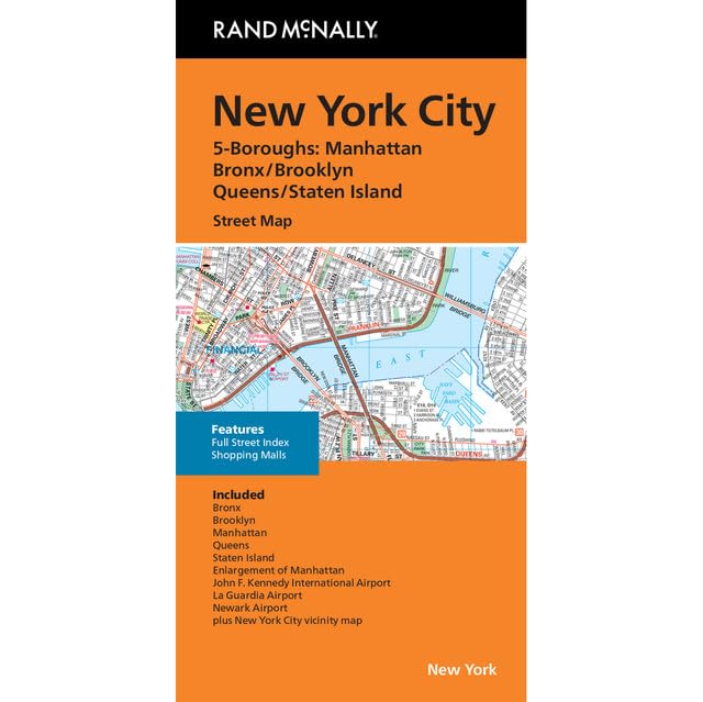
Rand McNally’s folded map for New York City 5 Boroughs: Manhattan/Bronx/Brooklyn/Queens/Staten Island is a must-have for anyone traveling in and around this part of New York, offering unbeatable accuracy and reliability at a great price. Our trusted cartography shows all Interstate, U.S., state, and county highways, along with clearly indicated parks, points of interest, airports, county boundaries, and streets. The easy-to-use legend and detailed index make for quick and easy location of destinations. You’ll see why Rand McNally folded maps have been the trusted standard for years.
Features
- Regularly updated, full-color maps
- Clearly labeled Interstate, U.S., state, and county highways
- Indications of parks, points of interest, airports, county boundaries, and more
- Detailed and full street index
- Coverage Area Communities Included: Bronx, Brooklyn, Manhattan, Queens, Staten Island
- Copyright 2023

![Wall Art Impact 38"x24" Poster Topographic Map - MyTopo Custom Topo Maps, Aerial Photos, Online Maps, and Map Software [Laminated]](https://m.media-amazon.com/images/I/51BS36akJaL.jpg)

Reviews
There are no reviews yet.