
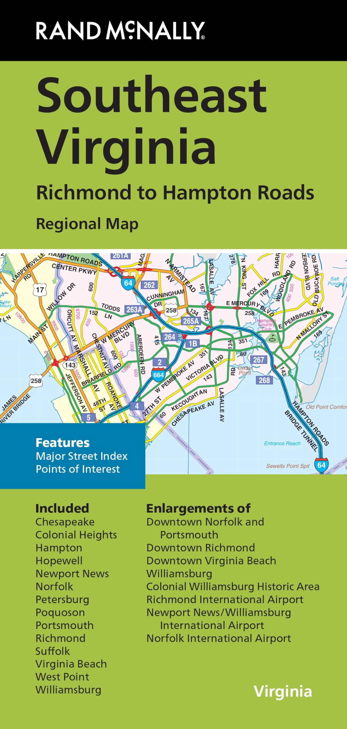
Rand McNally’s folded map for Southeast Virginia Richmond to Hampton Roads is a must-have for anyone traveling in and around this part of Virginia, offering unbeatable accuracy and reliability at a great price. Our trusted cartography shows all Interstate, U.S., state, and county highways, along with clearly indicated parks, points of interest, airports, county boundaries, and streets. The easy-to-use legend and detailed index make for quick and easy location of destinations. You’ll see why Rand McNally folded maps have been the trusted standard for years. – Regularly updated. – Full-color maps. – Clearly labeled Interstate, U.S., state, and county highways. – Indications of parks, points of interest, airports, county boundaries, downtown & vicinity maps. – Major attractions & Golf Courses. – Enlargements of Norfolk and Portsmouth downtown, Richmond downtown, Virginia Beach downtown, Williamsburg, Colonial Williamsburg Historic Area, Richmond Int’l Airport, Newport News/Williamsburg Int’l Airport, Norfolk Int’l Airport. – Easy-to-use legend. – Detailed index & Major Street Index. Coverage Area: Chesapeake, Colonial Heights, Hampton, Hopewell, Newport News, Norfolk, Petersburg, Poquoson, Portsmouth, Richmond, Suffolk, Virginia Beach, West Point, Williamsburg. Product Details: Measures 9.5″ x 4″ and folds out to 40″ x 28″.
Features
- Regularly updated, full-color maps
- Clearly labeled Interstate, U.S., state, and county highways
- Indications of parks, points of interest, airports, county boundaries, schools, shopping malls, downtown & vicinity maps
- Major attractions and Golf Courses
- Enlargements of Norfolk and Portsmouth downtown, Richmond downtown, Virginia Beach downtown, Williamsburg, Colonial Williamsburg Historic Area, Richmond Int’l Airport, Newport News/Williamsburg Int’l Airport, Norfolk Int’l Airport
- Easy-to-use legend
- Detailed index & Major Street Index
- Copyright 2023
- Coverage Area Chesapeake, Colonial Heights, Hampton, Hopewell, Newport News, Norfolk, Petersburg, Poquoson, Portsmouth, Richmond, Suffolk, Virginia Beach, West Point, Williamsburg
![Wall Art Impact 30"x24" Poster Thematic Map - The Pilgrim Progress [Laminated]~](https://m.media-amazon.com/images/I/71B3ErUr4TL.jpg)

![Wall Art Impact 38"x24" Poster Topographic Map - MyTopo Custom Topo Maps, Aerial Photos, Online Maps, and Map Software [Laminated]](https://m.media-amazon.com/images/I/51BS36akJaL.jpg)
![Wall Art Impact 26"x24" Poster Resource Map - Australia Mineral Resources Map My [Laminated]](https://m.media-amazon.com/images/I/81kDfsItG3L.jpg)
Reviews
There are no reviews yet.