
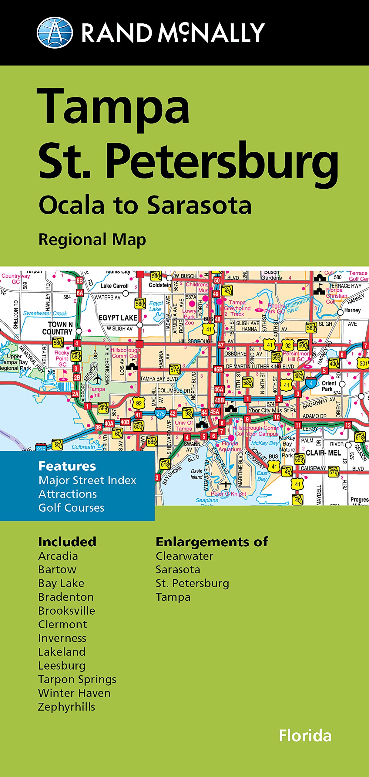
Our trusted cartography shows all Interstate, U.S., state, and county highways, along with clearly indicated parks, points of interest, airports, county boundaries, and streets. The easy-to-use legend and detailed index make for quick and easy location of destinations. You’ll see why Rand McNally folded maps have been the trusted standard for years.
Features
- Regularly updated
- Full-color maps
- Clearly labeled Interstate, U.S., state, and county highways
- Indications of parks, points of interest, airports, county boundaries, downtown & vicinity maps
- Major attractions & Golf Courses
- Enlargements of Clearwater, Sarasota, St. Petersburg & Tampa
- Easy-to-use legend
- Detailed index & Major Street Index
- Convenient folded size
- Copyright 2022

![Wall Art Impact 24"x34" Poster Topographic Map Us Geological Survey [Laminated]](https://m.media-amazon.com/images/I/81lShKnjk2L.jpg)
![Wall Art Impact 30"x24" Poster Thematic Map - The Pilgrim Progress [Laminated]~](https://m.media-amazon.com/images/I/71B3ErUr4TL.jpg)
Reviews
There are no reviews yet.