
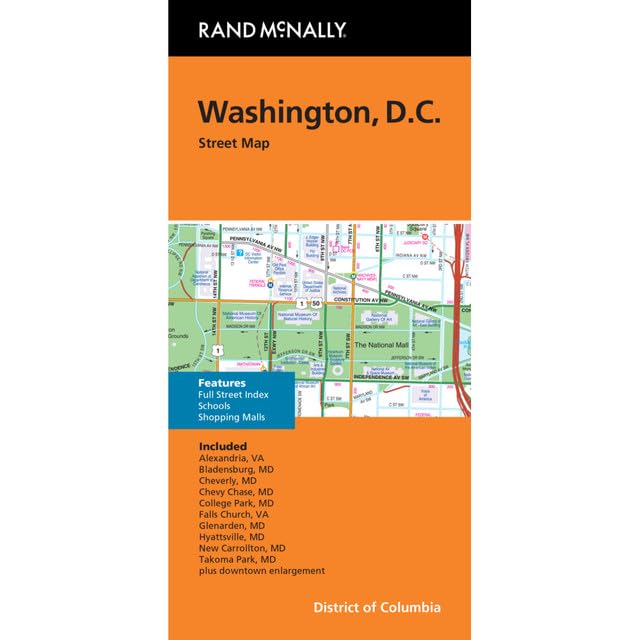
Rand McNally’s folded map for Washington, D.C. is a must-have for anyone traveling in and around this part of District of Columbia, offering unbeatable accuracy and reliability at a great price. Our trusted cartography shows all Interstate, U.S., state, and county highways, along with clearly indicated parks, points of interest, airports, county boundaries, and streets. The easy-to-use legend and detailed index make for quick and easy location of destinations. You’ll see why Rand McNally folded maps have been the trusted standard for years.
Features
- Regularly updated, full-color maps
- Clearly labeled Interstate, U.S., state, and county highways
- Indications of parks, points of interest, airports, county boundaries, and more
- Detailed and full street index
- Coverage Area: Alexandria, Va Bladensburg, Md Cheverly, Md Chevy Chase, Md College Park, Md Falls Church, Va Glenarden, Md Hyattsville, Md New Carrollton, Md Takoma Park, Md plus downtown enlargement.
![2 Pack - Giant World Map & US Map Poster Set - Extra Large Mega Chart of the World & United States - Laminated - 46" x 60" [Blue]](https://m.media-amazon.com/images/I/91LEEQUE1bL.jpg)
![Wall Art Impact 24"x39" Upside Down Political World Map. Rare Funny maps. [Laminated]](https://m.media-amazon.com/images/I/A1ozy4bAW2L.jpg)


Reviews
There are no reviews yet.