
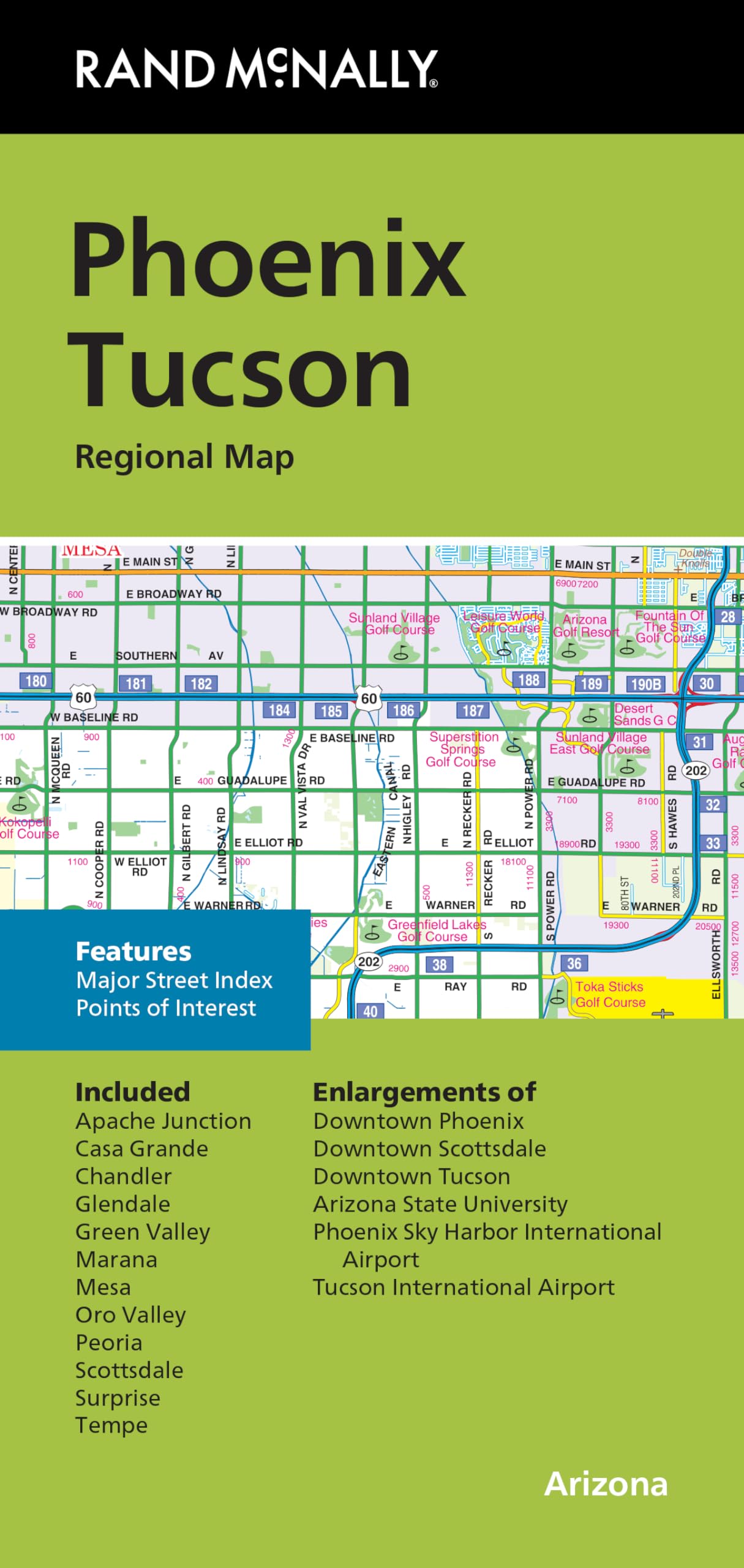
Rand McNally’s folded map for Phoenix Tucson is a must-have for anyone traveling in and around this part of Arizona, offering unbeatable accuracy and reliability at a great price. Our trusted cartography shows all Interstate, U.S., state, and county highways, along with clearly indicated parks, points of interest, airports, county boundaries, and streets. The easy-to-use legend and detailed index make for quick and easy location of destinations. You will see why Rand McNally folded maps have been the trusted standard for years. – Regularly updated. – Full-color maps. – Clearly labeled Interstate, U.S., state, and county highways. – Indications of parks, points of interest, airports, county boundaries, downtown & vicinity maps. – Major attractions & Golf Courses. – Enlargements of Phoenix downtown, Scottsdale downtown, Tucson downtown, Arizona State University, Phoenix Sky Harbor Int’l Airport, Tucson Int’l Airport. – Easy-to-use legend. – Detailed index & Major Street Index. – Convenient folded size. Coverage Area: Communities included, Apache Junction, Casa Grande, Chandler, Glendale, Green Valley, Marana, Mesa, Oro Valley, Peoria, Scottsdale, Surprise, Tempe. Product Details: Measures 9.5′ x 4′ and folds out to 40′ x 28′.
Features
- Regularly updated, full-color maps
- Clearly labeled Interstate, U.S., state, and county highways
- Indications of parks, points of interest, airports, county boundaries, schools, shopping malls, downtown & vicinity maps
- Major attractions and Golf Courses
- Enlargements of Phoenix downtown, Scottsdale downtown, Tucson downtown, Arizona State University, Phoenix Sky Harbor Int’l Airport, Tucson Int’l Airport
- Easy-to-use legend
- Detailed index & Major Street Index
- Copyright 2024
- Coverage Area Communities included, Apache Junction, Casa Grande, Chandler, Glendale, Green Valley, Marana, Mesa, Oro Valley, Peoria, Scottsdale, Surprise, Tempe
![2 Pack - Giant World Map & US Map Poster Set - Extra Large Mega Chart of the World & United States - Laminated - 46" x 60" [Blue]](https://m.media-amazon.com/images/I/91LEEQUE1bL.jpg)


Reviews
There are no reviews yet.