
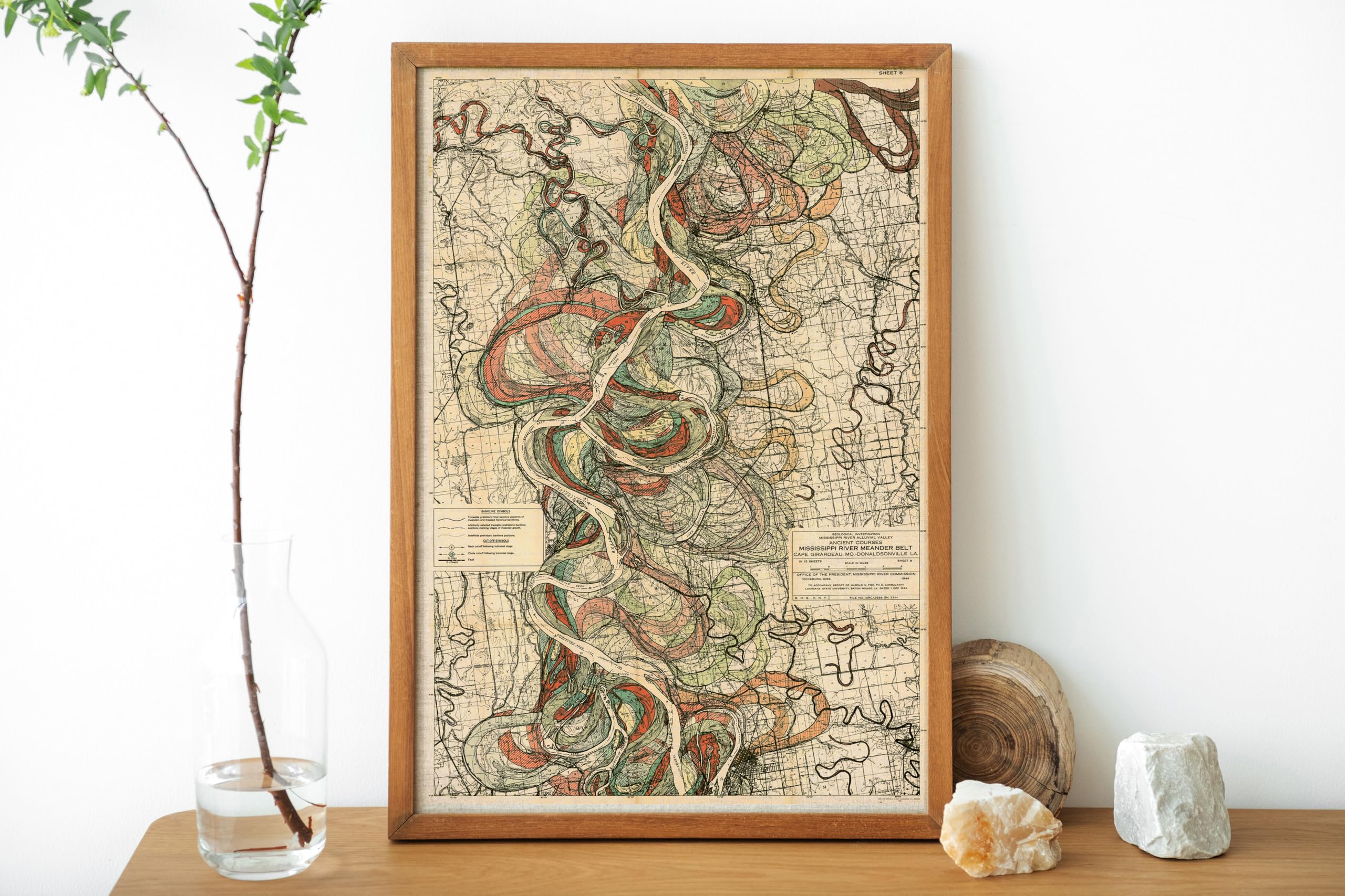
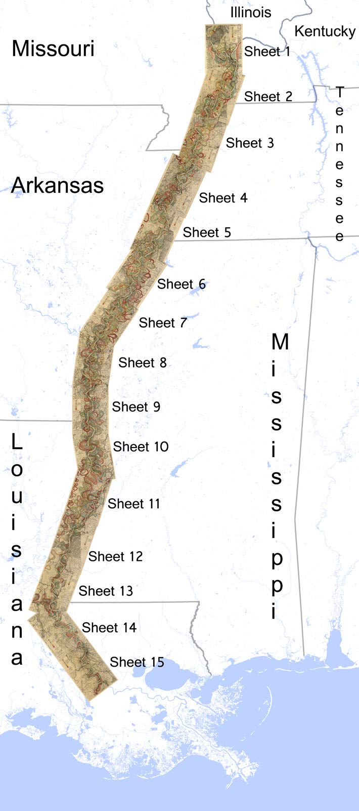
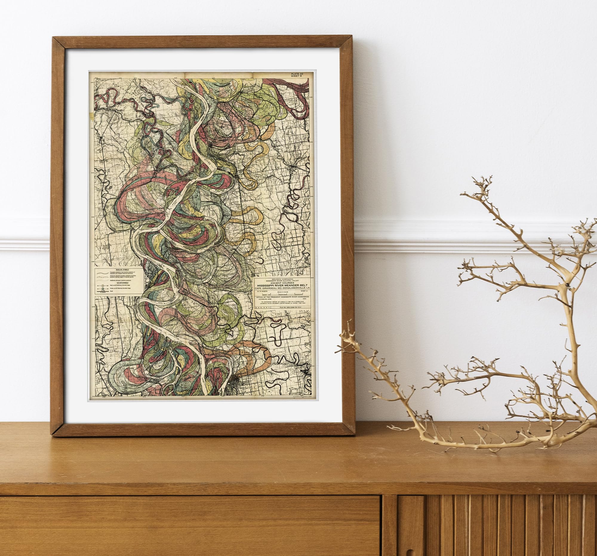


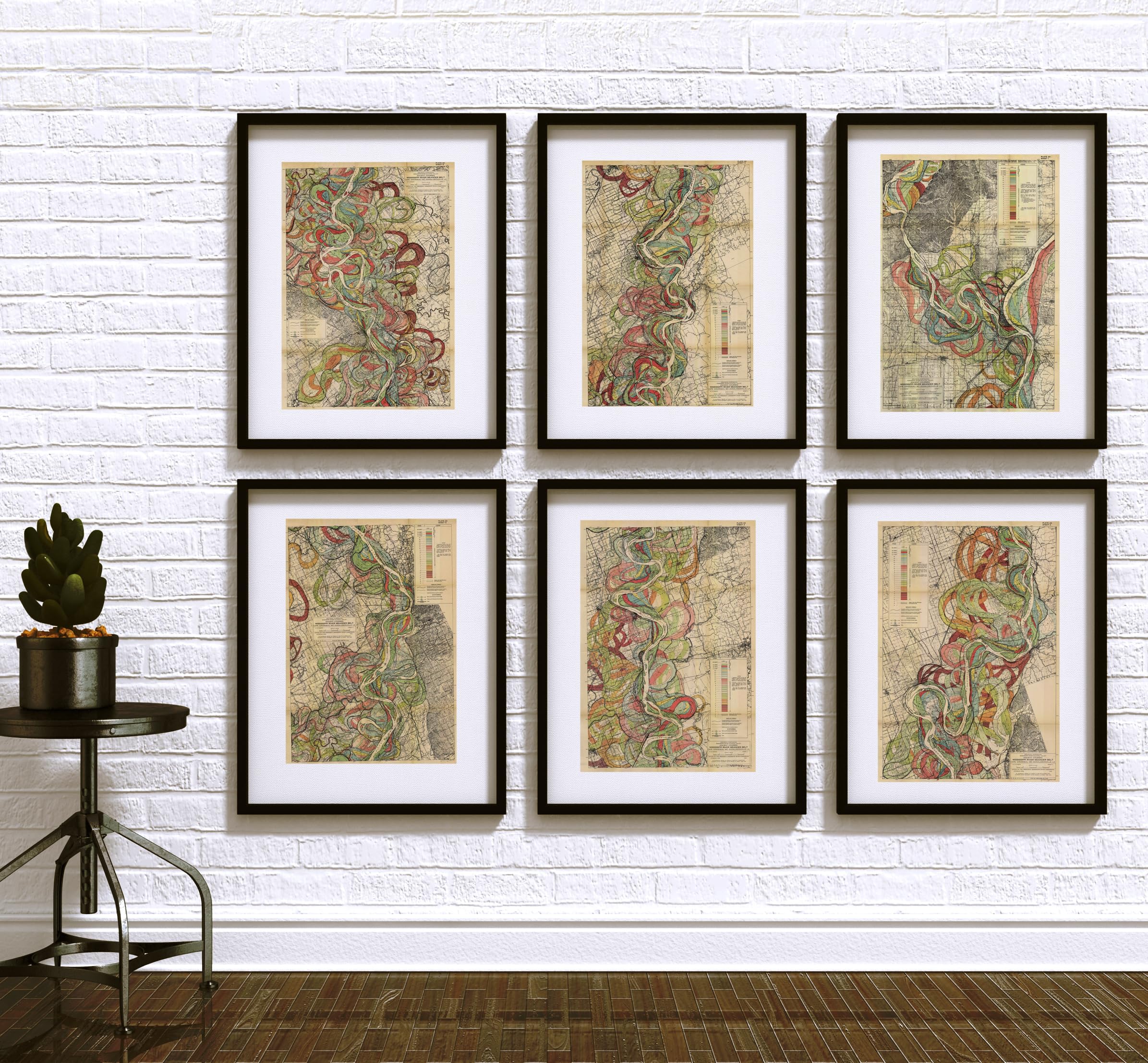
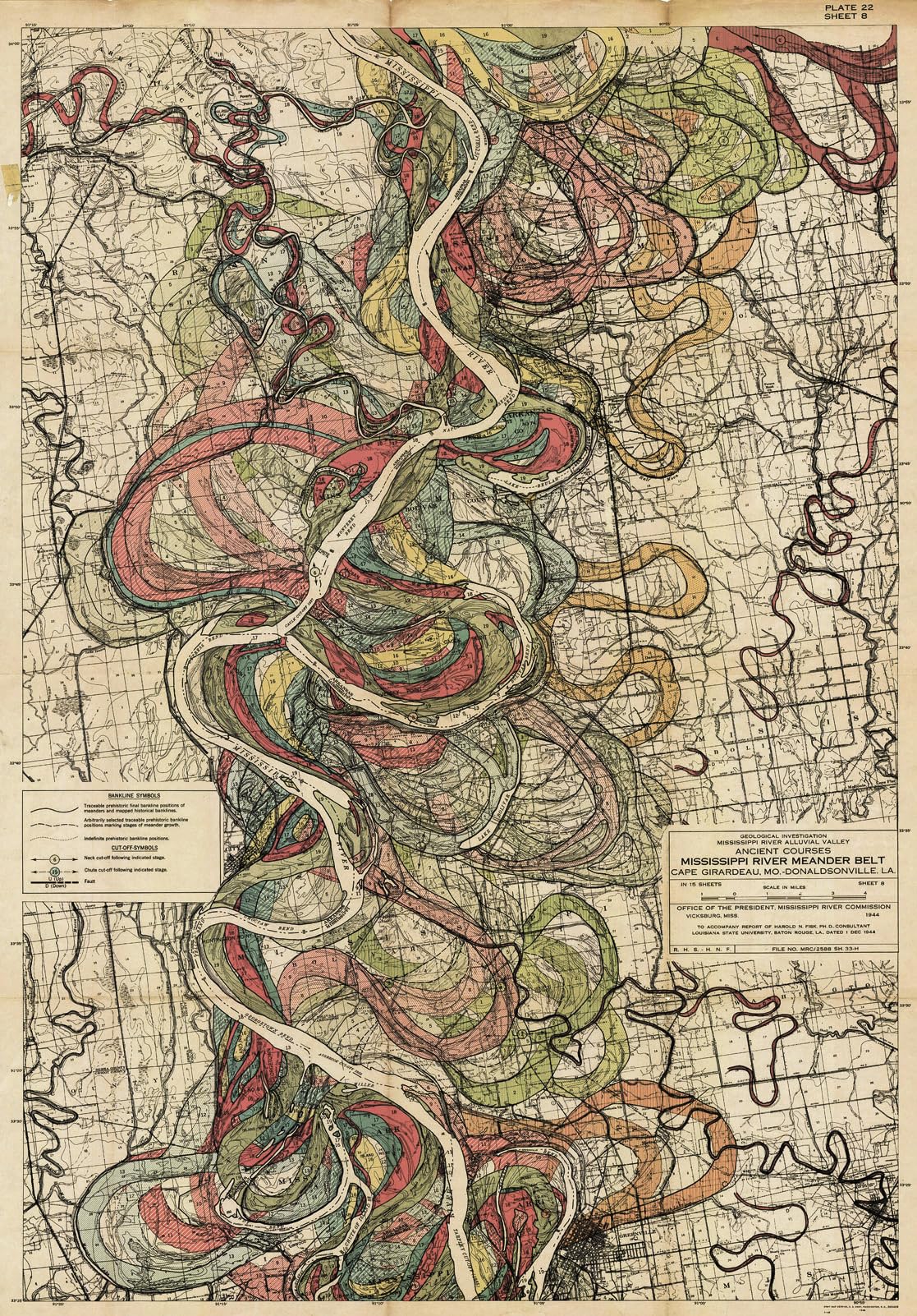
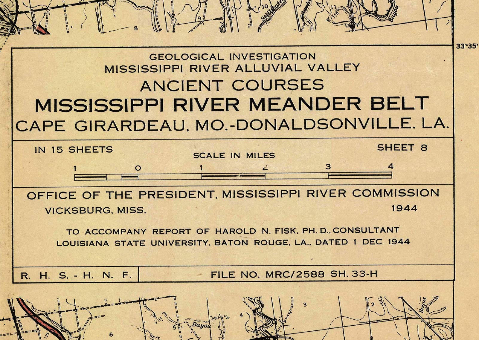
11×16 Inches Unframed 1944 Harold Fisk Mississippi River Meander Belt Alluvial Valley Map. Sheet 8 features the area between Victoria Bend, on the Arkansas side, and ends at Spanish Moss, and starts at Lake Concordia and ends near the Tarpley Cut-Off on the Mississippi side of the mighty Mississippi River. This is a modern reproduction of the original map. Printed on premium 36lb matte paper with fade resistant premium inks and includes a white border on all sides to allow for matting and framing and Made in the USA. You can find the other 14 of Harold Fisk’s Mississippi river maps in Our Store. You can see the assembly of all 15 maps under the pictures. – This map features the Geological Investigation of the ancient courses of the Mississippi River Meander Belt between Cape Girardeau, MO and Donaldsonville, LA. created by cartographer and geologist Harold Fisk compiled for the U.S. Army Corp of Engineers. The whole set includes 15 plates. Each of the fifteen plates document in vivid color the geography, a different portion of the Mississippi River and its various courses over time. The U.S. Army Corp of Engineers contracted Fisk as a consultant. He made the the full technical report “Geological Investigation of the Alluvial Valley of the Lower Mississippi River”. These 15 maps are only a portion of the whole report. Fisk, died in 1964, before the age of 60.
Features
- 11×16 Inches Unframed Mississippi River Map Reproduction; Sheet 8 features the area between Victoria Bend and ends at Spanish Moss and starts at Lake Concordia and ends near the Tarpley Cut-Off on the Mississippi side of the Mississippi River.
- Printed on premium 36lb matte paper with fade resistant premium inks and includes a white border on all sides to allow for matting and framing and Made in the USA.
- You can find the other 14 Harold Fisk’s Mississippi river maps in Our Store and you can see the assembly of all 15 maps in the pictures.
- River Decor; They blend scientific precision with artistic expression using colors and patterns to differentiate between various stages of the river’s evolution.
- River Wall Art; These maps visually depict the dynamic nature of the Mississippi River illustrating how its channels have shifted and meandered over thousands of years due to natural processes and changes in flow patterns.
- Mississippi Gift; By mapping the past courses of the river the maps offer valuable insights into how human settlements and land use have evolved alongside the river over centuries.

![Wall Art Impact 24"x36" Thematic Map Map of Seattle Area [Laminated]](https://m.media-amazon.com/images/I/81EiGmJ-J4L.jpg)

![2 Pack - Giant World Map & US Map Poster Set - Extra Large Mega Chart of the World & United States - Laminated - 46" x 60" [Blue]](https://m.media-amazon.com/images/I/91LEEQUE1bL.jpg)
Reviews
There are no reviews yet.