

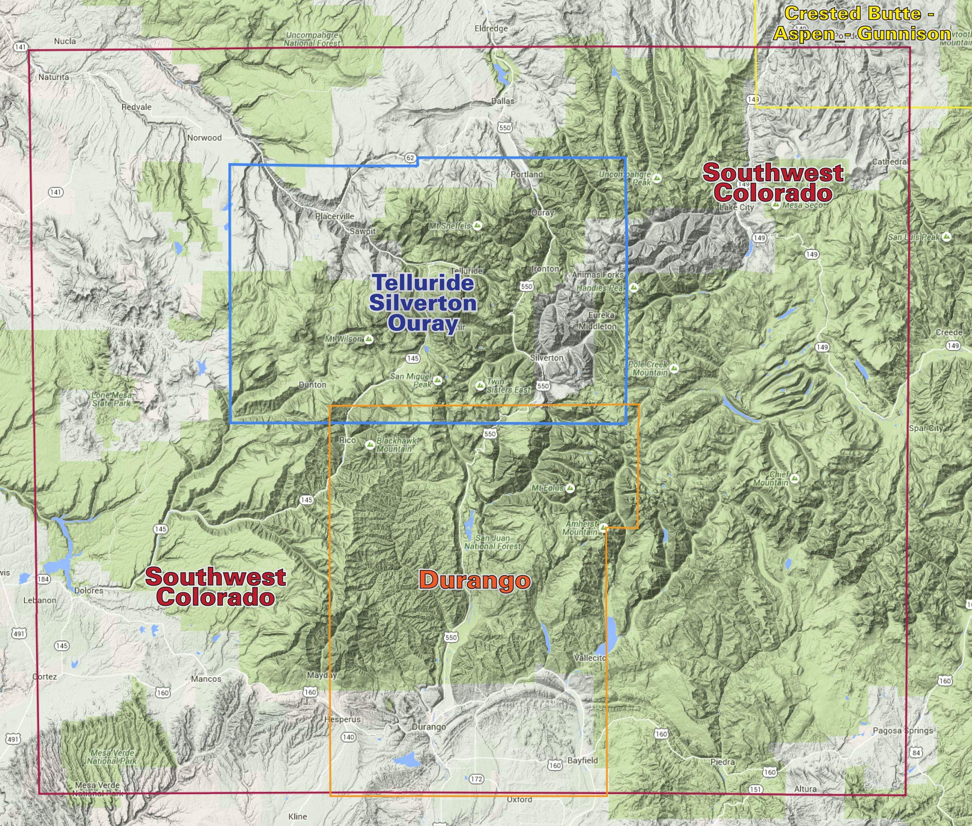
Map Coverage covers all or part of 18 USGS 1:24,000 7.5-minute topographic maps North – 7 miles north of Ouray South – 3 miles south of Lizard Head East – 6 miles east of Silverton West – Western boundary of Lizard Head Wilderness Size 39” x 25” flat 4” x 8” folded Scale 1:50,000 1”= 0.8 miles or 1.3 km Contour Interval – 50 feet with shaded relief base Latest Edition – 6th, 2018 Notes Seven-color, double-sided map Latitude and longitude map borders with UTM coordinates This map connects with the Durango map for continuous coverage of the western San Juan Mountain range Two-sided, self-cover, plastic folded map
Features
- Contour Interval – 50 feet with shaded relief base
- 1”= 0.8 miles
- 39” x 25” flat


Reviews
There are no reviews yet.