
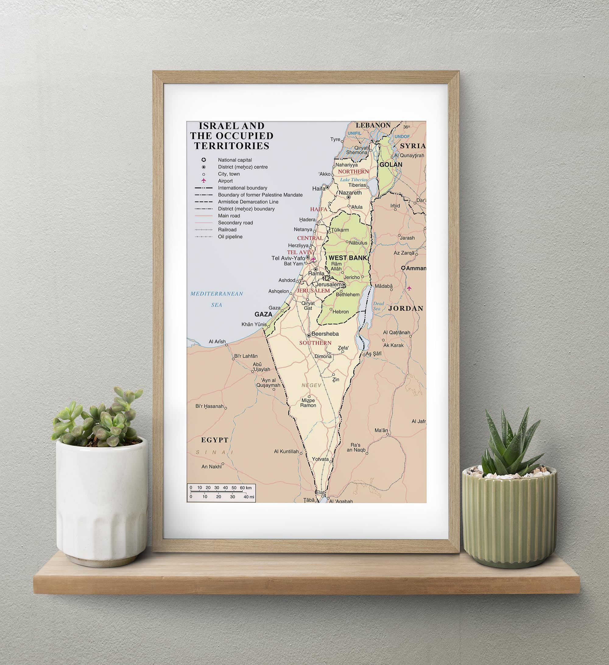
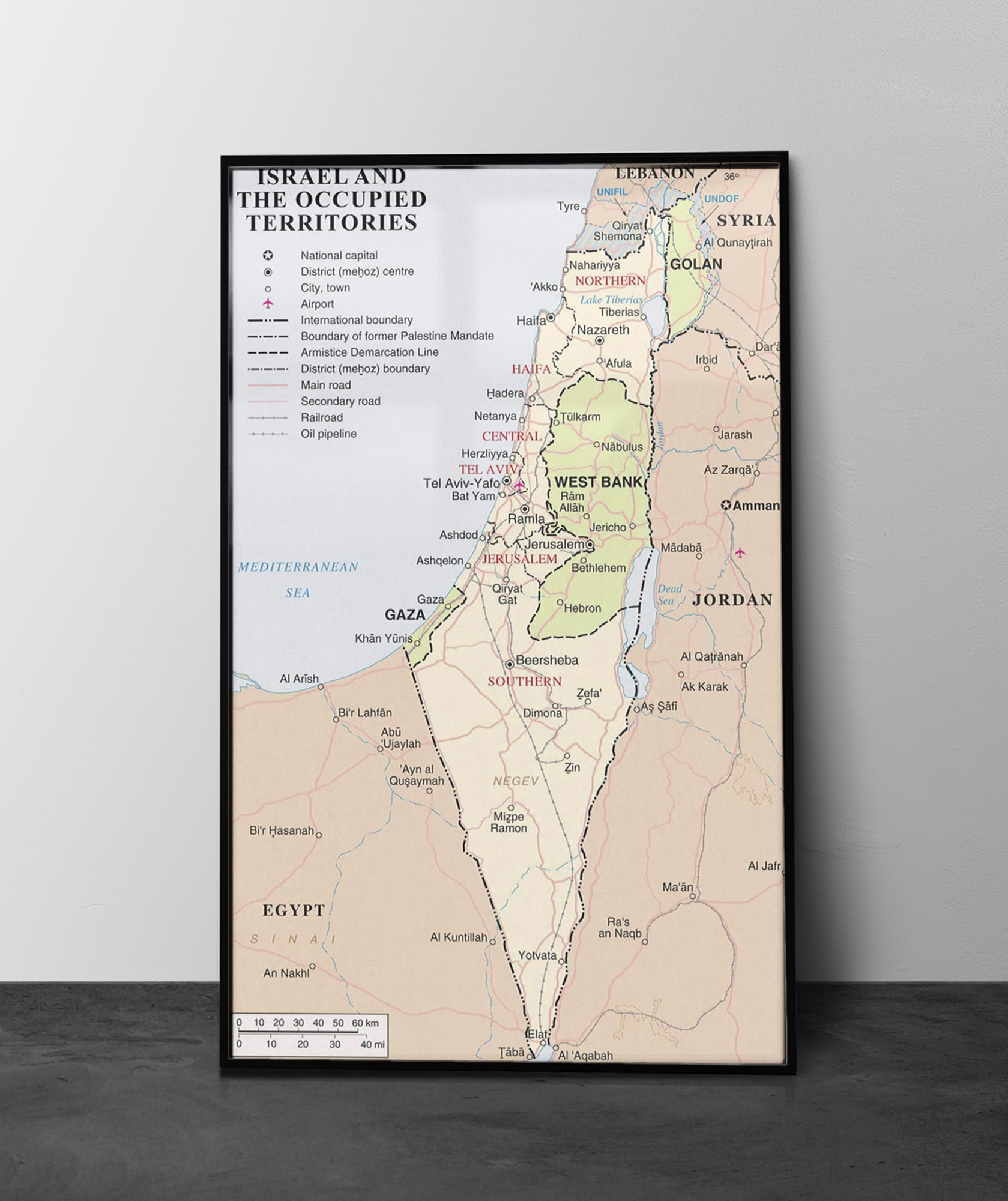
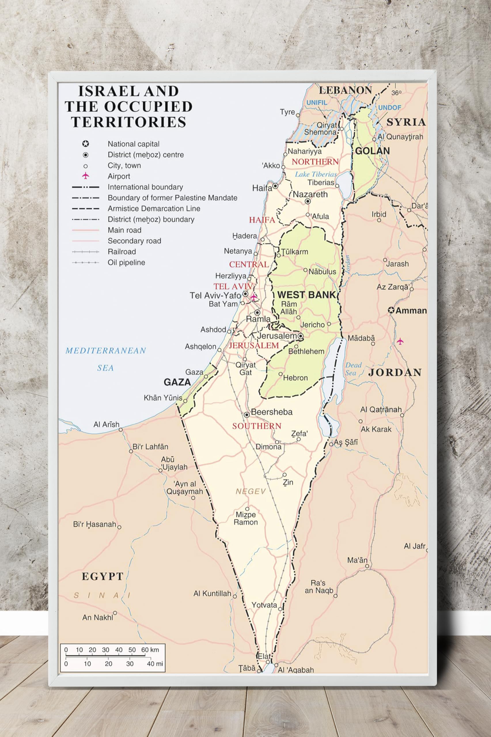
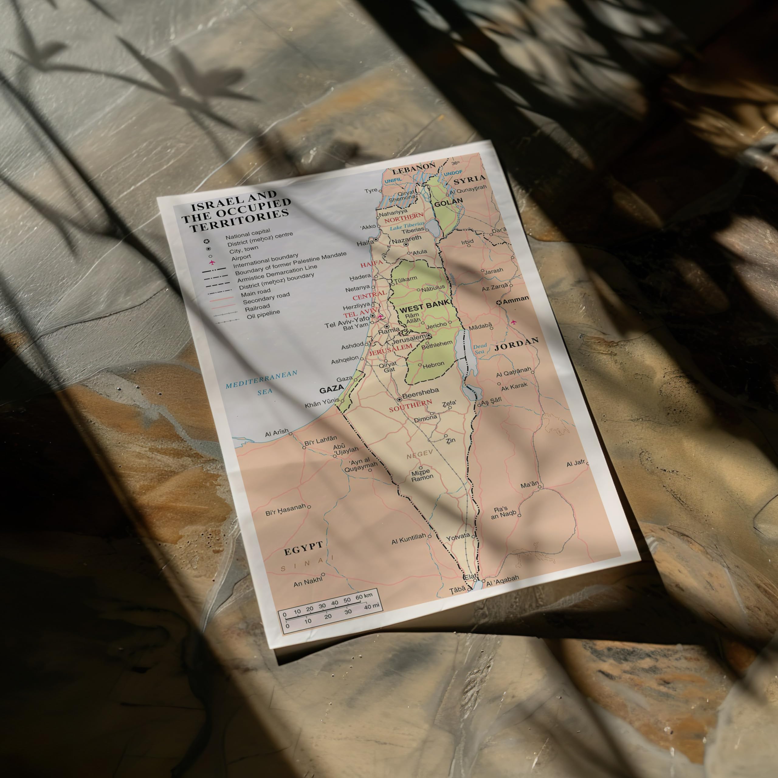
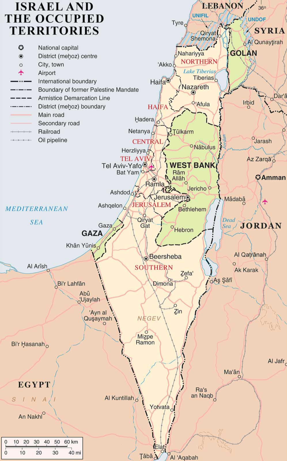
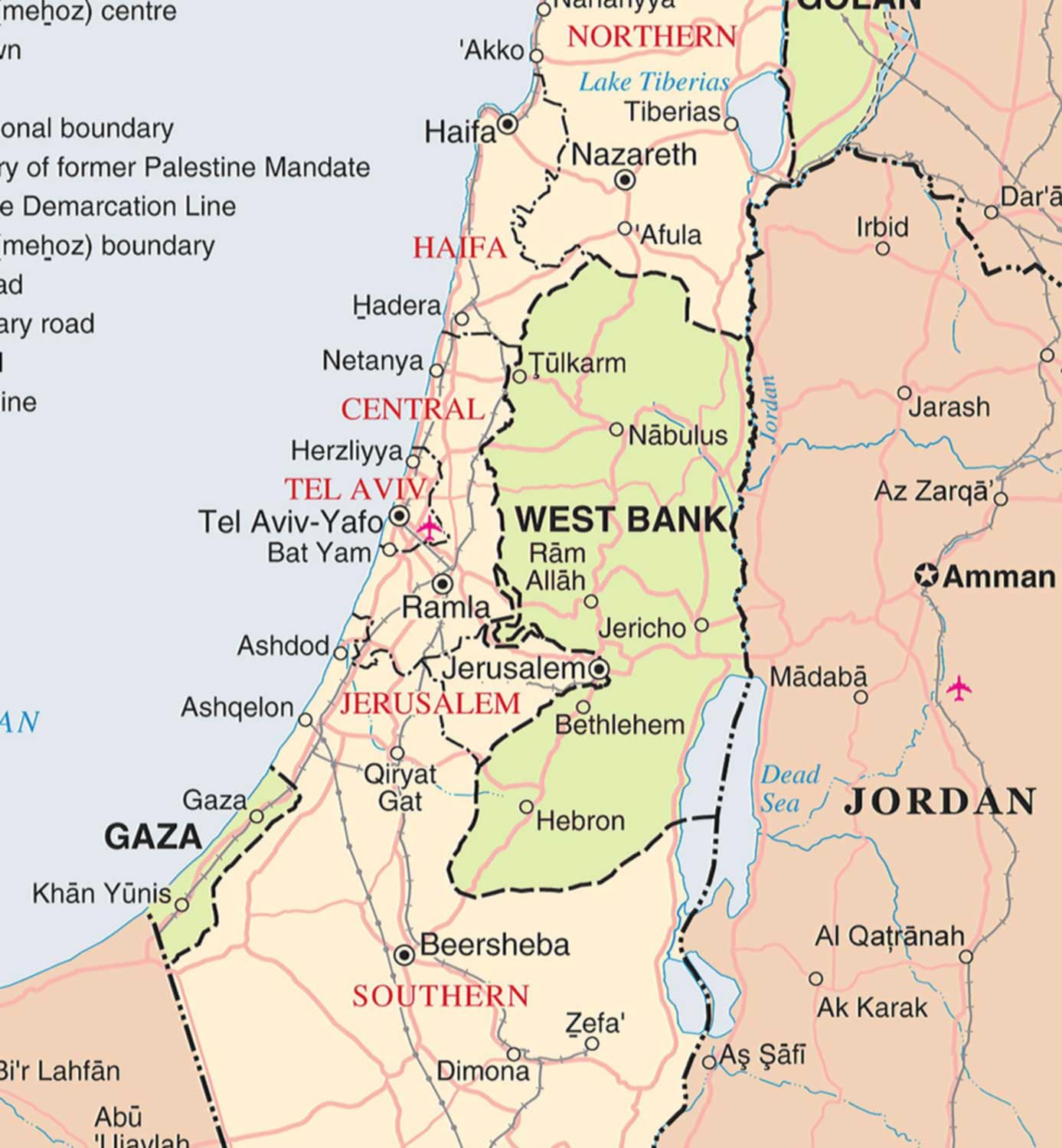
(Size: 10″x16″) Unframed United Nations 2018 Map of Israel, the Palestinian territories (West Bank and Gaza Strip), the Golan Heights, and portions of neighboring countries. Also former United Nations deployment areas in countries adjoining Israel or Israeli-held territory, as of February 2018. This map is printed on premium 36lb matte paper with fade resistant, premium inks and has a white border on all sides to allow for matting and framing. You can see Palestine, the Gaza Strip, the West Bank, Lebanon, Jordan, Syria and Egypt This is a reproduction of the original map.
Features
- 10″x16″ Unframed Map Of Israel printed on premium 36lb matte paper with fade resistant premium inks and includes a white border on all sides to allow for matting and framing.
- Middle East Map; Israel the Palestinian territories West Bank and Gaza Strip the Golan Heights,and portions of neighboring countries.
- Israel History; You can also see former United Nations deployment areas in countries adjoining Israel or Israeli-held territory as of February 2018.
- Map Of Middle East Made in USA
- Geographical Map Of Israel; Social Studies Classroom Decorations

![Wall Art Impact 24"x34" Poster Topographic Map Us Geological Survey [Laminated]](https://m.media-amazon.com/images/I/81lShKnjk2L.jpg)

Reviews
There are no reviews yet.