
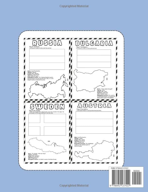
World Maps & Flags: Europe Coloring Book Learn And Color Countries Names, Capitals, Maps And Flags Around The World Great Geography Activity Book Gift For Kids And Adult Are you looking for a World Flags Coloring Book? This book specially for who looking for: maps coloring books, world flags coloring books, earth maps coloring book, countries coloring books. We take you on a journey across the world one Fag and Map at a time, starting in United States, travelling continent to continent until we reach Australia & Oceania. Each page includes the name of the country, written in clear and ready-to-color font, the national flag, map, motto, capital, largest city, population, area and geographic location. Relax and practicing mindfulness mediation while coloring these amazing geography world flags and maps. About this coloring book: * 54 Countries with Maps and Flags * The pages are a nice, large 8.5×11 size * Countries Names to coloring * High Quality Flag Outline Graphics for a superior coloring experience! * Beautiful Glossy Cover * Single sided Pages This coloring book has two purposes. The first purpose is to introduce colors, lines, forms and perceptions to young children. The second purpose is to introduce the concept of global differences. Coloring makes all these learnings possible it’s a hands-on experience. Is your child ready to absorb and retain new knowledge? Then grab a copy now! Great gift idea for Christmas , New year , Valentine’s Day and any occision. Make the perfect gift for anyone who loves coloring! Grab your coloring book now by adding to basket!!
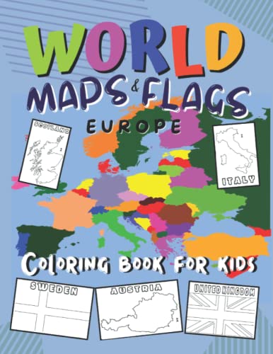
World Maps and Flags: Europe | Coloring Book: Learn And Color Countries Names, Capitals, Maps, Flags, Motto, Area and more | Great Geography facts for Kids and Adults
$6.98
This coloring book teaches European geography, including countries, capitals, and flags, through an interactive activity.
Additional information
| Weight | 0.354 lbs |
|---|---|
| Dimensions | 21.6 × 0.7 × 27.9 in |


Reviews
There are no reviews yet.