
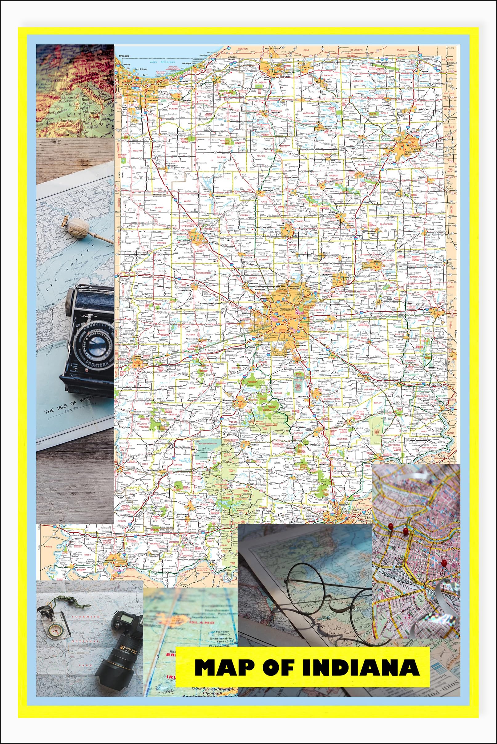


18×24 – Map of Indiana Large Detailed Roads and Highways, Map of Indiana State with All Cities, Parks and Landmarks – Laminated Wall Map Poster Print
$10.99
This map serves as a visual aid for teaching US geography, specifically the state of Indiana.
![Wall Art Impact 34"x24" Poster Large scale detailed political map of Oceania with major cities and capitals - 1982 Oceania [Laminated]](https://m.media-amazon.com/images/I/61Py1032UML.jpg)


Reviews
There are no reviews yet.