

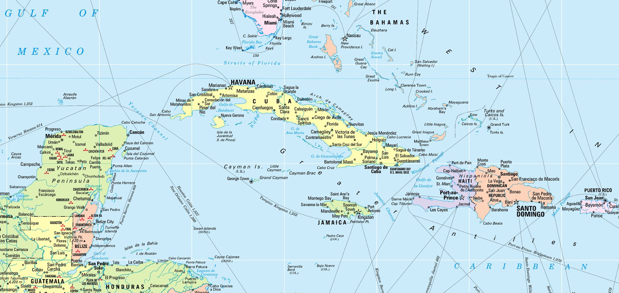
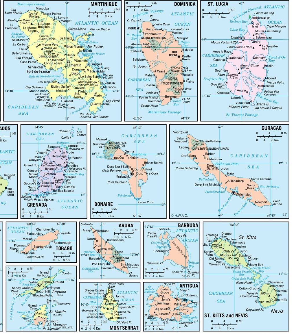
This NEW GULF, CARIBBEAN and ATLANTIC REGIONS wall map features all new digital cartography with many Caribbean island insets. It displays equally well in a home, office or even a school setting. This is a similar map that most get on-board cruise ships. Plan your vacation trip to the Caribbean islands or use it to locate places that you visited. If you like to frame it, this size fits stock frames. INSETS Aruba, Anguilla (with St. Martin), Antigua, Barbados, Bermuda, Bonaire, Curacao, Dominica, Grand Bahama, Grand Cayman, Grenada, Guadeloupe, Hispaniola (Haiti, Dominican Republic), Jamaica, Puerto Rico, Martinique, New Providence, St. Croix, St. Kitts and Nevis, St. Lucia, St. Martin (with Anguilla), St. Vincent, Trinidad, Tobago, Virgin Islands (St. Thomas, St. John).
Features
- Size: 36″x24″ (rolled laminated)
- For School or Home or Office use or Gift
- Many Island insets
- Made/Printed: In USA 2024
![Wall Art Impact 26"x24" Poster Resource Map - Australia Mineral Resources Map My [Laminated]](https://m.media-amazon.com/images/I/81kDfsItG3L.jpg)

![Wall Art Impact 34"x24" Poster Large scale detailed political map of Oceania with major cities and capitals - 1982 Oceania [Laminated]](https://m.media-amazon.com/images/I/61Py1032UML.jpg)

Reviews
There are no reviews yet.