
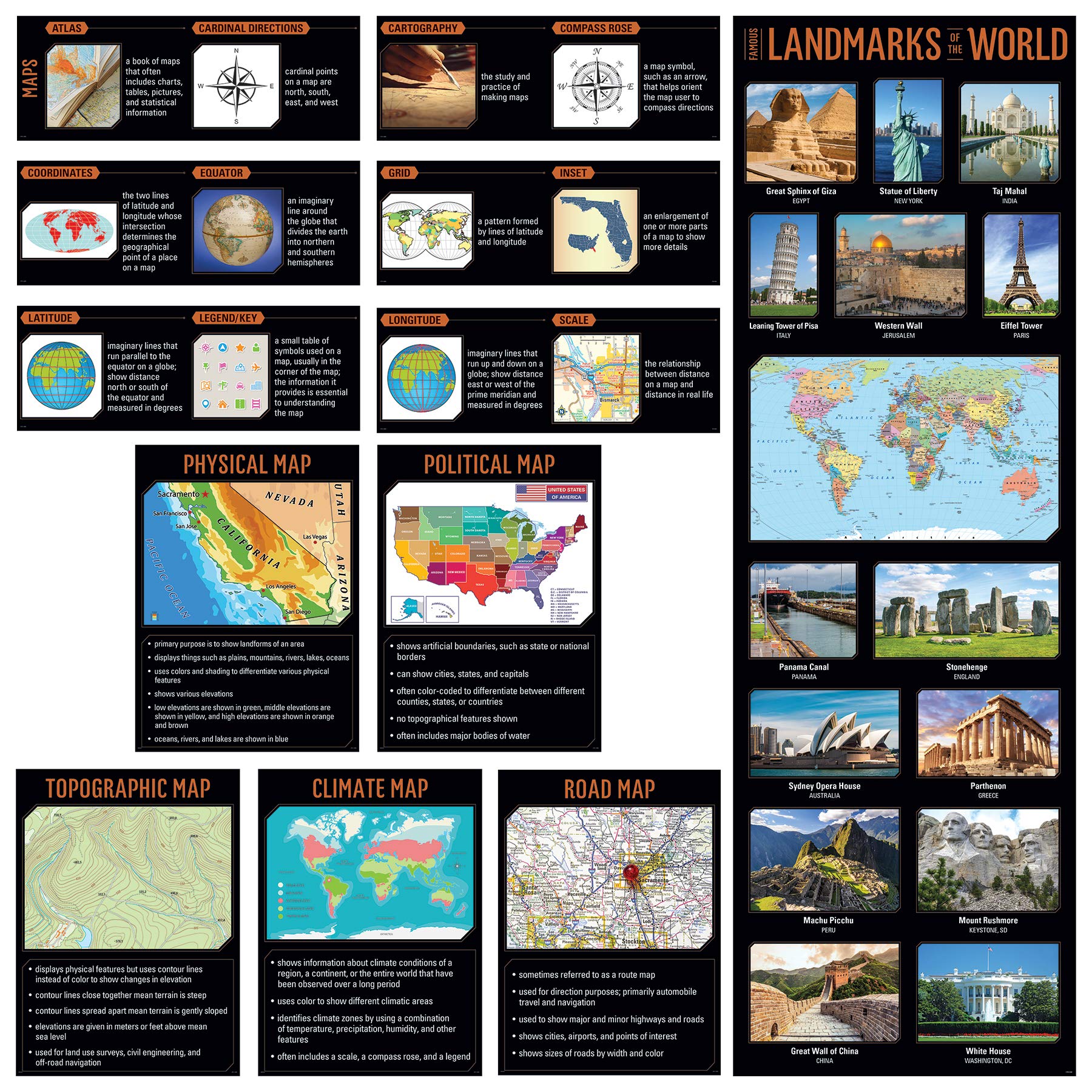
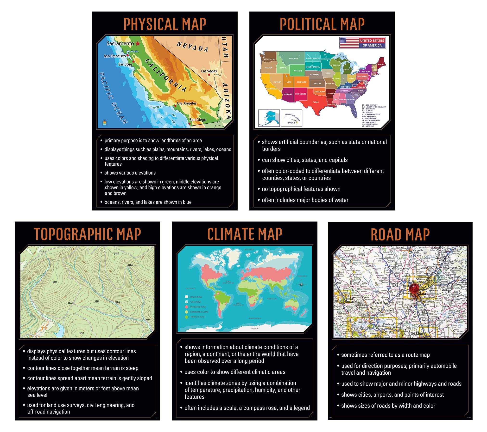
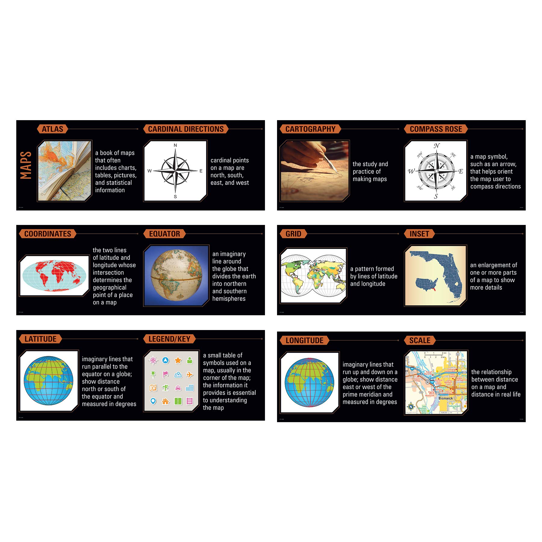


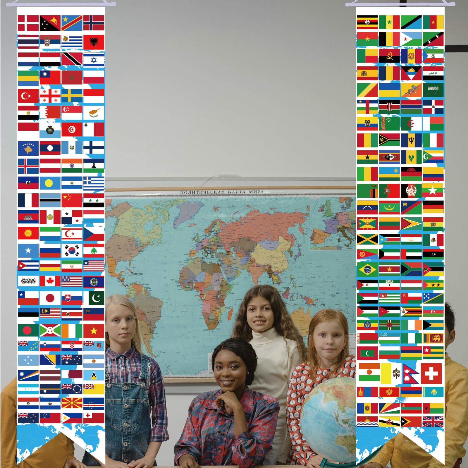
Three complementary decor products are available for each middle and upper grade topic. Each product comes in a different format and provides a different content focus. Together, all three products offer a complete package of instructional resources: Poster Set – features core content relevant to one topic Whiteboard Topper – highlights one specific element of the content and focuses on academic vocabulary Giant Banner – content encourages students to engage with the topic by making personal, real-world connections and supports critical thinking. This Maps Essentials Pack covers these topics: – Physical Map – Political Map – Topographic Map – Climate Map – Road Map – Famous landmarks of the world including the Great Sphinx of Giza (Egypt), Western Wall (Jerusalem), Stonehenge (England), Parthenon (Greece), Macchu Picchu (Peru), Mount Rushmore (US), and more – Different features of maps-related academic vocabulary–atlas, cardinal directions, coordinates, equator, latitude, legend/key, cartography, compass rose, grid, inset, longitude, and scale The resources in this set feature vivid, engaging photography alongside easy-to-read text to capture students’ attention, reinforce instruction, and foster learning. They help bring content to life and create a stimulating, standards-based classroom environment. Hang these resources as a reference for students during geography lessons. Use on a bulletin board, on a doorway, in a hallway, in the library, or anywhere students study. Perfect for elementary school GATE programs, plus middle school and high school classrooms. Pack contains: CTP 10147 Maps 5 Poster Set CTP 10148 Maps Whiteboard Topper CTP 10149 Maps Giant Banner Each poster measures 17 1/2″ x 24″ (5 posters included) Whiteboard Topper measures 12′ long x 8 3/4″ high when fully assembled Giant Banner measures 22″ wide x 68″ high (nearly 6′) when fully assembled Poster set also includes an instructional guide with lesson ideas, classroom activities, and a reproducible.
Features
- The resources in this set feature vivid, engaging photography alongside easy-to-read text to capture students’ attention, reinforce instruction, and foster learning.
- Hang these resources as a reference for students during geography lessons. Use on a bulletin board, on a doorway, in a hallway, in the library, or anywhere students study.
- Perfect for elementary school GATE programs, plus middle school and high school classrooms.
- Each poster measures 17 1/2″ x 24″ (5 posters included)
- Whiteboard Topper measures 12′ long x 8 3/4″ high when fully assembled
Reviews
There are no reviews yet.