
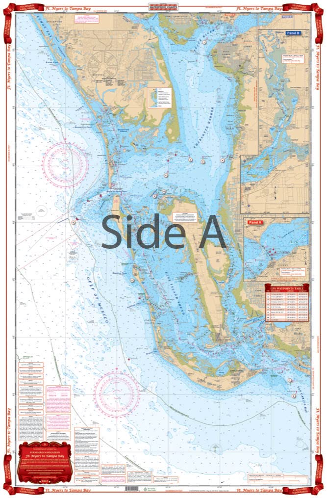
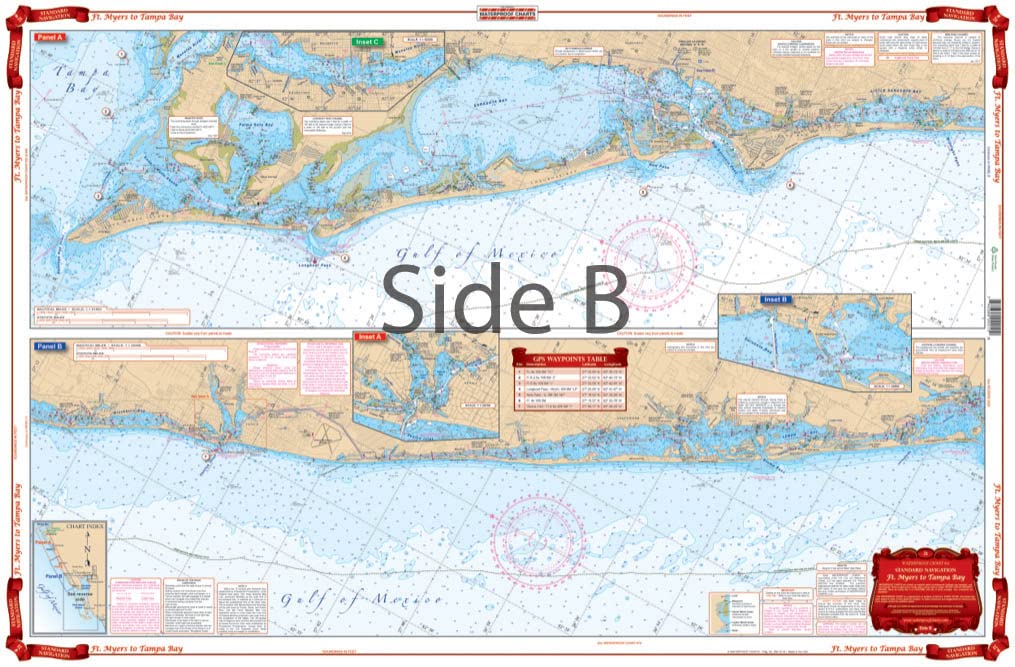
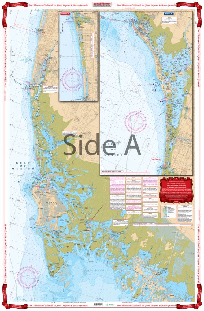
5 Waterproof Charts and a Chart Tube make the planning and execution of your trip from Tampa Bay to the Florida Bay possible. Charts include: #21 Ft. Myers to Tampa Bay; #25 Ten Thousands Islands to Boca Grande; #41 Everglades and 10000 Islands; #39 Lostmans River to Whitewater Bay; #33 Upper Florida Keys; This chart kit that includes 5 charts plus a chart tube takes along the west coast of Florida from Tampa Bay down to the Upper Florida Keys. – Easy-to-Read – Large Print Waterproof Paper – Tear resistant Paper (Indescribable) – Printed on two sides – 2 charts in 1 – Larger Area of Coverage Charts are Compiled From Several NOAA Charts & Local Information
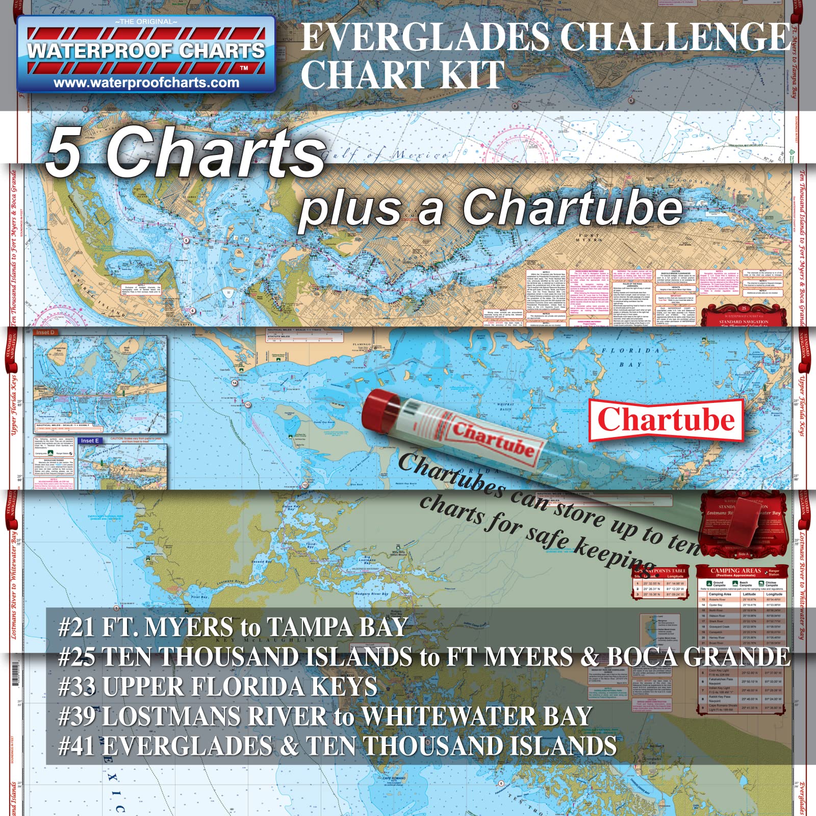
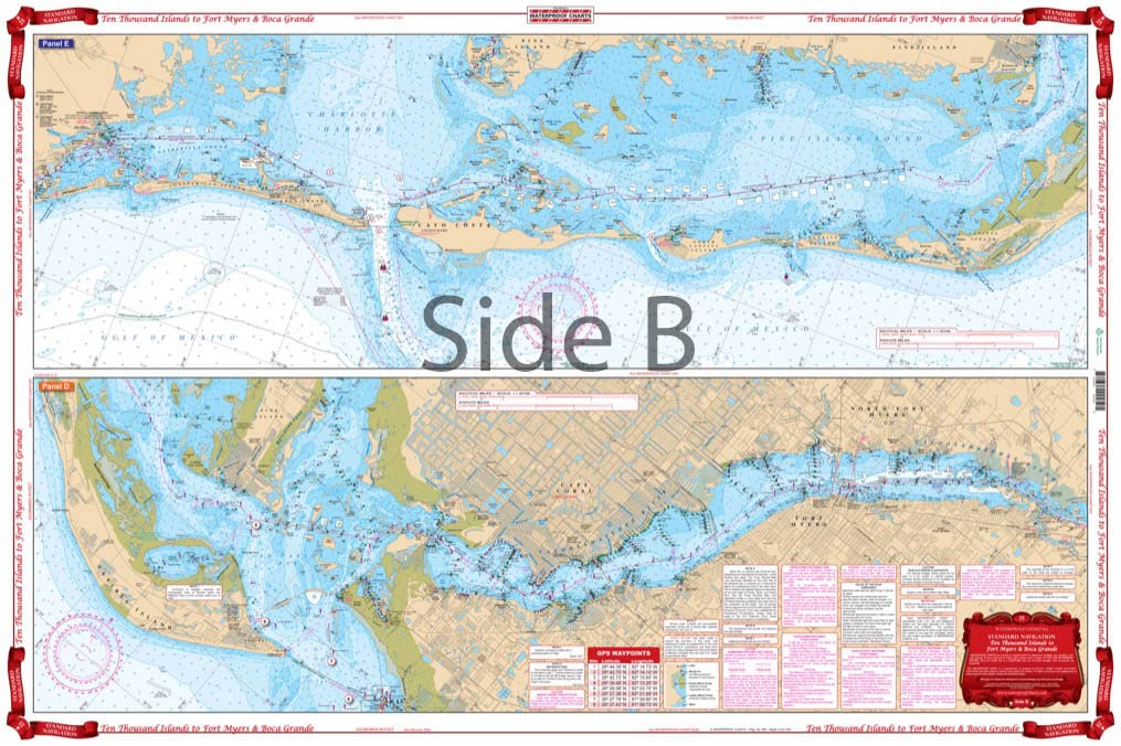
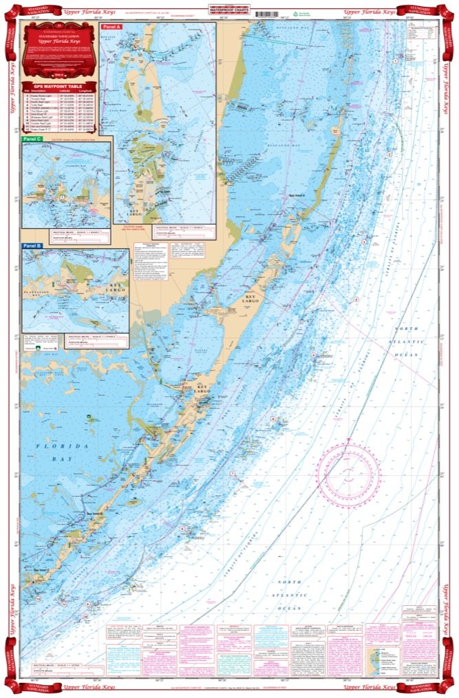
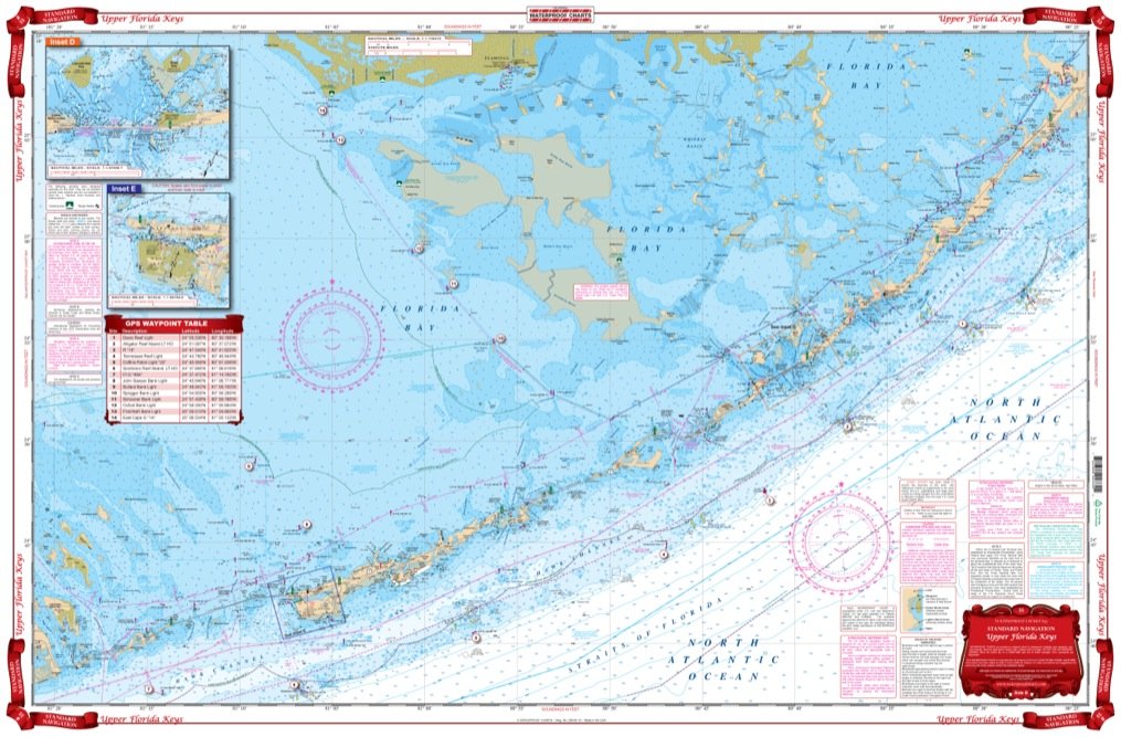
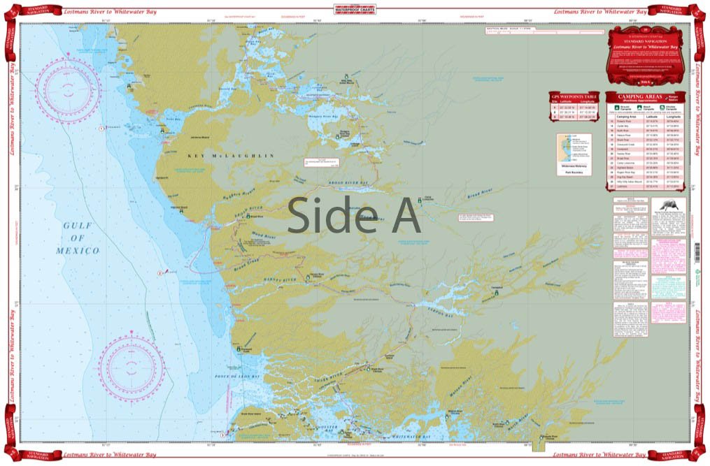
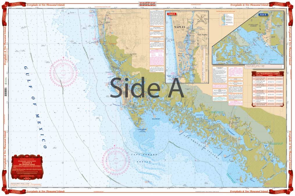
Everglades Challenge Chart Kit, 5 Standard Navigation Charts, Florida Boating, Easy-to-Read, Large Print, Waterproof Paper, Tear Resistant, Printed on two sides, 2 charts in 1, NOAA Charts
$119.99
These navigational charts support the study of Florida geography, cartography, and practical navigation skills.


Reviews
There are no reviews yet.