

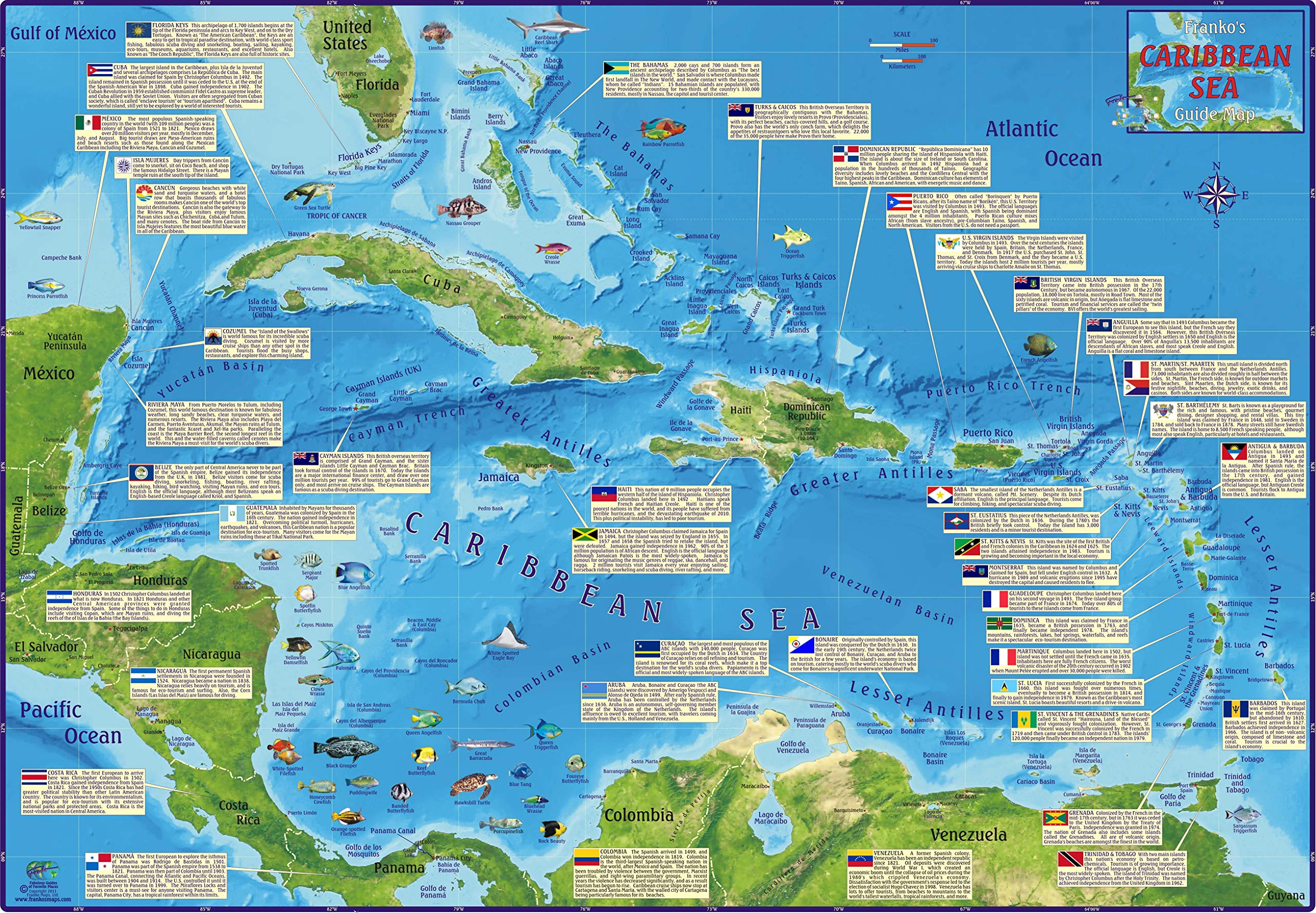
This map offers a great overview of the Caribbean region! Side One shows the entire island chain, from the Florida Keys to Venezuela on a physical relief map with shading for land heights and water depths. Side Two starts with the same map and adds information blocks and flags for each country, along with colorful illustrations of some tropical fish found in Caribbean waters. 18.5inch x 26inch, folded to 4inch x 9inch and printed on waterproof, rip resistant synthetic stock.
Features
- Reference map for the Caribbean Sea & its islands
- Waterproof, 18.5″ x 26″, folded to 4″ x 9″


Reviews
There are no reviews yet.