
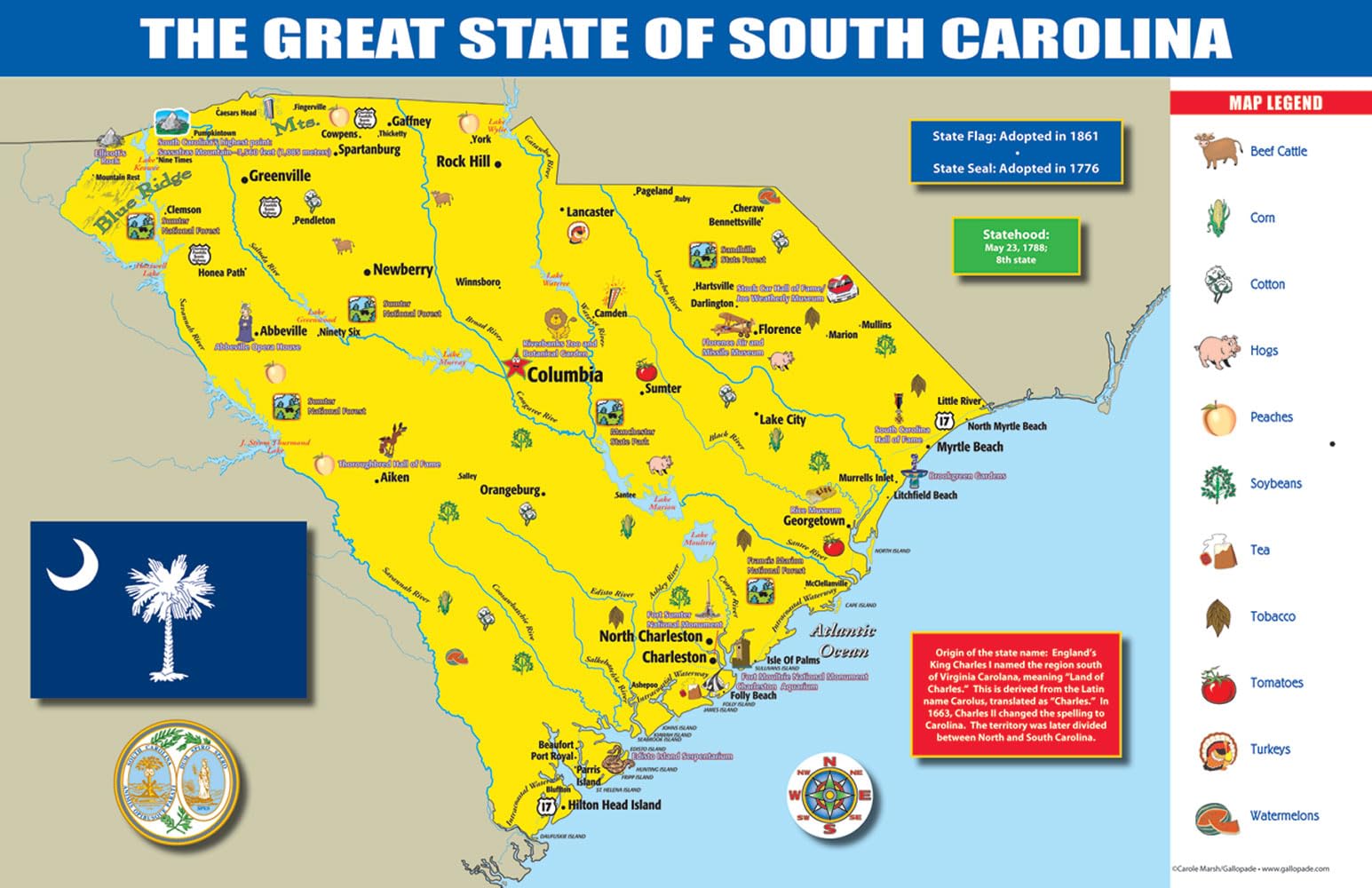
This 11″ x 17″ poster map features a map of the state with neighbors, cities, counties, and landmarks plus state symbols, a state timeline, geography and history information, and lots more.
Features
- The colorful, educational and contemporary map about YOUR state will wake up the walls in your home, classroom or office.
- The map shows neighboring states, major cities, capital, counties, landmarks, rivers and a timeline about YOUR state.
- Information about YOUR state including: bird, flower, tree, nickname, statehood date, motto, fish, song, grain, gemstone, and butterfly.
- A key of all state industries and the state industries are shown on the map.
- The map is 11″ X 17″ and printed cardstock paper.


![Wall Art Impact 26"x24" Poster Resource Map - Australia Mineral Resources Map My [Laminated]](https://m.media-amazon.com/images/I/81kDfsItG3L.jpg)
Reviews
There are no reviews yet.