
Each map has two sides. Side 1 includes: A colorful map of Kansas that includes all the major cities A map legend that includes where all the major industries are located throughout the state Origin of Kansas’s name History of Kansas’s flag and image of the flag Kansas’s statehood date Kansas state seal Side 2 includes: A black & white image of all of the counties in Kansas Each map is 8.5” X 11” and printed glossy paper.
Features
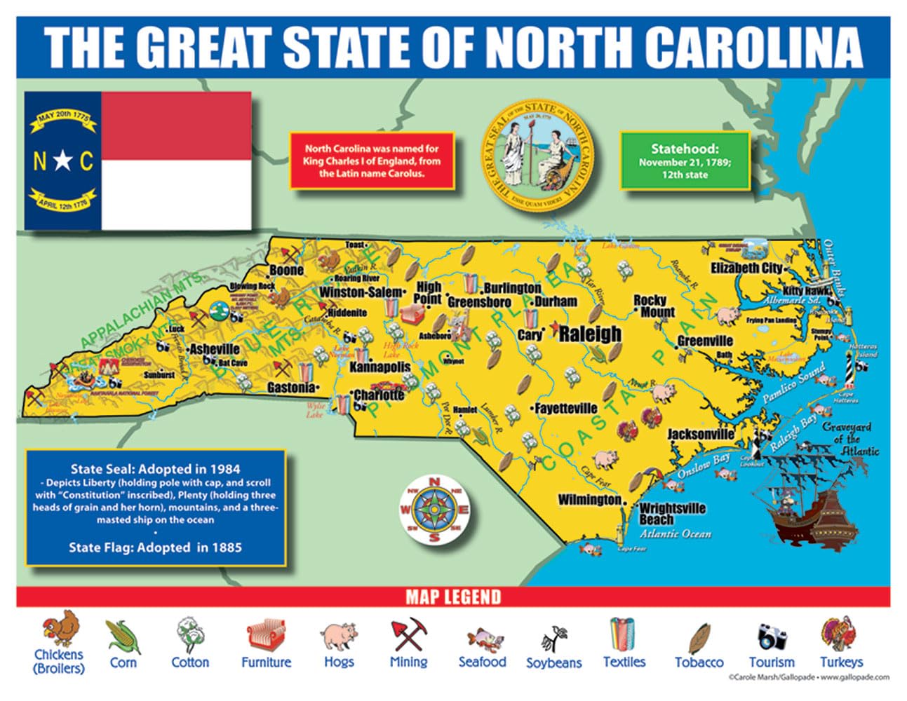
- A map legend that includes where all the major industries are located throughout the state (chickens corn cotton furniture hogs mining seafood soybeans textiles tobacco tourism turkeys
- Origin of North Carolina’s name History of North Carolina’s flag and image of the flag North Carolina’s statehood date North Carolina state seal
- Side 2 includes: A black & white image of all of the counties in North Carolina
- Each map is 8.5”X 11”and printed glossy paper.
![Wall Art Impact 38"x24" Poster Topographic Map - MyTopo Custom Topo Maps, Aerial Photos, Online Maps, and Map Software [Laminated]](https://m.media-amazon.com/images/I/51BS36akJaL.jpg)
![Wall Art Impact 24"x39" Upside Down Political World Map. Rare Funny maps. [Laminated]](https://m.media-amazon.com/images/I/A1ozy4bAW2L.jpg)

Reviews
There are no reviews yet.