
One of the largest and most detailed maps available for the North Star State. Rich shaded relief makes Alaska’s incredibly diverse terrain easy to visualize and remarkably beautiful. The map includes hundreds of named places including primary and secondary towns, political boundaries, infrastructure, hydrography, national parks, state parks, wilderness areas, major peaks, military reservations, and more. It shows Alaska in its entirety, including the entire 2,200 mile Aleutian Island chain that when mapping it in detail, cartographers almost always break it into sections for convenience. This map, however, portrays the entire State at the same scale on one wide sheet–offering an unparalleled perspective on Alaska’s true size. Also found on the map is an inset map which displays Alaska’s relative size to the conterminous U.S. The map is encapsulated in heavy-duty 1.6 mil laminate which makes the paper much more durable and resistant to the swelling and shrinking caused by changes in humidity. Laminated maps can be framed without the need for glass, so the frames can be much lighter and less expensive. Map Scale = 1:3,628,000 Sheet Size = 40.5″ x 30.25″
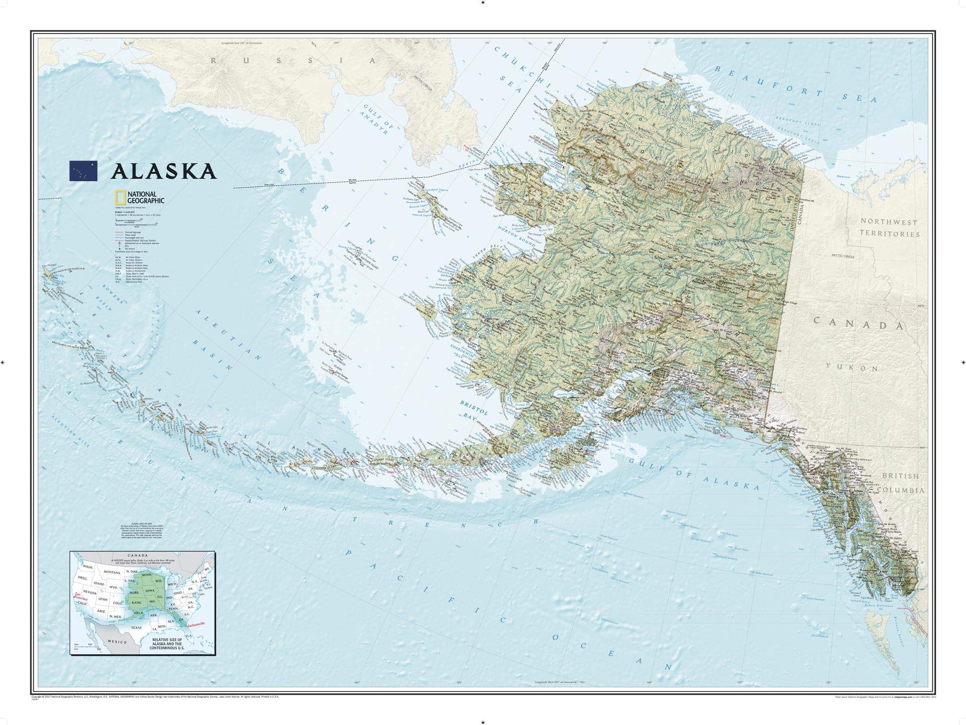
National Geographic Alaska Wall Map – Laminated (40.5 x 30.25 in) (National Geographic Reference Map)
$45.47
This laminated wall map provides a durable visual reference for learning about Alaska’s geography, topography, and infrastructure.
Additional information
| Weight | 0.454 lbs |
|---|---|
| Dimensions | 94.9 × 7.6 × 7.6 in |


Reviews
There are no reviews yet.