
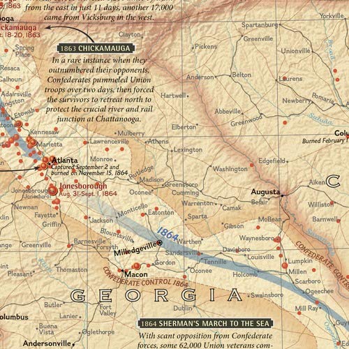
This comprehensive map shows major land campaigns, Union and Confederate troop movements, major Union naval campaigns, roads, railroads, battle outcomes and their impacts on the war, dates of capture by Union forces and more. Two inset maps – Battle for the Capitals and Turning Points of the War – as well as a timeline of battles with map location, casualties and impacts of battles are included. Created with the assistance of the National Park Service, Civil War Preservation Trust, American Battlefield Protection Program, Naval Historical Center, Virginia War Museum, National Museum of Civil War Medicine, and the U.S. Naval Academy. The map is encapsulated in heavy-duty 1.6 mil laminate which makes the paper much more durable and resistant to the swelling and shrinking caused by changes in humidity. Laminated maps can be framed without the need for glass, so the frames can be much lighter and less expensive. Map Scale = 1:2,550,000 Sheet Size = 35.75″ x 23.25″

National Geographic Battles of the Civil War Wall Map – Laminated (35.75 x 23.25 in) (National Geographic Reference Map)
$29.95
This historical wall map serves as a visual aid for learning about the American Civil War.
Additional information
| Weight | 0.463 lbs |
|---|---|
| Dimensions | 94 × 8.3 × 8.3 in |


Reviews
There are no reviews yet.