
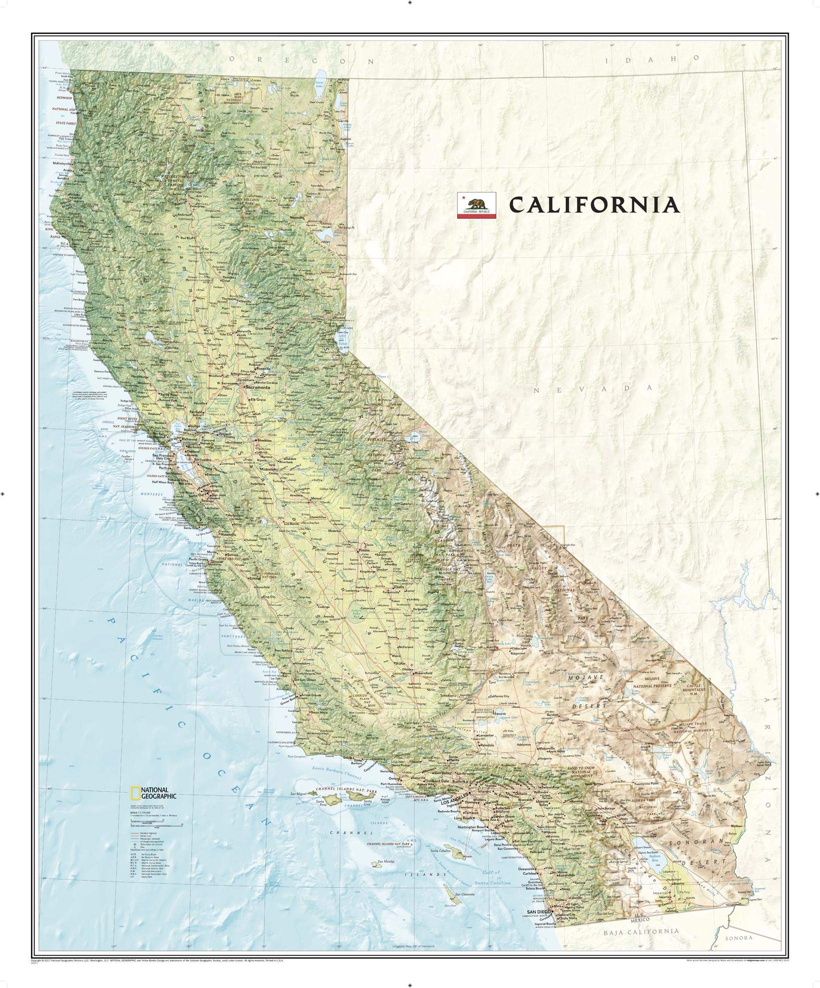
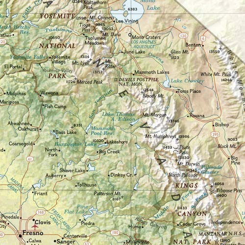
National Geographic’s wall map of California offers a dramatic visualization of the Golden State’s physical geography. From the Sonoran and Mohave deserts, the fertile Central Valley, the mighty Sierra Nevada Mountains, and the Redwood Empire, the entire state is rendered in elegant detail. Stunning shaded relief depicts mountains and ocean depths, while vibrant colorization distinguishes forests, deserts, valleys, and other physical topography. In addition to the geographical features such as mountain ranges, prominent peaks, islands, major lakes, rivers, and reservoirs, this map includes the location of cities, towns, airports, national and state parks, and military bases. The Pacific Crest Trail, a long-distance hiking and equestrian trail that runs through the entire state from the border with Mexico into Oregon, is shown as well. The map is packaged in a two inch diameter tube with a label showing a thumbnail of the map with dimensions and other pertinent information. Map Scale = 1:1,176,000 Sheet Size = 33.5″ x 40.5″
National Geographic California Wall Map (33.5 x 40.5 in) (National Geographic Reference Map)
$24.95
This California wall map serves as a visual aid for students to learn about the state’s geography, cities, and physical features.
Additional information
| Weight | 0.232 lbs |
|---|---|
| Dimensions | 5.6 × 83.8 × 101.6 in |


Reviews
There are no reviews yet.