
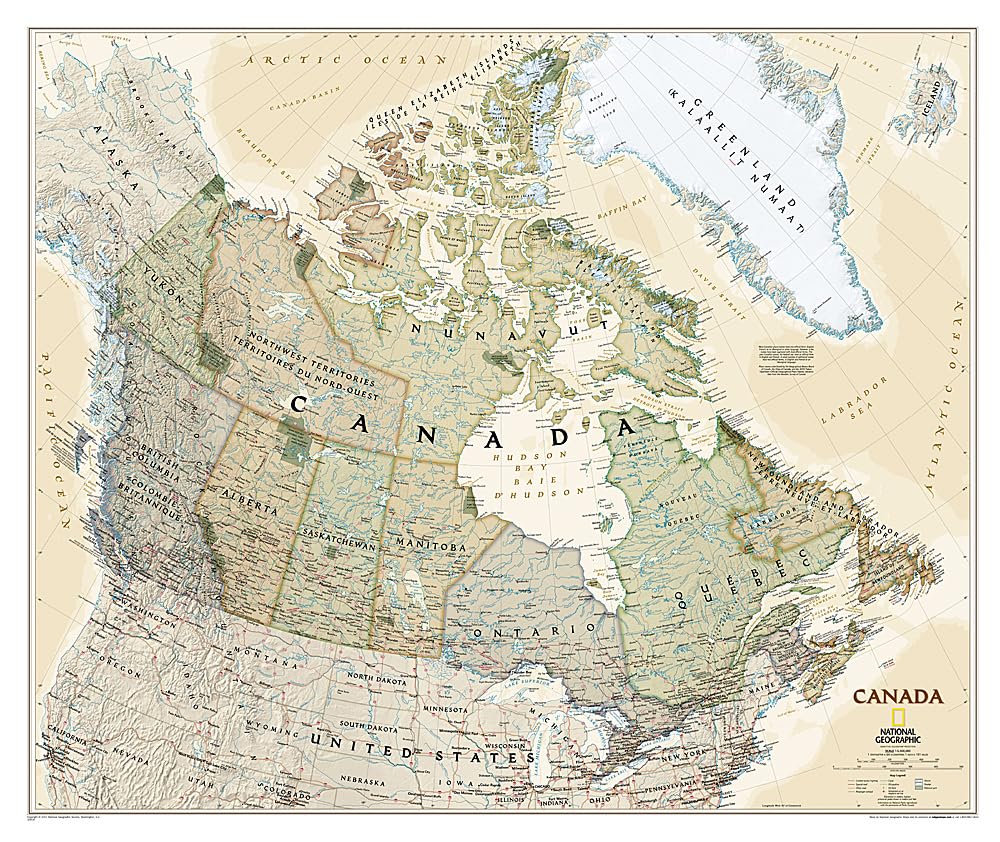
The Executive political map of Canada is a striking example of the cartographic excellence National Geographic is known for. This map features an attractive antique-style color palette, stunning shaded relief, thousands of place names, accurate political boundaries, national parks, archeological sites, and major infrastructure networks such as roads, airports, canals, and railroads. In addition to Canada, coverage includes Iceland, Greenland, and the northern United States. The map is encapsulated in heavy-duty 1.6 mil laminate which makes the paper much more durable and resistant to the swelling and shrinking caused by changes in humidity. Laminated maps can be framed without the need for glass, so the frames can be much lighter and less expensive. Map Scale = 1:6,468,000 Sheet Size = 38″ x 32″
National Geographic Canada Wall Map – Executive – Laminated (38 x 32 in) (National Geographic Reference Map)
$24.95
This map serves as a visual aid for learning Canadian geography, political boundaries, and major infrastructure.
Additional information
| Weight | 0.263 lbs |
|---|---|
| Dimensions | 91.4 × 5.7 × 5.7 in |


Reviews
There are no reviews yet.