
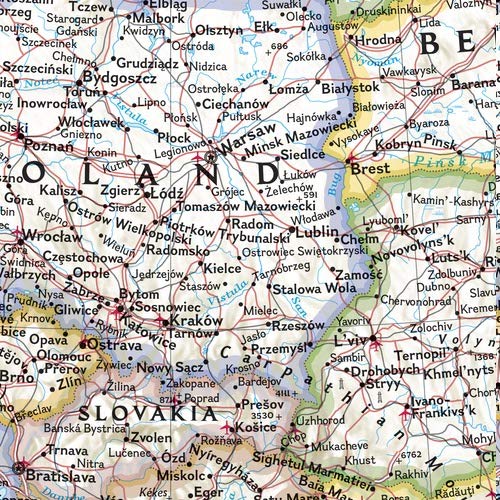
Expertly researched and designed, National Geographic’s Europe Wall Map is the authoritative map of Europe by which other reference maps are measured. Product Features: Antique-style “executive” color palette Background shows mountain ranges and valleys in subtle shaded relief with mountain ranges labeled Major water bodies including rivers, lakes, glaciers, oceans, seas, gulfs, bays, straits, and bathymetry Clearly defined international boundaries, cities, islands, airports, and physical features Thousands of place names carefully and artfully placed to maintain legibility in heavily populated areas Up-to-date international boundaries and territorial control reflect de facto status on the ground Meticulously researched using multiple authoritative sources including the United Nations and policies of individual governments. Accurate place names use a combination of conventional English names, official national names, and standard transliterations for non-Latin alphabets. Countries shown include: Albania, Armenia, Austria, Azerbaijan, Belarus, Belgium, Bosnia & Herzegovina, Bulgaria, Croatia, Cyprus, Czech Republic, Denmark, Estonia, Finland, France, Georgia, Germany, Greece, Hungary, Iceland, Ireland, Italy, Kosovo, Latvia, Liechtenstein, Lithuania, Luxembourg, Moldova, Montenegro, The Netherlands, North Macedonia, Norway, Poland, Portugal, Romania, Russia, Serbia, Slovakia, Slovenia, Spain, Sweden, Switzerland, Turkey, Ukraine, and the United Kingdom. Enlarged maps provide an immersive experience in any home or office environment. The exceptional cartography is even easier to appreciate at the larger size. The map is encapsulated in heavy-duty 1.6 mil laminate which makes the paper much more durable and resistant to the swelling and shrinking caused by changes in humidity. Laminated maps can be framed without the need for glass, so the frames can be much lighter and less expensive. Map Scale = 1:5,419,000 Sheet Size = 46″ x 35.75″

National Geographic Europe Wall Map – Executive – Laminated (Enlarged: 46 x 35.75 in) (National Geographic Reference Map)
$49.95
This enlarged map of Europe allows for detailed study of the continent’s political boundaries, topography, and geography.
Additional information
| Weight | 0.2 lbs |
|---|---|
| Dimensions | 5 × 5 × 90 in |


Reviews
There are no reviews yet.