National Geographic Kids United States Atlas

$17.05

This atlas provides detailed maps and geographical information about the United States, enhancing a student’s knowledge of geography and social studies.

National Geographic Kids United States Atlas
$17.05

[wpforms id=”1190″ title=”true” description=”Request a call back”]

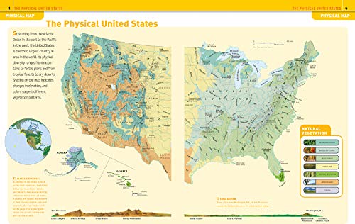
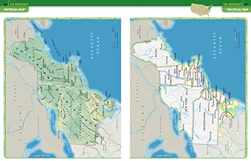
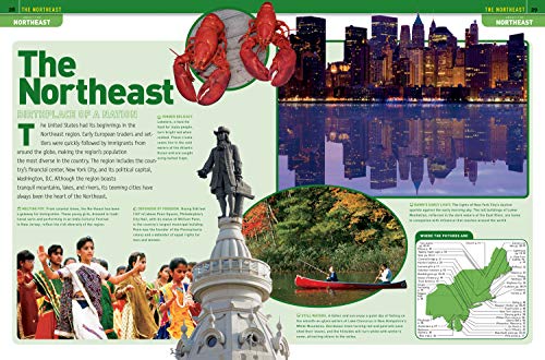
The award-winning National Geographic Kids United States Atlas features lively maps, and graphics; updated essays and statistics; 8 thematic map spreads, on topics such as immigration, natural hazards, the water crisis, and the “greening” of America; same-size physical and political maps for each region for easy comparison; vibrant photo essays on each region and state; more than 350 full-color illustrations; 80-plus pages of National Geographic maps; 50-plus info graphics; updated state fact boxes; geo-whiz facts; state flags, birds, and flowers; comprehensive place-name index with coordinates for easy reference; and glossary of geographic terms. Just like its companion volume National Geographic Kids World Atlas, the USA atlas is INTERACTIVE. A specially designed Web site will allow kids to link directly to hundreds of National Geographic maps, photographs, and articles plus videos, music, games, and more that will expand their knowledge and perspective about this country and its states and regions. All maps are custom-designed for middle-grade students by the Society’s world-famous cartographers and each is shown in the context of surrounding areas. Throughout, locator maps and color coding make it easy for kids to keep track of where they are and to quickly navigate from region to region and state to state. The combination of large, detailed, yet easy-to-read maps–both physical and political; stunning, full-color photo essays; information-packed thematic spreads; and the interactive component sets this atlas apart from every other U.S. atlas currently available for the 8-12 age market and makes it an invaluable resource.

Features

  • Used Book in Good Condition

Additional information

Weight 0.658 lbs
Dimensions 22.9 × 1.1 × 30.3 in

Reviews

There are no reviews yet.

Be the first to review “National Geographic Kids United States Atlas”

Your email address will not be published. Required fields are marked *

National Geographic Kids United States Atlas

$102.20

This atlas serves as a key reference tool for learning U.S. geography, civics, and data analysis skills.

National Geographic Kids United States Atlas
$102.20

[wpforms id=”1190″ title=”true” description=”Request a call back”]

Kids will have fun learning about every U.S. state in this amazing atlas, packed with maps, stats, facts, and pictures. National Geographic’s world-renowned cartographers have paired up with education experts to create maps of the 50 states, U.S. territories, and Washington, D.C., that pinpoint the physical features, capitals, and towns and cities of each state. Discover the latest data and trends along with colorful photography of each state and the people who live there. Key points reflect the latest information about land and water, people, and places. Lively essays cover each region of the country. Eight specially themed maps on nature, population, energy, climate, and more, delve deeper into key issues. State birds and state flags add to the high visual interest. This is a great reference for home and school with all the basics kids need to know to succeed in middle school, high school, and beyond.

Additional information

Weight 0.726 lbs
Dimensions 23 × 1.1 × 30.3 in

Reviews

There are no reviews yet.

Be the first to review “National Geographic Kids United States Atlas”

Your email address will not be published. Required fields are marked *