
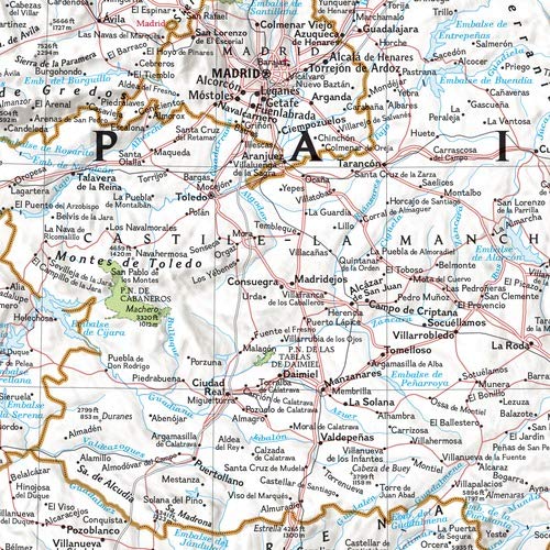
The signature Classic style wall map of Spain and Portugal features a bright color palette with blue oceans and the country’s terrain detailed in stunning shaded relief that has been a hallmark of National Geographic wall maps for over 75 years. The map includes thousands of place names, accurate boundaries, national parks, and major infrastructure networks such as roads, highways, airports, ferry routes, and railroads. Coastal bathymetry is shown with depth curves and soundings. Spain’s Balearic Islands in the Mediterranean are included. Inset maps provide detail of the Madeira Islands, Azores, and Canary Islands, as well as their location in relation to Spain and Portugal. The map is packaged in a two inch diameter tube with a label showing a thumbnail of the map with dimensions and other pertinent information. Map Scale = 1:2,065,000 Sheet Size = 33″ x 22″

National Geographic Spain and Portugal Wall Map – Classic (33 x 22 in) (National Geographic Reference Map)
$16.95
This map serves as a visual aid for students to understand the geography and political layout of Spain and Portugal.
Additional information
| Weight | 0.454 lbs |
|---|---|
| Dimensions | 7.6 × 7.6 × 68.6 in |


Reviews
There are no reviews yet.