
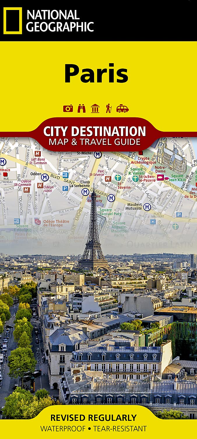
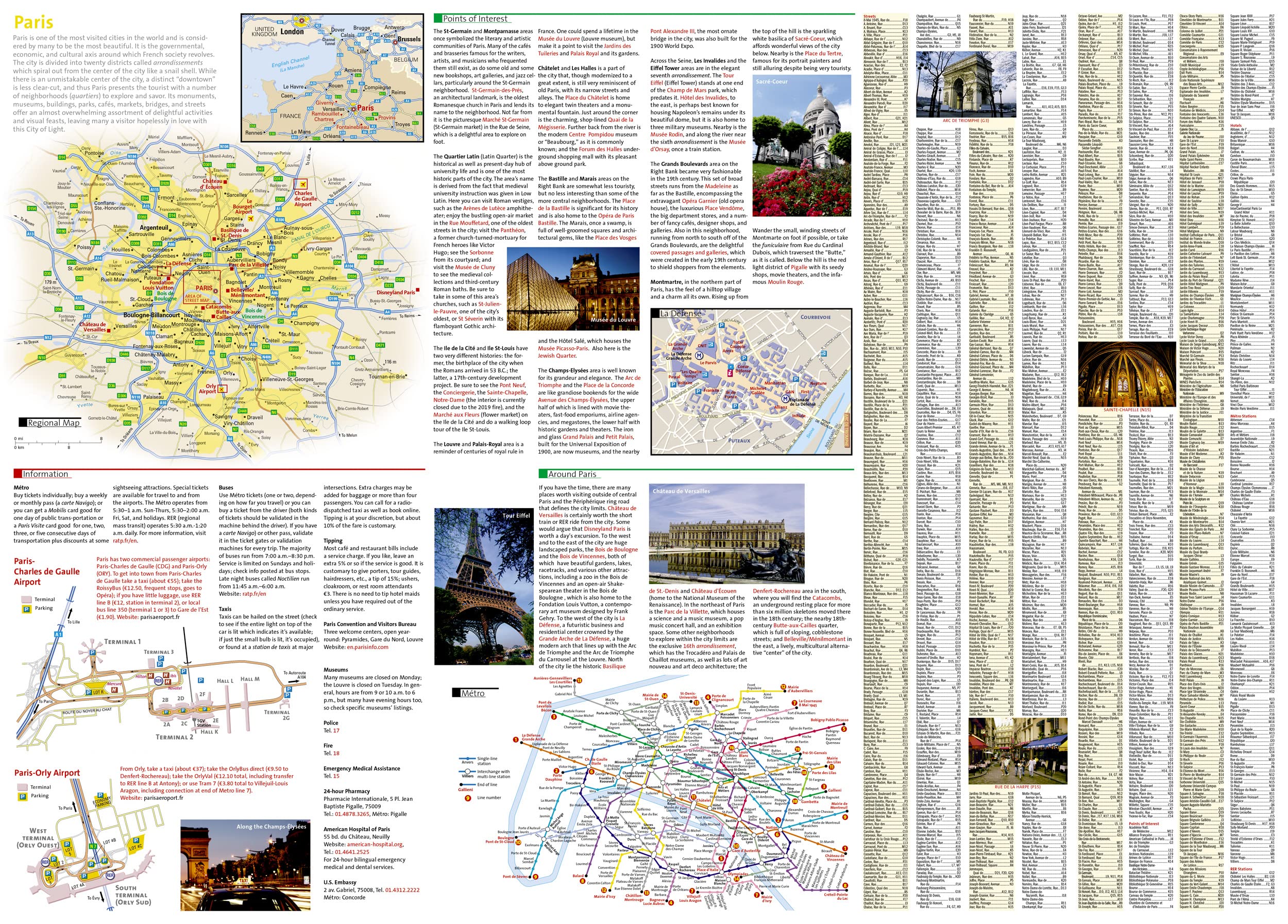
* Waterproof * Tear-Resistant * Travel Map National Geographic’s City Destination map of Paris is a complete travel guide to this top tourist destination, with valuable information not found in traditional maps. The front side presents an easy-to-read map of the city with its road network and features 3D depictions of many top attractions, like Arc de Triomphe, Eiffel Tower and The Louvre. Hundreds of points of interest are displayed with the aid of a multi-language legend, including metro and train stations, hotels, parks, hospitals, police stations, places of worship, theaters and pedestrian areas. The reverse side has a regional map and descriptions of the city, many popular attractions and the transit system. A user-friendly index of streets, metro stations, hotels and points of interest along with a metro map and diagrams of Charles de Gaulle and Orly Airports will help you arrive at your destination quickly. With all of this specialized content, this map is the perfect companion to National Geographic’s Paris Traveler Guide. Every City Destination Map is printed on durable synthetic paper, making them waterproof, tear-resistant and tough — capable of withstanding the rigors of any kind of travel. Map Scale = 1:11,500 Sheet Size = 24.75″ x 17.75″ Folded Size = 4″ x 8.75″


Paris Map (National Geographic Destination City Map)
$9.95
This map of Paris helps a student learn about geography, navigation, and the layout of a major world city.
Additional information
| Weight | 0.045 lbs |
|---|---|
| Dimensions | 10.8 × 0.6 × 22.9 in |


Reviews
There are no reviews yet.