

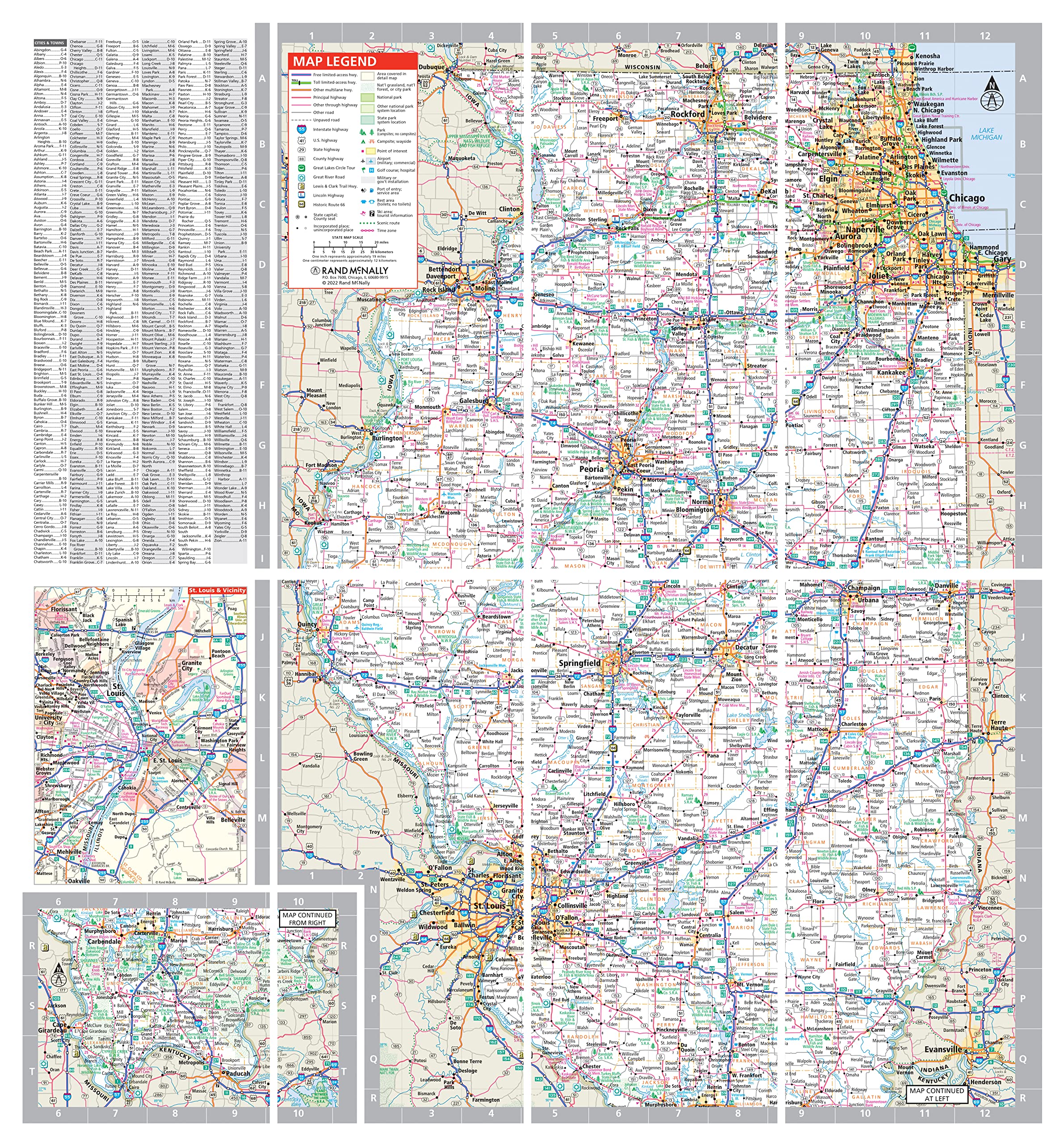
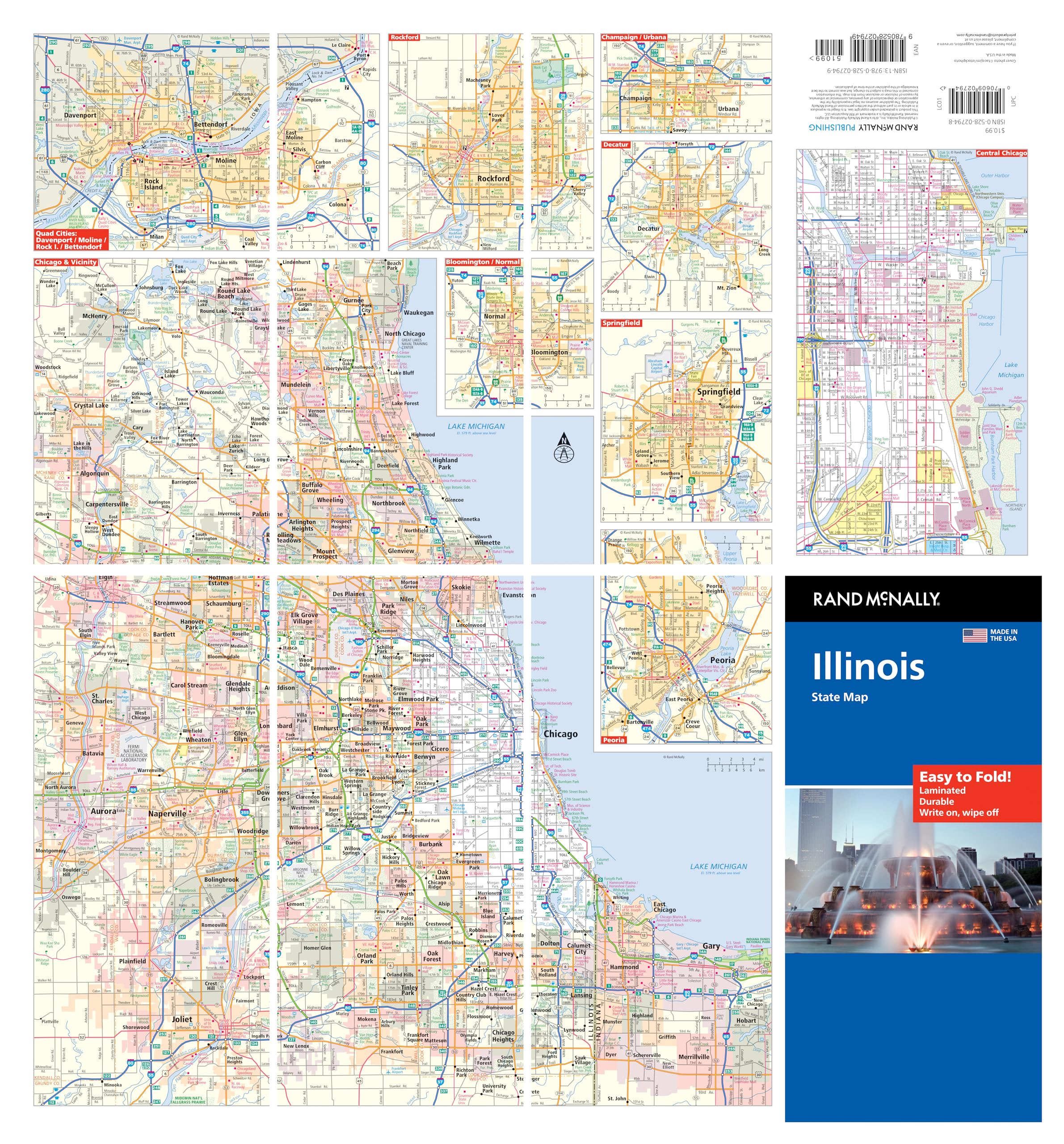
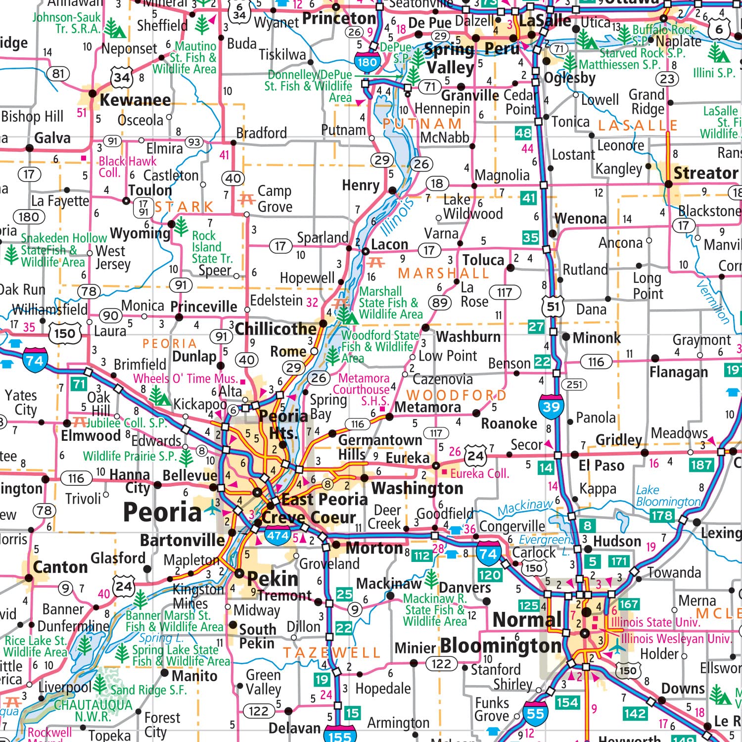
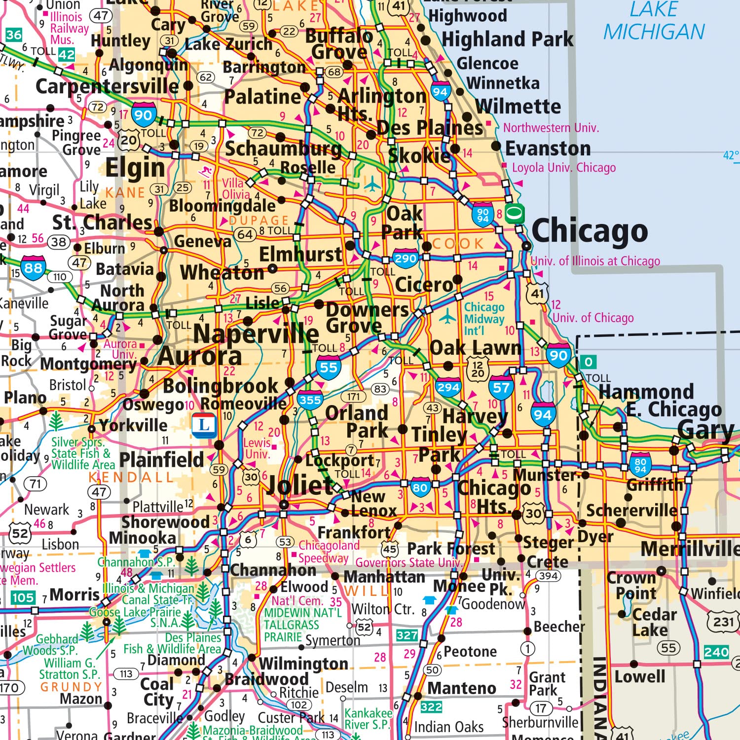
The durable and convenient Illinois Easy To Fold state map will take all the wear and tear your journey can dish out. The heavy-duty laminated design allows you to mark your route, make notes, then wipe the surface clean for further use. This is a must-have for navigation whether you’re a state resident or just passing through. – Easy to fold means no fumbling. – Heavy-duty lamination allows you to write on, wipe off. – Durable and tear resistant. – Folds to display individual map sections. – Full-color maps with enhanced cartography. – Clearly indicated highways, county boundaries, points of interest, and more. – Quick-reference legend and city index. Product Details: Dimensions: 9″ x 4.25″ folded; 18″ x 17″ unfolded.
 Seek & Find Atlas of Brainy Challenges") Rand McNally: The Ultimate Map It!(tm) Seek & Find Atlas of Brainy Challenges
$15.99
Rand McNally: The Ultimate Map It!(tm) Seek & Find Atlas of Brainy Challenges
$15.99
 Rand McNally Easy to Fold: United States Laminated Map
Original price was: $10.99.$10.22Current price is: $10.22.
Rand McNally Easy to Fold: United States Laminated Map
Original price was: $10.99.$10.22Current price is: $10.22.
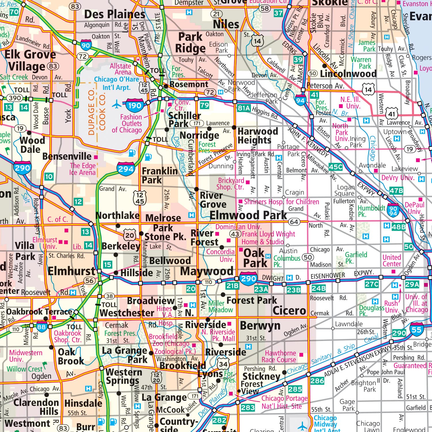
Rand McNally Easy to Fold: Illinois State Laminated Map
$10.99
This Illinois state map provides an educational benefit by helping students visually learn state geography and infrastructure.
Additional information
| Weight | 0.091 lbs |
|---|---|
| Dimensions | 11.2 × 1.8 × 23.4 in |
Related products
-
Books, Criticism and Theory, History and Criticism, Literature and Fiction, Subjects
Original price was: $45.50.$41.52Current price is: $41.52.Add to cart -

-
Books, Children's Books, Subjects
Original price was: $123.00.$88.00Current price is: $88.00.Add to cart -
Books, Gaming, Science Fiction and Fantasy, Subjects
Original price was: $175.00.$170.00Current price is: $170.00.Add to cart

")
")
Reviews
There are no reviews yet.