
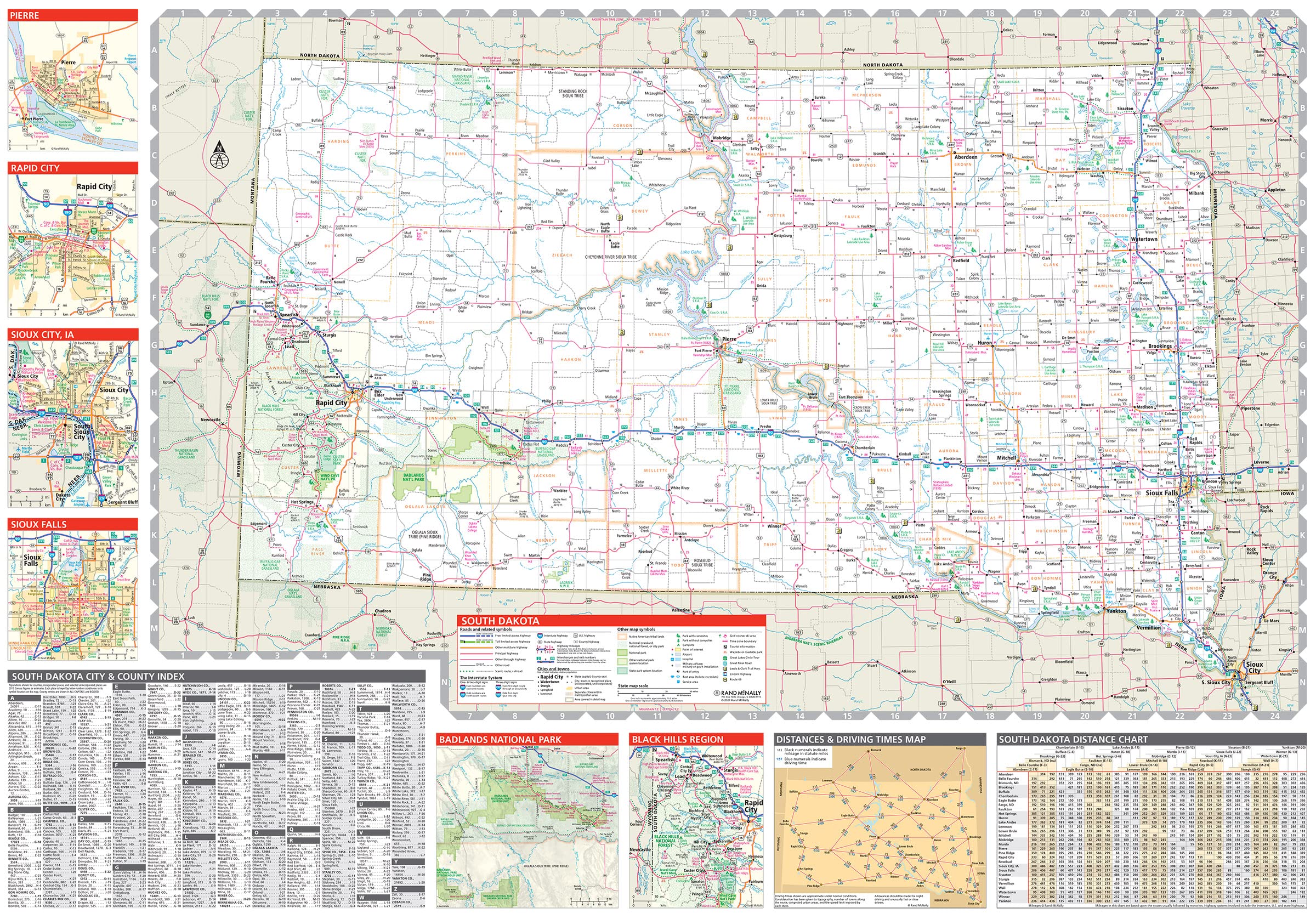
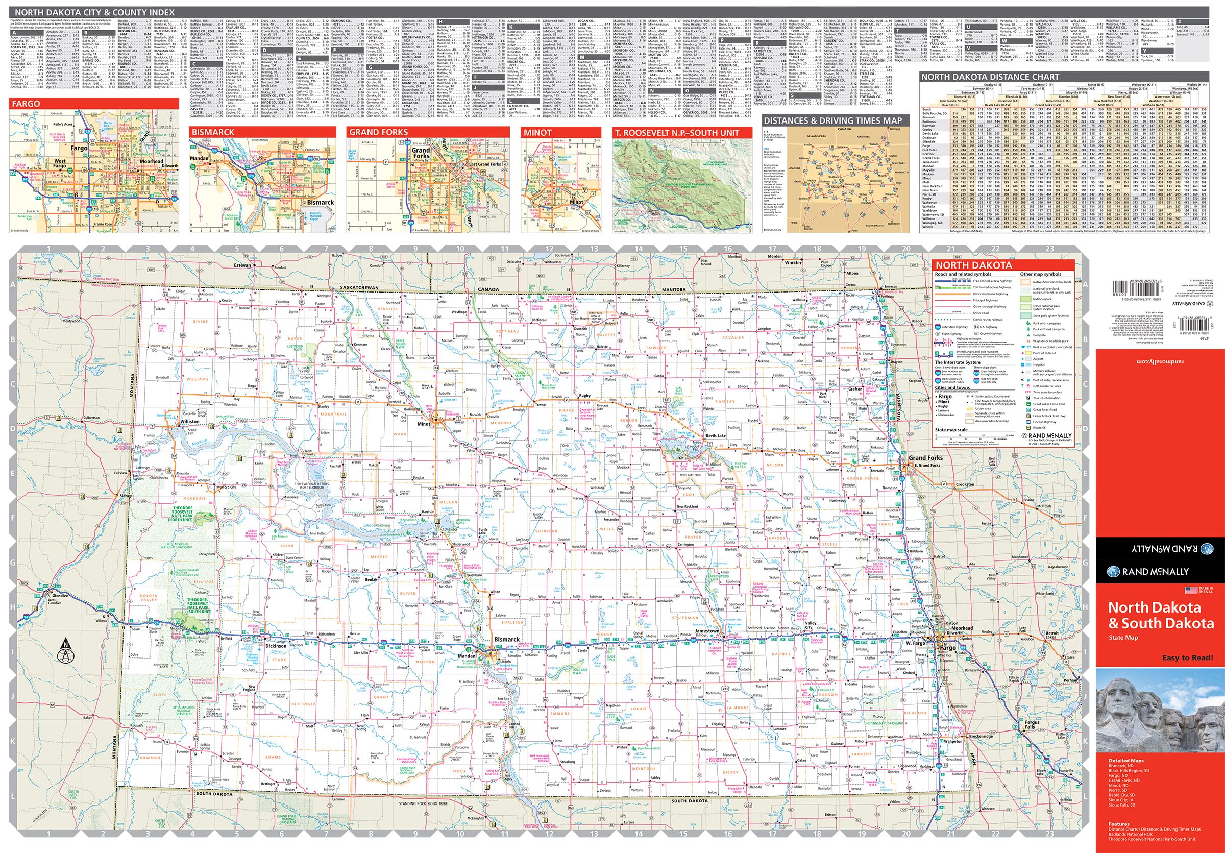
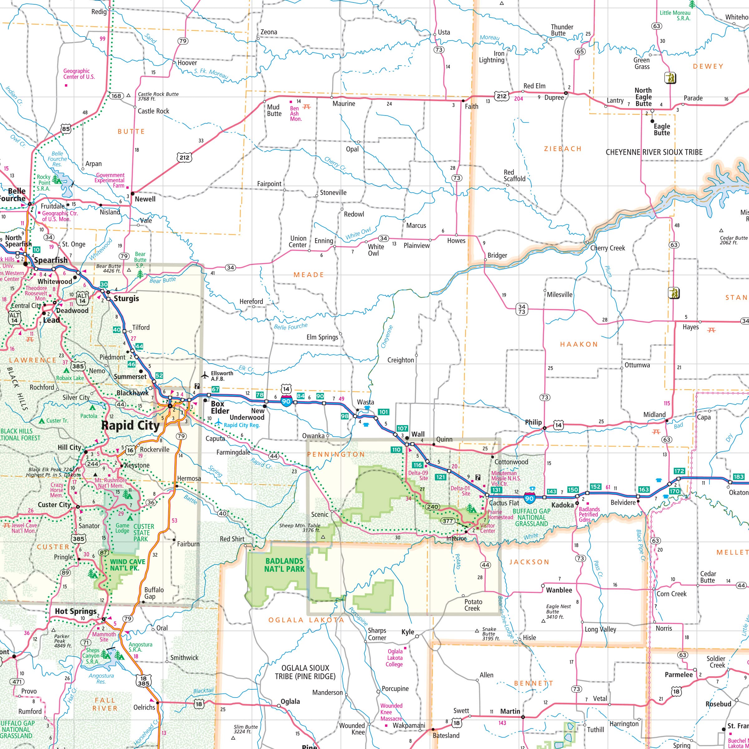
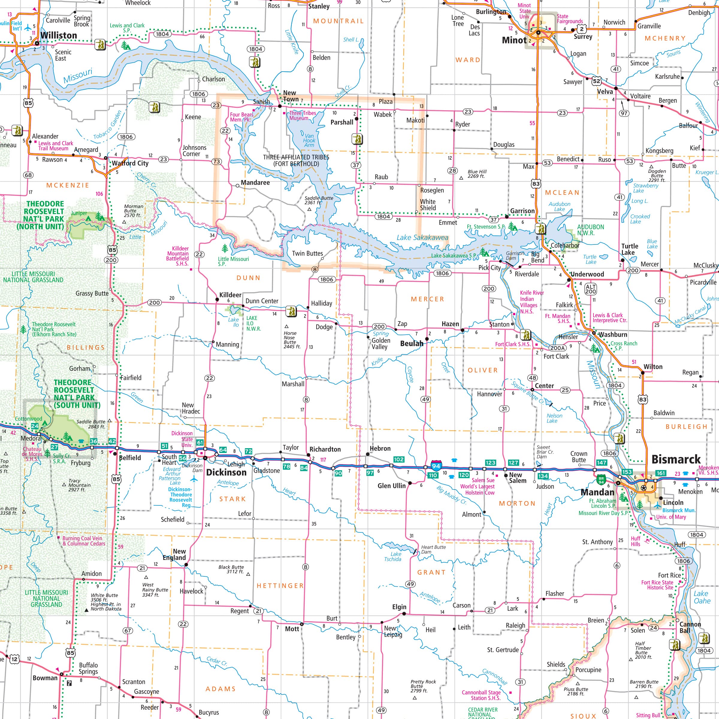
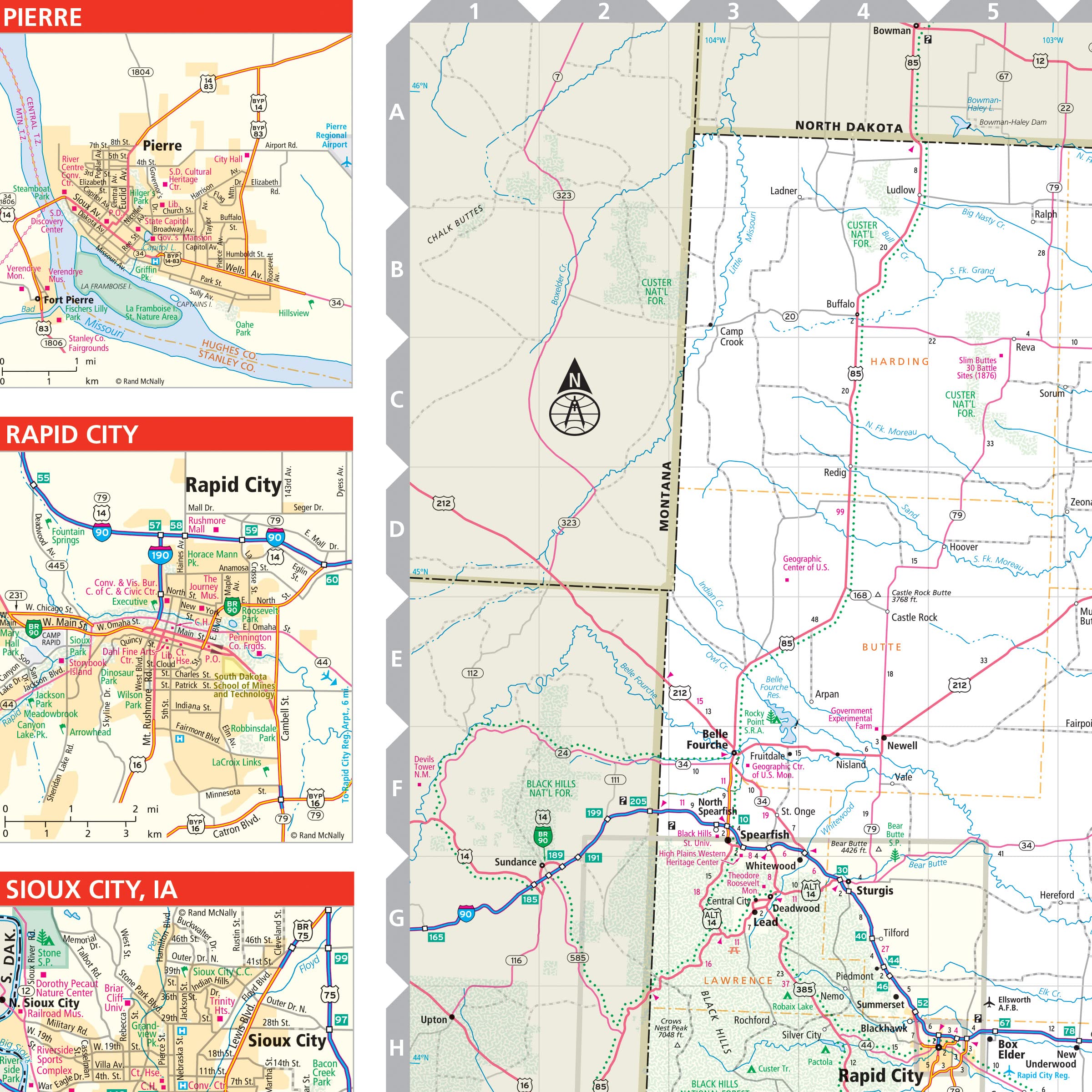
Rand McNally’s folded map for North Dakota and South Dakota is a must-have for anyone traveling in or through the states, offering unbeatable accuracy and reliability at a great price. Our trusted cartography shows all Interstate, U.S., state, and county highways and much more. – Points of interest. – State Park chart. – State mileage chart. – Driving times map. – On-the-road toolbox. – Visitor center information. – Climate data. – State facts & symbols. – Easy-to-use legend. – Detailed indexed. Coverage Area Detailed maps include: Bismark, ND; Black Hills Region, Fargo, ND; Grand Forks, ND; Pierre, SD; Rapid City, SD; Sioux Falls, SD. Product Details: Measures 9.0″ x 4.125″ and folds out to 25.5″ x 36.75″.
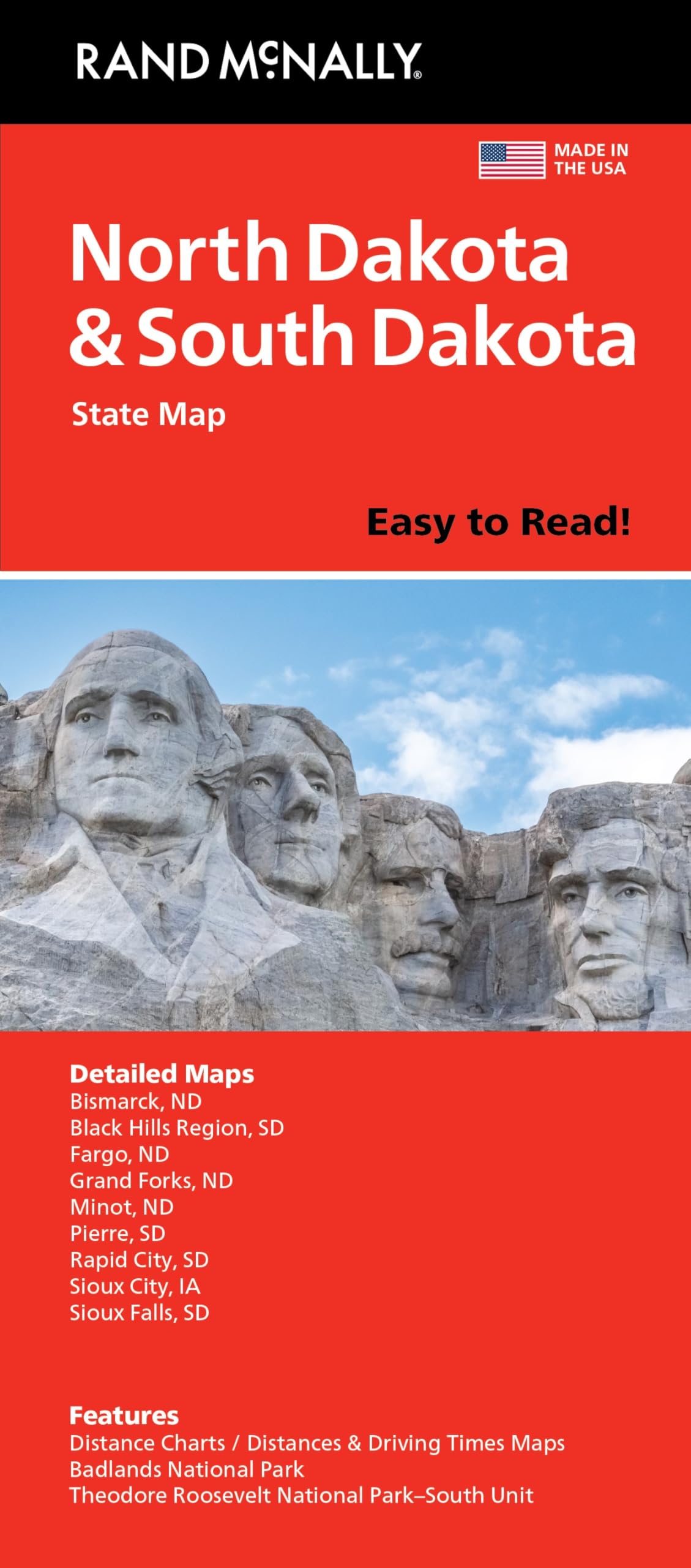
Rand McNally Easy to Read: North Dakota, South Dakota State Map
$9.99
This state map helps students learn the geography, major cities, and highway systems of North Dakota and South Dakota.
Additional information
| Weight | 0.054 lbs |
|---|---|
| Dimensions | 10.6 × 0.4 × 24.2 in |


Reviews
There are no reviews yet.