
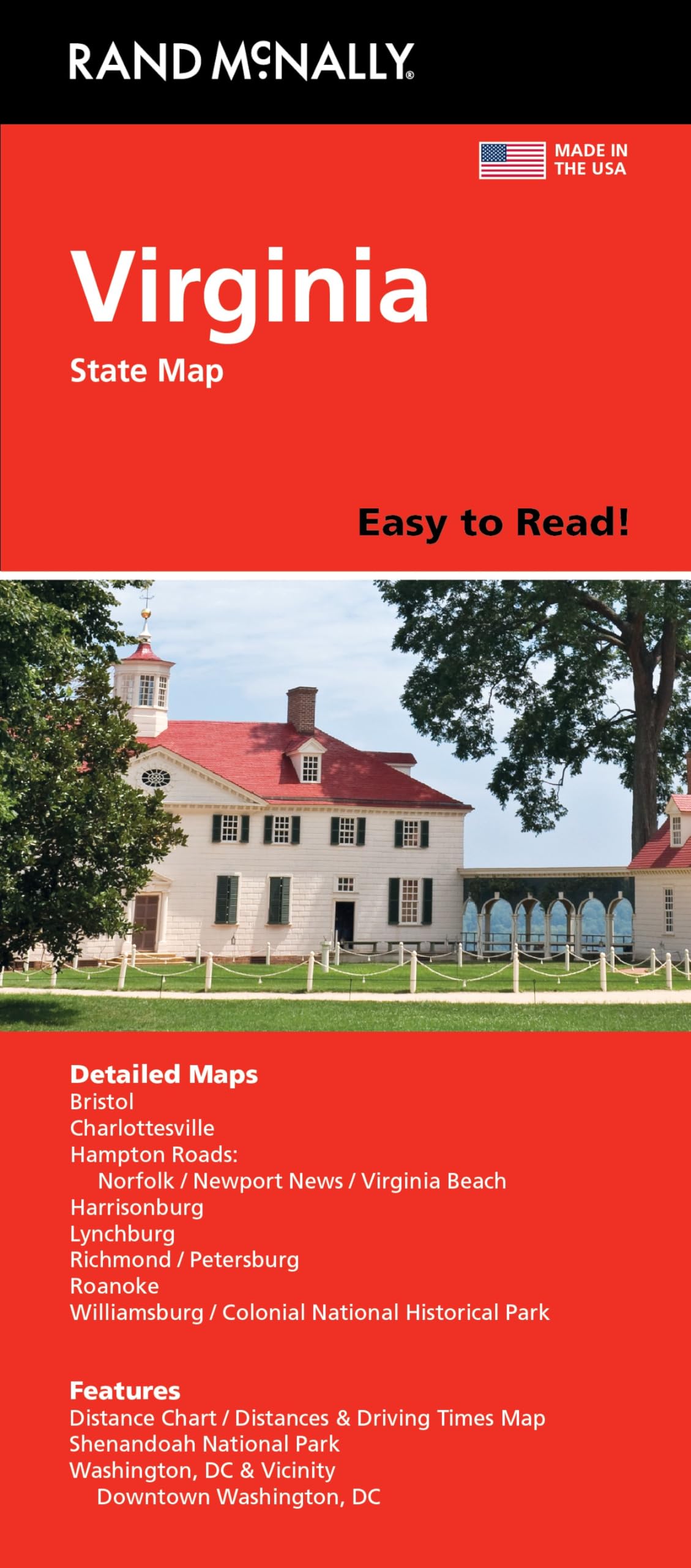
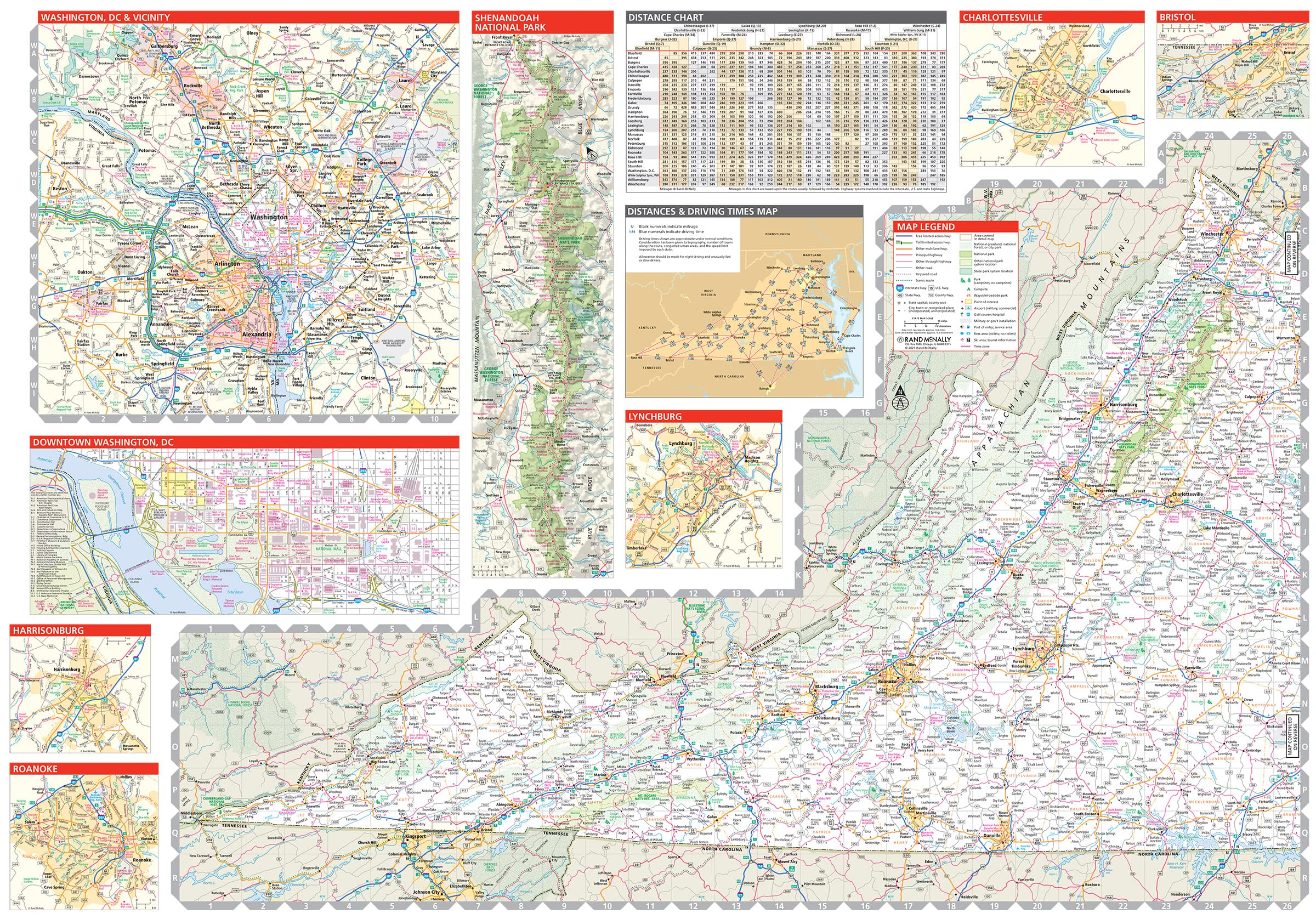
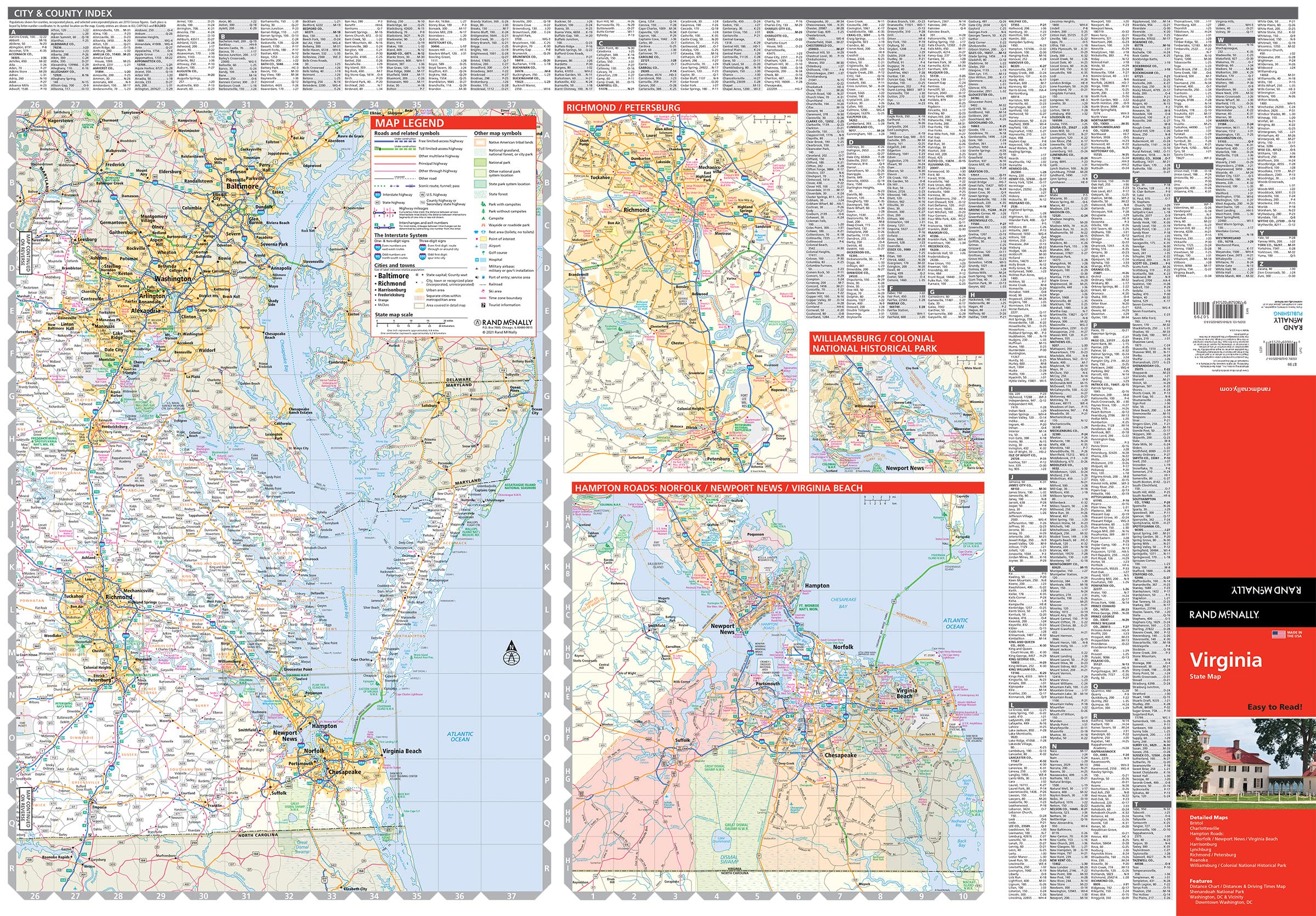

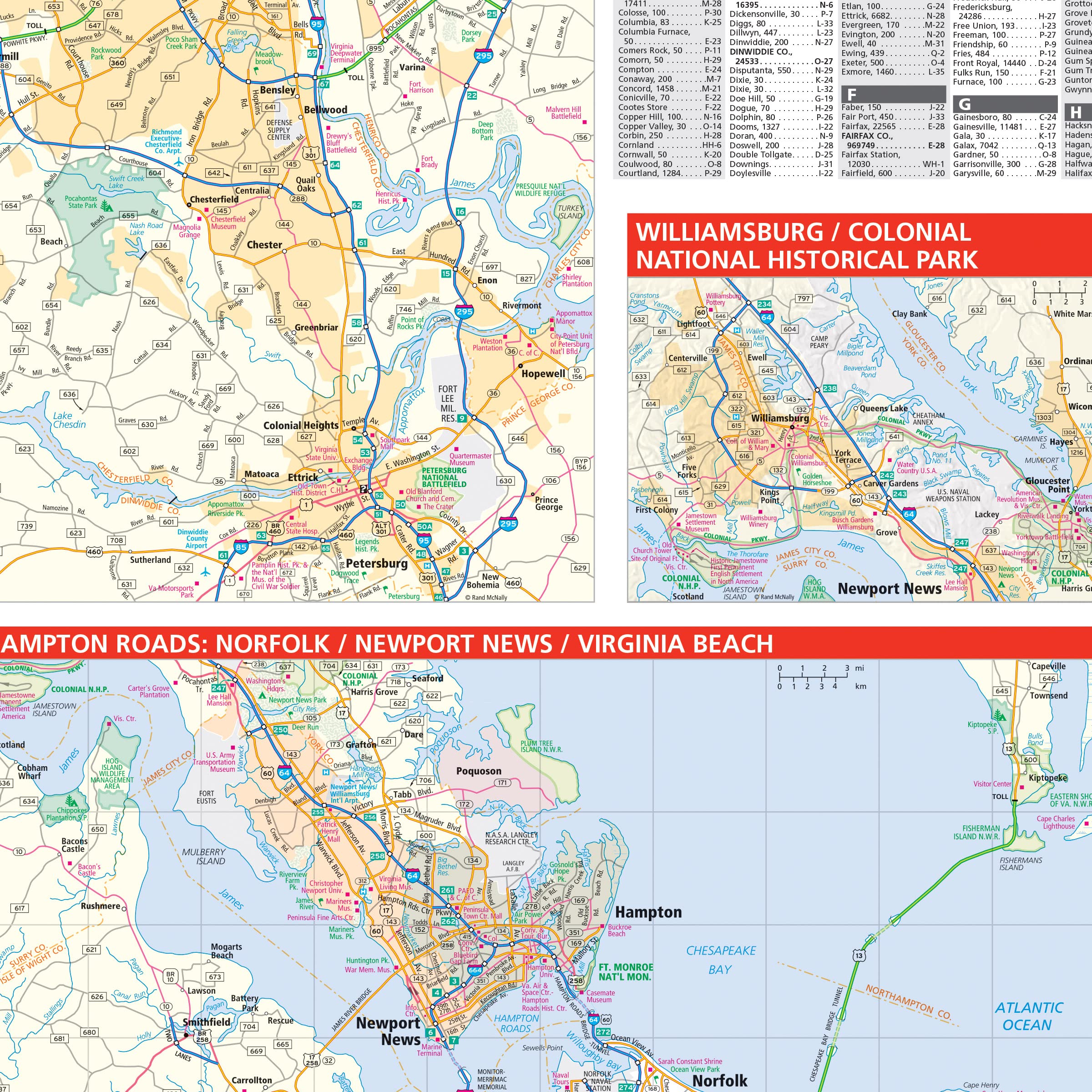
Rand McNally’s folded map for Virginia is a must-have for anyone traveling in or through the state, offering unbeatable accuracy and reliability at a great price. Our trusted cartography shows all Interstate, U.S., state, and county highways and much more. – Points of interest. – State Park chart. – State mileage chart. – Driving times map. – Visitor center information. – Climate data. – State facts & symbols. – Easy-to-use legend. – Detailed indexed. Coverage Area Detailed maps include: Alexandria/Arlington, Bristol, Charlottesville, Hampton Roads: Norfolk/Newport News/Virginia Beach, Lynchburg, Richmond/Petersburg, Roanoke, Shenandoah National Park, Washington, D.C. & Vicinity, Williamsburg/Colonial National Historic Park. Product Details: Measures 9.0″ x 4.125″ and folds out to 25.5″ x 36.75″.
Features
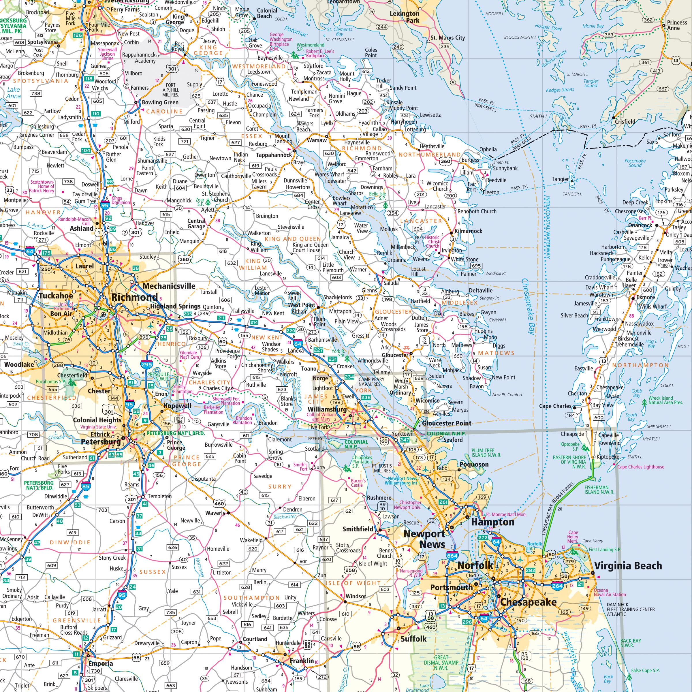
- Regularly updated, full-color maps
- Clearly labeled Interstate, U.S., state, and county highways
- Indications of parks, points of interest, airports, county boundaries, schools, shopping malls, downtown & vicinity maps
- Easy-to-use legend
- Mileage and driving times map
- Detailed index
- Copyright 2021
- Coverage Area Detailed maps include: Alexandria/Arlington, Bristol, Charlottesville, Hampton Roads: Norfolk/Newport News/Virginia Beach, Lynchburg, Richmond/Petersburg, Roanoke, Shenandoah National Park, Washington, D.C. & Vicinity, Williamsburg/Colonial National Historical Park

![Wall Art Impact 26"x24" Poster Resource Map - Australia Mineral Resources Map My [Laminated]](https://m.media-amazon.com/images/I/81kDfsItG3L.jpg)

![2 Pack - Giant World Map & US Map Poster Set - Extra Large Mega Chart of the World & United States - Laminated - 46" x 60" [Blue]](https://m.media-amazon.com/images/I/91LEEQUE1bL.jpg)
Reviews
There are no reviews yet.