
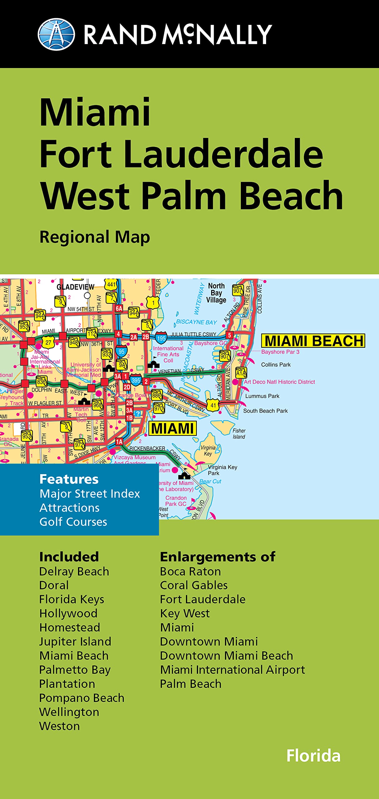
Rand McNally’s folded map for Miami, Fort Lauderdale, and West Palm Beach is a must-have for anyone traveling in and around this part of Florida, offering unbeatable accuracy and reliability at a great price. Our trusted cartography shows all Interstate, U.S., state, and county highways, along with clearly indicated parks, points of interest, airports, county boundaries, and streets. The easy-to-use legend and detailed index make for quick and easy location of destinations. You’ll see why Rand McNally folded maps have been the trusted standard for years. – Regularly updated. – Full-color maps. – Clearly labeled Interstate, U.S., state, and county highways. – Indications of parks, points of interest, airports, county boundaries, downtown & vicinity maps. – Attractions & Golf courses. – Enlargements of Boca Raton, Coral Gables, Fort Lauderdale, Key West, Miami, Miami downtown, Miami Beach downtown, Miami International Airport & Palm Beach. – Easy-to-use legend. – Detailed & full street index. – Convenient folded size. Coverage Area Communities Included: Delray Beach, Doral, Florida Keys, Hollywood, Homestead, Jupiter Island, Miami Beach, Palmetto Bay, Plantation, Pompano Beach, Wellington, Weston. Product Details: Measures 9.5′ x 4′ and folds out to 40′ x 28′.
Rand McNally Folded Map: Miami, Fort Lauderdale, and West Palm Beach Regional Map
$8.99
This regional map helps students learn local geography for the Miami, Fort Lauderdale, and West Palm Beach areas.
Additional information
| Weight | 0.077 lbs |
|---|---|
| Dimensions | 10.4 × 1 × 22.4 in |


Reviews
There are no reviews yet.