

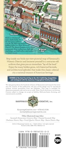
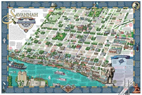


Updated for 2025, in its 8th edition: The Best Illustrated Map of Savannah’s Historic District! With walking shoes on and this birds-eye-view guide map in hand, you’ll feel like you stepped back in time in Savannah’s Historic Landmark District. Beautiful, functional, and informative, this is the only companion piece you’ll need in a city where a historic building, monument or point of interest beckons around every corner. The map features pictorial depictions of popular landmarks so you know what to expect and how to get there. And, we’ve even included the free shuttle and ferry stops to get you around town quicker.
History lovers will also appreciate the many factoids explaining the city’s rich, colorful, and sometimes dark history.
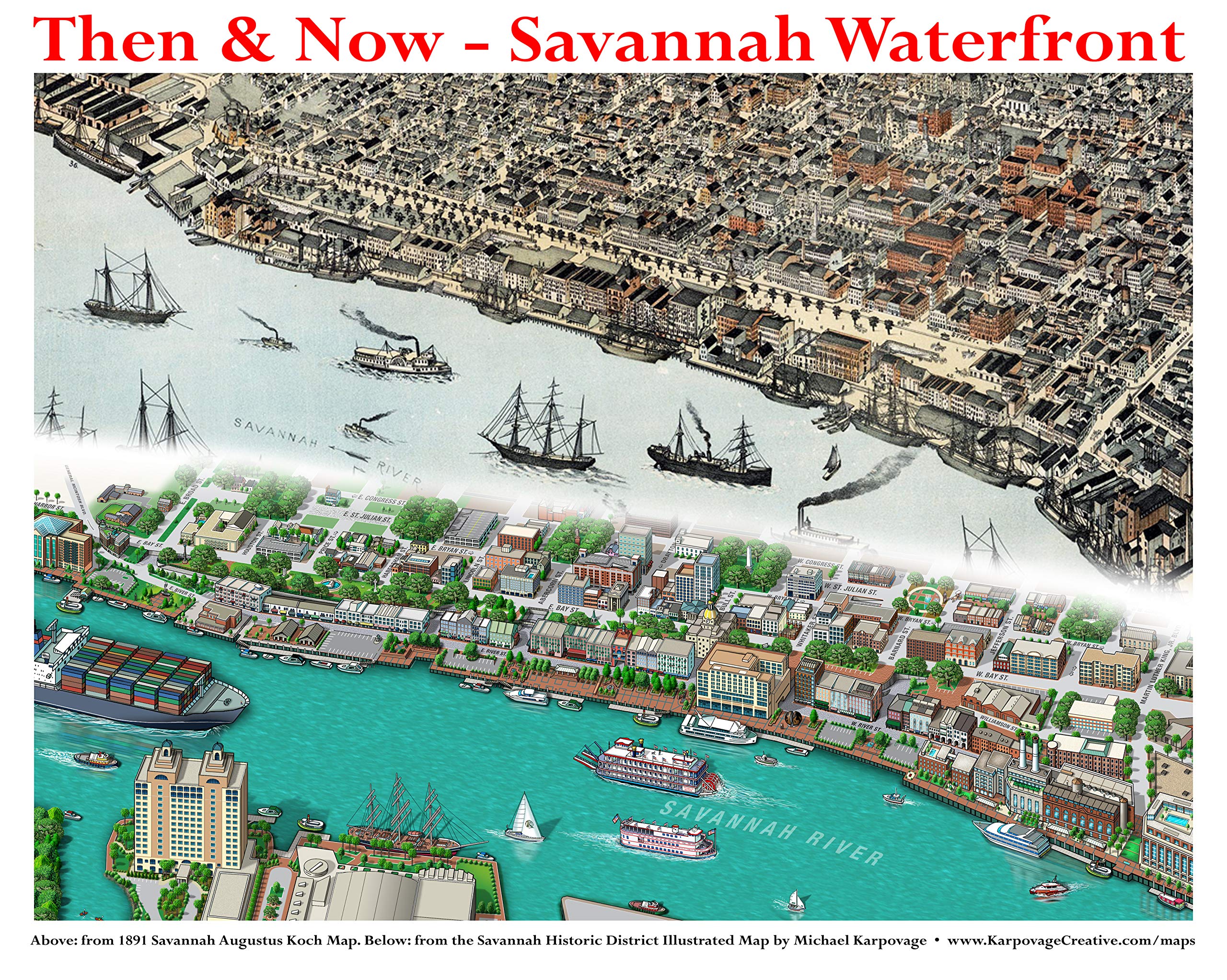
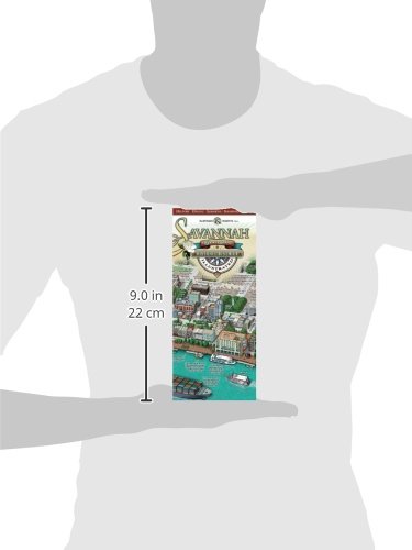
Our national award-winning Savannah Historic District Illustrated Map comes folded at a convenient 4×9″ size to stow in your pocket or purse and unfolds to 18×27″ to reveal the captivating artwork within. You’ll immediately see a “lay of the land” mirroring the classic maps of Savannah in the 19th century that depict the river (or North) on the bottom. The map is NOT upside down.
Note on compass: NORTH is on the bottom because of the historical significance of the riverfront. This area is what draws over 13 million visitors each year and what has turned the city around economically since the late 1970s. Illustrative maps of other cities move compass directions when there is a specific tourism area that needs to be marketed to. There would be no Savannah if not for the riverfront port. It’s where her riches came from dating back to the early 1700s. A vast majority of the incredible 19th century birds-eye-view maps of Savannah also show her in this non-traditional, north on bottom, format. Once you get your orientation adjusted, this map is all you’ll need for wayfinding.
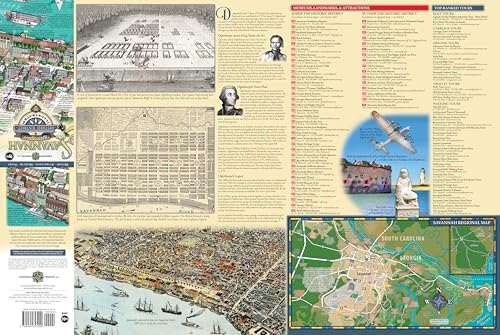
On the reverse side, you’ll read of the famous squares and how they originated. Popular museums, landmarks, and attractions are listed, along with their locations on the map. Or you can choose from our top-ranked tour listings and let a professional guide take you on a narrated tour. Plus, we have a regional map showing the best attractions should you wish to venture outside the historic district.
There’s no need to navigate from a tiny phone screen, as you miss the history that surrounds you. Get our map or get lost! And don’t settle for the small, flimsy throwaway freebie maps devoid of any history and filled with distracting ads. Our map is advertisement-free, of high quality paper (not laminated), and meant as a true walking tour guide that you can bring back home as a souvenir.
Do you like ghost stories, paranormal activity, and strange tales of the macabre? Then you’ll love our HAUNTED SAVANNAH ILLUSTRATED MAP a must-have when touring America’s Most Haunted City. And if you’re planning a visit to the historic outdoor museum of Bonaventure Cemetery in Savannah, do not enter without our BONAVENTURE CEMETERY ILLUSTRATED MAP, or you’re guaranteed to get lost.
Happy mapping from Karpovage Creative!
Features
- birds-eye-view illustration
- specific to historic district
- navigational street map
- history and information
- no annoying advertisements
- heavy durable paper
- folded for easy storage

")


Reviews
There are no reviews yet.