

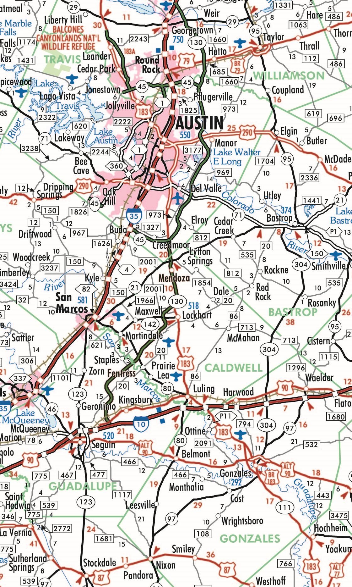
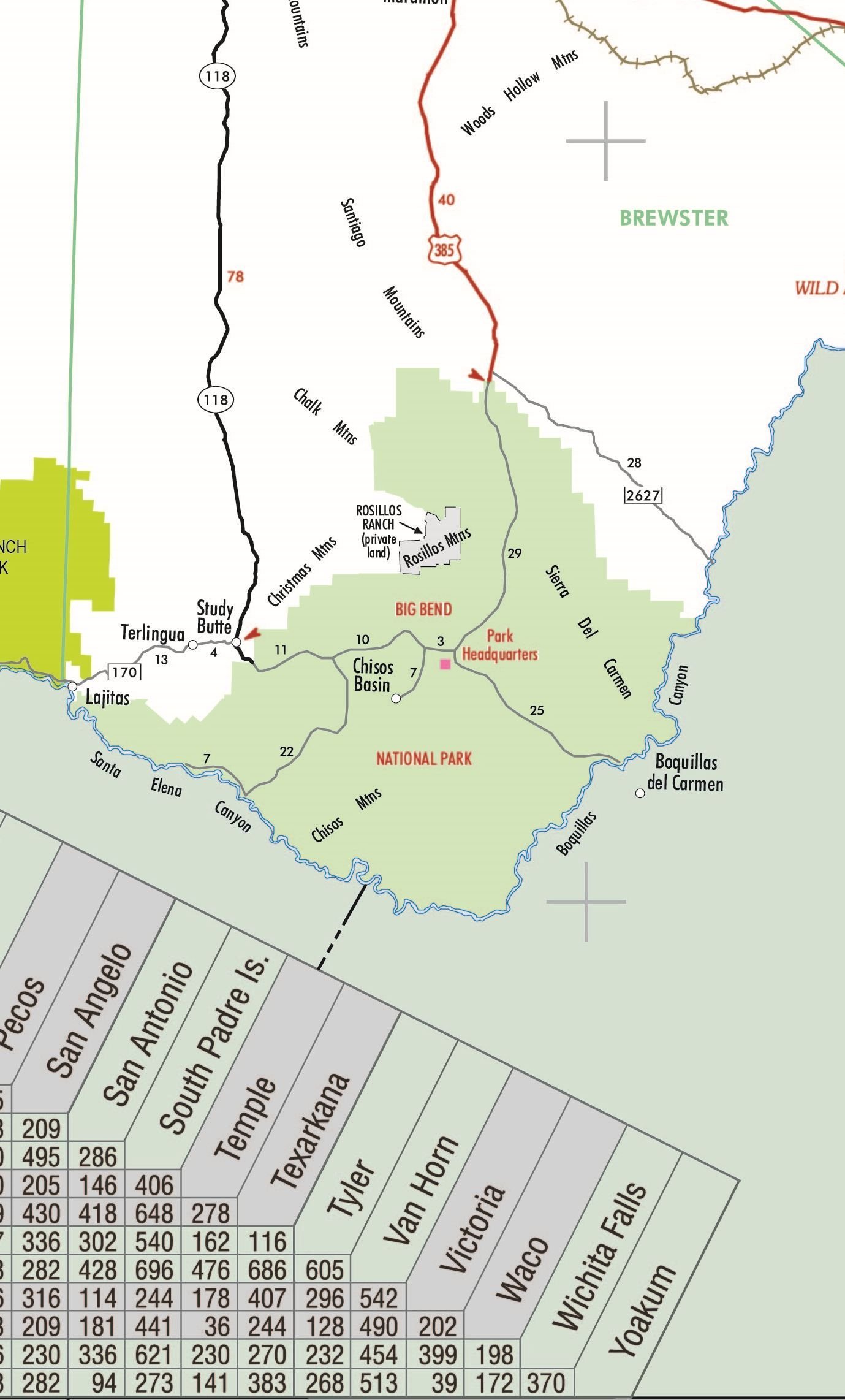
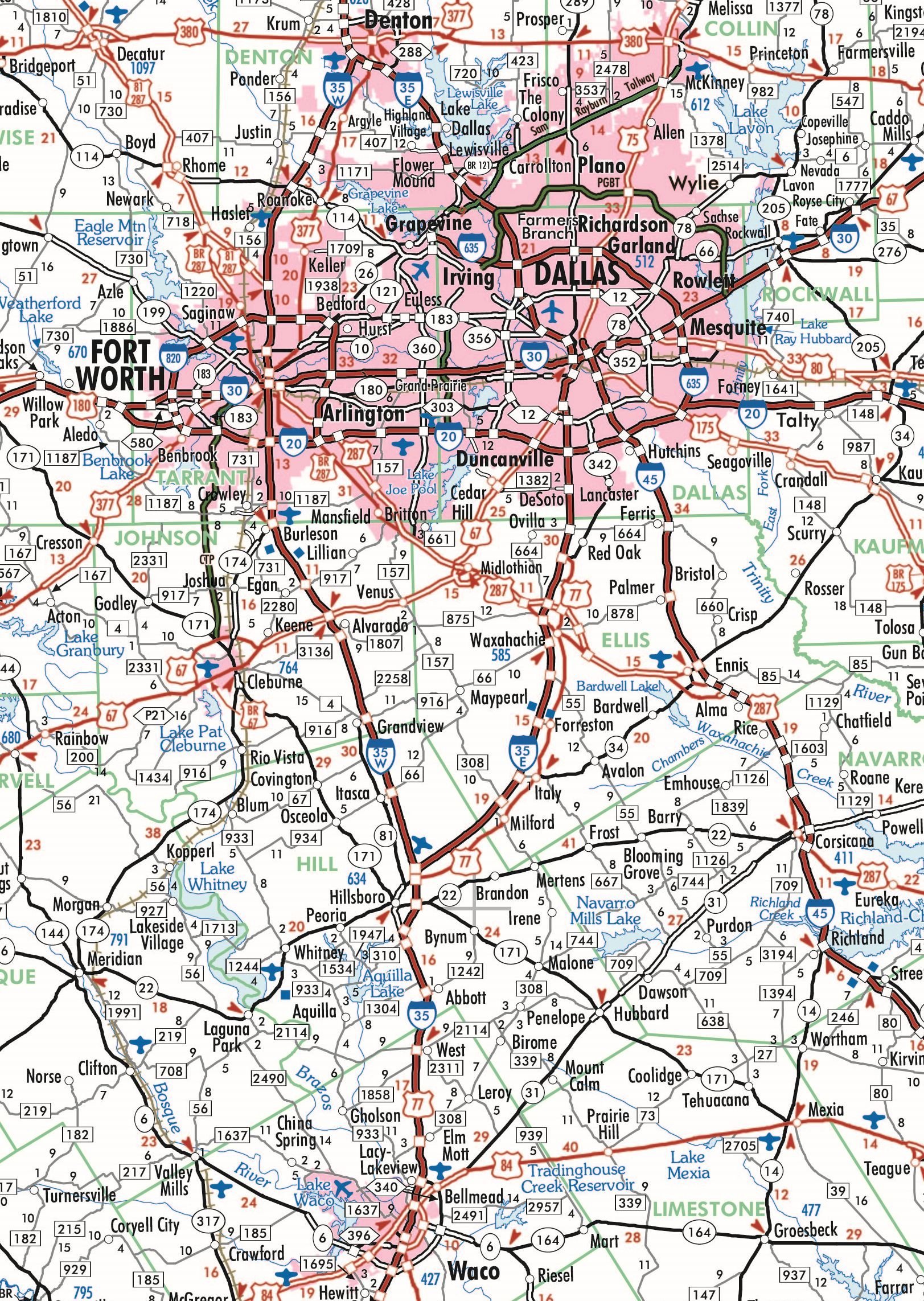
This fully indexed and highly detailed map is ideally sized (42″ x 39″) making it perfectly readable, yet small enough to be incorporated into most any existing wall space. Includes all state, US and Interstate highways, cities & towns, airports, elevations, rivers, lakes, parks and county names and boundaries. Also included are inset maps of telephone area codes and statewide elevation contours and a mileage chart.
Features
- 42w x 39h
- highways, cities and towns, counties, lakes and rivers
- inset map of area codes and elevations
- mileage chart
- fully indexed
![Wall Art Impact 24"x36" Thematic Map Map of Seattle Area [Laminated]](https://m.media-amazon.com/images/I/81EiGmJ-J4L.jpg)
![2 Pack - Giant World Map & US Map Poster Set - Extra Large Mega Chart of the World & United States - Laminated - 46" x 60" [Blue]](https://m.media-amazon.com/images/I/91LEEQUE1bL.jpg)
![Wall Art Impact 24"x34" Poster Topographic Map Us Geological Survey [Laminated]](https://m.media-amazon.com/images/I/81lShKnjk2L.jpg)

Reviews
There are no reviews yet.