
Topographic full color Arizona state map is scaled at 1″ = 12.5 miles. Elevation contours each 1,000 feet (color shaded each 2,000 feet at higher elevations) portray the general geography. Old Route 66 is highlighted in yellow. Also shown are national forests, wilderness areas, campgrounds, parks, state game and fish areas, ski areas, mining districts, points of interest, and more. More roads are shown than on typical highway maps. Much printed information is also included.
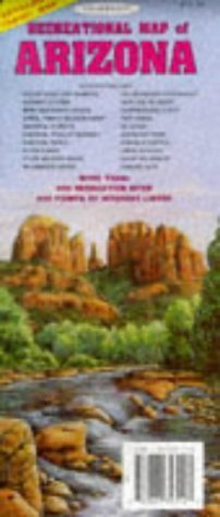
Topographic Recreational Map of Arizona
$15.95
This topographic map serves as a resource for learning about the geography and notable routes of Arizona.
Related products


Topographic Recreational map of Arizona
$5.95
This map provides detailed reference information on Arizona’s geography, cities, and points of interest for educational use.
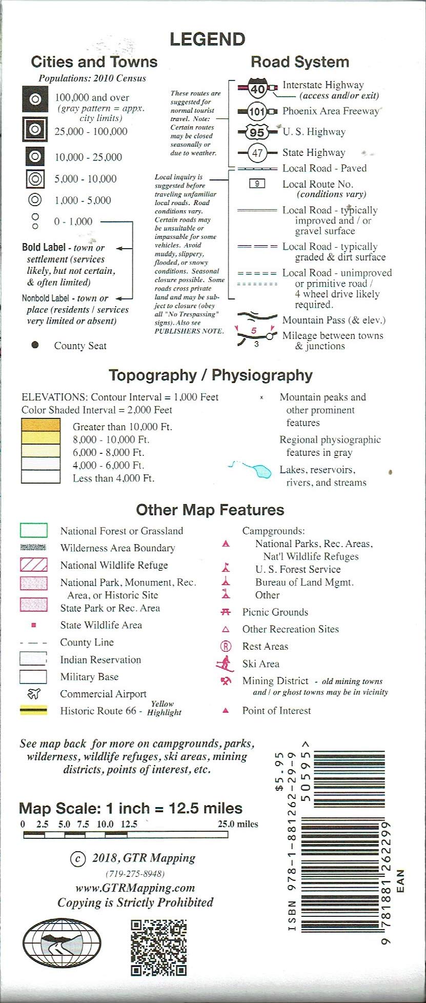
Topographic map of Arizona with legend and climate data and mileage chart. Relief shown by contours and spot heights. On reverse cities, towns and places index, national parks, wilderness areas, points of interest, ski areas, state parks, state wildlife areas, recreation sites, fishing and hunting, boating and rafting, mountains and national forests information.
Features
- Color Shaded Topography
- Historic Route 66
- GPS Coordinates
Reviews
There are no reviews yet.


Reviews
There are no reviews yet.