
Western Australia at 1:2,500,000 on an indexed road map from Hema with prominent highlighting of its protected areas. On the reverse is a street plan of central Perth, a throughroad map of the suburbs of Perth and Frementle, seven enlargements of popular regions, plus a table of facilities in the national parks and a list of information centres. On one side is a state road map with prominent highlighting for national parks and other protected areas, as well as Aboriginal Lands. Road classification indicates sealed and unsealed roads and includes rough 4WD tracks. Highways are shown with their names and numbers. Driving distances are marked on main and many local routes. The map also shows locations of 24-hrs fuel stations and of diesel, unleaded, and Opal stations. Other symbols indicate different types of rest areas, caravanning and camping sites, visitor information offices, and various points of interest. Latitude and longitude lines are drawn at 2deg intervals. The index is next to the map, together with a distance table. On the reverse, a detailed CBD street plan of Perth highlights 35 various facilities and sights, 36 selected accommodation choices, and 10 travel information centres. A throughroads map shows the suburbs of Perth and Fremantle. Panels present more detailed road maps annotated with GPS waypoints and covering seven of the state s popular areas including the coast between Augusta and Busselton, Cape Range NP, Purnululu NP, Walpole-Nornalup NP, etc. Also provided is a table showing facilities available in the national parks plus a list of local information centres.
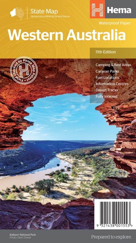
Western Australia State National Park 1 : 250 000
$16.27
This map of Western Australia is an educational tool for teaching geography, navigation, and map-reading skills.


Reviews
There are no reviews yet.